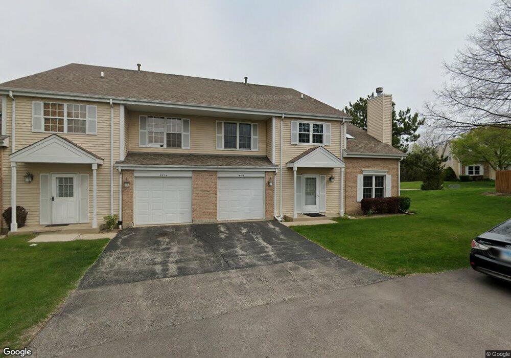
4411 Sheffield Ct Unit 11 Gurnee, IL 60031
Estimated Value: $243,000 - $260,000
3
Beds
2
Baths
1,408
Sq Ft
$177/Sq Ft
Est. Value
About This Home
This home is located at 4411 Sheffield Ct Unit 11, Gurnee, IL 60031 and is currently estimated at $249,397, approximately $177 per square foot. 4411 Sheffield Ct Unit 11 is a home located in Lake County with nearby schools including Spaulding Elementary School, Viking Middle School, and Warren Township High School.
Ownership History
Date
Name
Owned For
Owner Type
Purchase Details
Closed on
Nov 22, 1995
Sold by
Osullivan Donal M and Stutes Osullivan Raquel P
Bought by
Joy Marilyn
Current Estimated Value
Home Financials for this Owner
Home Financials are based on the most recent Mortgage that was taken out on this home.
Original Mortgage
$64,900
Interest Rate
7.45%
Create a Home Valuation Report for This Property
The Home Valuation Report is an in-depth analysis detailing your home's value as well as a comparison with similar homes in the area
Home Values in the Area
Average Home Value in this Area
Purchase History
| Date | Buyer | Sale Price | Title Company |
|---|---|---|---|
| Joy Marilyn | $115,000 | -- |
Source: Public Records
Mortgage History
| Date | Status | Borrower | Loan Amount |
|---|---|---|---|
| Closed | Joy Marilyn | $64,900 |
Source: Public Records
Tax History Compared to Growth
Tax History
| Year | Tax Paid | Tax Assessment Tax Assessment Total Assessment is a certain percentage of the fair market value that is determined by local assessors to be the total taxable value of land and additions on the property. | Land | Improvement |
|---|---|---|---|---|
| 2024 | $4,025 | $63,017 | $8,227 | $54,790 |
| 2023 | $4,038 | $55,688 | $7,270 | $48,418 |
| 2022 | $4,038 | $51,178 | $7,271 | $43,907 |
| 2021 | $3,639 | $49,124 | $6,979 | $42,145 |
| 2020 | $3,983 | $47,916 | $6,807 | $41,109 |
| 2019 | $3,880 | $46,525 | $6,609 | $39,916 |
| 2018 | $3,626 | $43,553 | $4,331 | $39,222 |
| 2017 | $3,584 | $42,305 | $4,207 | $38,098 |
| 2016 | $3,466 | $40,422 | $4,020 | $36,402 |
| 2015 | $3,354 | $38,337 | $3,813 | $34,524 |
| 2014 | $3,364 | $39,517 | $3,761 | $35,756 |
| 2012 | $3,198 | $39,820 | $3,790 | $36,030 |
Source: Public Records
Map
Nearby Homes
- 287 Kensington Ct Unit 4
- 93 Berkshire Ct Unit D
- 3947 Blackstone Ave
- 4481 Country Trail Unit 1
- 450 Tanglewood Dr
- 4837 Middle Rd
- 00 Northwood Ave
- 0 Northwoods Ave Unit MRD11938775
- 662 Waterbury Ave
- 33564 Greenleaf St
- 3910 Ingleside Ave
- 4437-4495 W Kennedy Dr
- 3810 1st St
- 4506 W Forest Ave
- 4520 W Lawn Ave
- 963 Belle Plaine Ave
- 3503 Elaine Ave
- 4390 W Parkway Ave
- 3513 Barb Ave Unit 178
- 525 Lawrence Ave
- 4425 Kensington Ct Unit 11
- 4414 Sheffield Ct Unit 11
- 4427 Kensington Ct Unit 11
- 4433 Sheffield Ct Unit 12
- 4417 Kensington Ct Unit 12
- 4422 Sheffield Ct Unit 9
- 4431 Sheffield Ct Unit 12
- 4424 Sheffield Ct Unit 9
- 4415 Kensington Ct Unit 12
- 4415 Kensington Ct Unit 4415
- 267 Yorkshire Ct Unit 9
- 265 Yorkshire Ct Unit 9
- 4445 Sheffield Ct Unit 10
- 4404 Kensington Ct Unit 13
- 4394 Brookhaven Rd Unit 13
- 4442 Brookhaven Rd Unit 10
- 4402 Kensington Ct Unit 13
- 4447 Sheffield Ct Unit 10
- 4392 Brookhaven Rd Unit 13
- 4444 Brookhaven Rd Unit 10