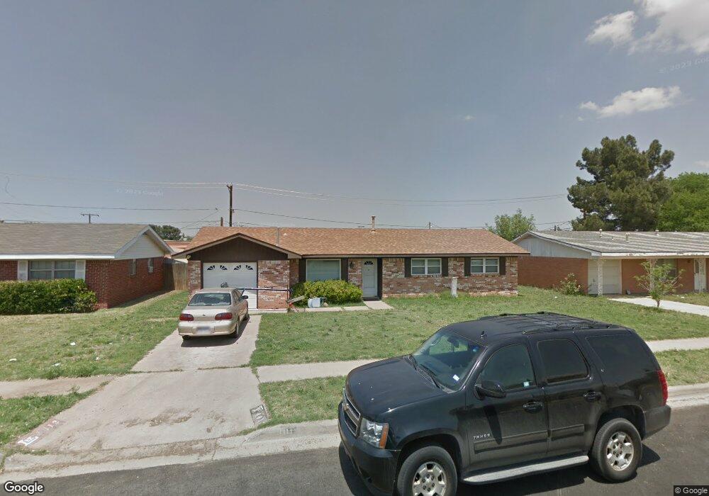
4412 Stanolind Ave Midland, TX 79707
Wydewood NeighborhoodEstimated Value: $226,798 - $242,000
--
Bed
2
Baths
1,301
Sq Ft
$179/Sq Ft
Est. Value
About This Home
This home is located at 4412 Stanolind Ave, Midland, TX 79707 and is currently estimated at $233,200, approximately $179 per square foot. 4412 Stanolind Ave is a home located in Midland County with nearby schools including Bush Elementary School, Abell Junior High School, and Premier High School - Midland.
Ownership History
Date
Name
Owned For
Owner Type
Purchase Details
Closed on
May 24, 2013
Sold by
Handley Randall L
Bought by
Rodrigues Kossivi
Current Estimated Value
Purchase Details
Closed on
Jul 23, 2004
Sold by
Rla Watkins Ltd
Bought by
Rodrigues Kossivi
Purchase Details
Closed on
Mar 3, 2004
Sold by
Grieneeks Laura
Bought by
Rodrigues Kossivi
Purchase Details
Closed on
Feb 1, 1971
Bought by
Rodrigues Kossivi
Create a Home Valuation Report for This Property
The Home Valuation Report is an in-depth analysis detailing your home's value as well as a comparison with similar homes in the area
Home Values in the Area
Average Home Value in this Area
Purchase History
| Date | Buyer | Sale Price | Title Company |
|---|---|---|---|
| Rodrigues Kossivi | -- | -- | |
| Rodrigues Kossivi | -- | -- | |
| Rodrigues Kossivi | -- | -- | |
| Rodrigues Kossivi | -- | -- |
Source: Public Records
Tax History Compared to Growth
Tax History
| Year | Tax Paid | Tax Assessment Tax Assessment Total Assessment is a certain percentage of the fair market value that is determined by local assessors to be the total taxable value of land and additions on the property. | Land | Improvement |
|---|---|---|---|---|
| 2025 | $1,950 | $235,330 | $15,770 | $219,560 |
| 2024 | $1,954 | $198,400 | $15,770 | $182,630 |
| 2023 | $2,982 | $198,970 | $15,770 | $183,200 |
| 2022 | $3,095 | $198,110 | $15,770 | $182,340 |
| 2021 | $3,384 | $194,260 | $15,770 | $178,490 |
| 2020 | $2,754 | $188,230 | $15,770 | $172,460 |
| 2019 | $3,359 | $177,410 | $15,770 | $172,460 |
| 2018 | $3,136 | $161,280 | $15,770 | $145,730 |
| 2017 | $2,851 | $146,620 | $15,770 | $130,850 |
| 2016 | $2,728 | $140,070 | $15,770 | $124,300 |
| 2015 | -- | $134,670 | $15,770 | $118,900 |
| 2014 | -- | $128,990 | $0 | $0 |
Source: Public Records
Map
Nearby Homes
- 4313 W Dengar Ave
- 2306 Abbey Place
- 4342 W Dengar Ave
- 1824 Northern Ln
- 1818 Northern Ln
- 2000 Freeport Ln
- 3802 Suncrest Ave
- 2906 Aurora Ln
- 3210 Preston Dr
- 1715 Bates St
- 4310 Nelson Rd
- 3220 Preston Dr
- 4618 Andrews Hwy
- 4620 Andrews Hwy
- 4206 Nelson Rd
- 3007 Whittle Way
- 2402 Idlewilde Dr
- 3205 Dentcrest Dr Unit B
- 3205 Dentcrest Dr Unit A
- 3200 Highsky Dr
- 4414 Stanolind Ave
- 4410 Stanolind Ave
- 4416 Stanolind Ave
- 4408 Stanolind Ave
- 4413 Stanolind Ave
- 4415 Stanolind Ave
- 4411 Stanolind Ave
- 4418 Stanolind Ave
- 4417 Stanolind Ave
- 4406 Stanolind Ave
- 4409 Stanolind Ave
- 4505 Neely Ct
- 4503 Neely Ct
- 4419 Stanolind Ave
- 4407 Stanolind Ave
- 4412 Gulf Ave
- 4507 Neely Ct
- 4420 Stanolind Ave
- 4404 Stanolind Ave
- 4414 Gulf Ave