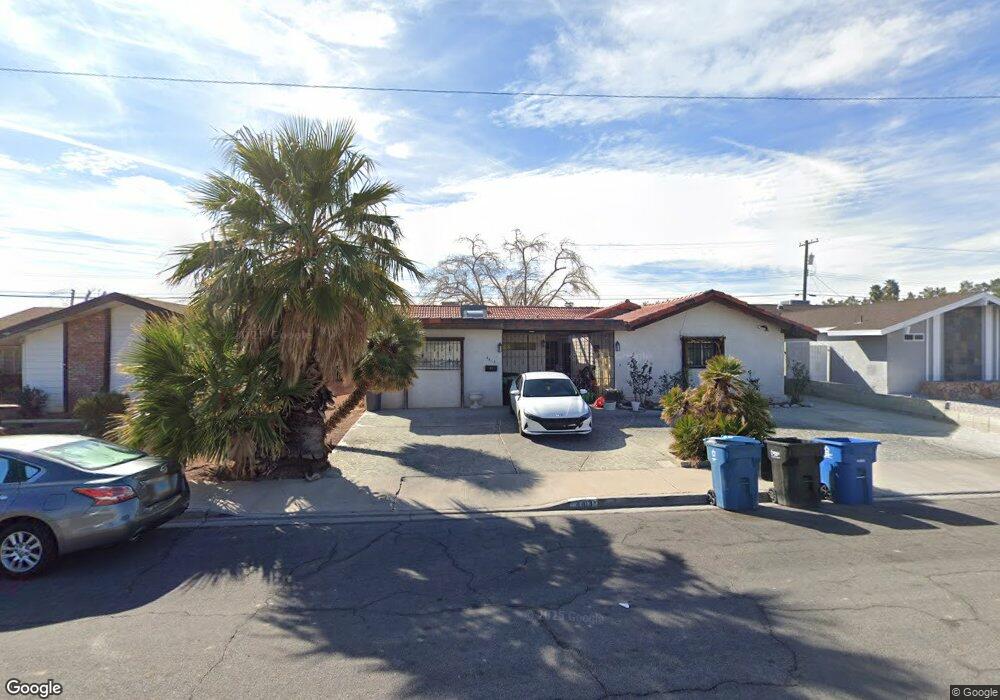
4413 Saint Andrews Cir Las Vegas, NV 89107
Twin Lakes NeighborhoodEstimated Value: $386,207 - $469,000
3
Beds
2
Baths
2,482
Sq Ft
$169/Sq Ft
Est. Value
About This Home
This home is located at 4413 Saint Andrews Cir, Las Vegas, NV 89107 and is currently estimated at $420,302, approximately $169 per square foot. 4413 Saint Andrews Cir is a home located in Clark County with nearby schools including E.W. Griffith Elementary School, Robert O Gibson Middle School, and Western High School.
Ownership History
Date
Name
Owned For
Owner Type
Purchase Details
Closed on
Feb 25, 2003
Sold by
Dickinson Sheila L
Bought by
Dickinson Sheila L and The Sheila L Dickinson Trust
Current Estimated Value
Home Financials for this Owner
Home Financials are based on the most recent Mortgage that was taken out on this home.
Original Mortgage
$71,500
Interest Rate
6.06%
Purchase Details
Closed on
Dec 30, 2002
Sold by
Dickinson Sheila L
Bought by
Dickinson Sheila L
Home Financials for this Owner
Home Financials are based on the most recent Mortgage that was taken out on this home.
Original Mortgage
$71,500
Interest Rate
6.06%
Create a Home Valuation Report for This Property
The Home Valuation Report is an in-depth analysis detailing your home's value as well as a comparison with similar homes in the area
Home Values in the Area
Average Home Value in this Area
Purchase History
| Date | Buyer | Sale Price | Title Company |
|---|---|---|---|
| Dickinson Sheila L | -- | -- | |
| Dickinson Sheila L | -- | Nevada Title Company |
Source: Public Records
Mortgage History
| Date | Status | Borrower | Loan Amount |
|---|---|---|---|
| Closed | Dickinson Sheila L | $71,500 |
Source: Public Records
Tax History Compared to Growth
Tax History
| Year | Tax Paid | Tax Assessment Tax Assessment Total Assessment is a certain percentage of the fair market value that is determined by local assessors to be the total taxable value of land and additions on the property. | Land | Improvement |
|---|---|---|---|---|
| 2025 | $1,373 | $66,097 | $32,200 | $33,897 |
| 2024 | $1,333 | $66,097 | $32,200 | $33,897 |
| 2023 | $1,398 | $64,590 | $33,950 | $30,640 |
| 2022 | $1,357 | $57,480 | $30,100 | $27,380 |
| 2021 | $1,257 | $51,006 | $25,550 | $25,456 |
| 2020 | $1,217 | $49,550 | $24,850 | $24,700 |
| 2019 | $1,202 | $45,208 | $21,350 | $23,858 |
| 2018 | $1,147 | $39,899 | $17,500 | $22,399 |
| 2017 | $1,302 | $39,710 | $17,500 | $22,210 |
| 2016 | $1,087 | $37,228 | $13,300 | $23,928 |
| 2015 | $1,084 | $33,509 | $9,100 | $24,409 |
| 2014 | $1,052 | $31,153 | $5,950 | $25,203 |
Source: Public Records
Map
Nearby Homes
- 4301 Fortune Ave
- 309 Estella Ave
- 312 Estella Ave
- 800 Langtry Dr
- 821 Mar Jay Ct
- 605 N Yale St
- 424 Stanford St
- 605 Stanford St
- 604 N Minnesota St
- 504 N Minnesota St
- 4901 Nebraska Ave
- 5004 Cannon Blvd
- 304 N Minnesota St
- 104 Stanford St
- 5117 Arbor Way
- 1221 Oak Tree Ln
- 1300 Oak Tree Ln
- 1317 Pyramid Dr
- 601 Huntington St
- 4404 Mayflower Ln
- 4409 Saint Andrews Cir
- 4405 Saint Andrews Cir
- 4421 Saint Andrews Cir
- 631 Hogan Dr
- 4412 Saint Andrews Cir
- 4416 Saint Andrews Cir
- 4408 Saint Andrews Cir
- 4401 St Andrews Cir
- 4401 Saint Andrews Cir
- 4404 Saint Andrews Cir
- 4400 Snead Dr
- 627 Hogan Dr
- 4425 Saint Andrews Cir Unit 2B
- 4400 Saint Andrews Cir
- 4428 Saint Andrews Cir
- 4413 Thompson Cir
- 4417 Thompson Cir
- 4409 Thompson Cir
- 4424 Saint Andrews Cir
- 623 Hogan Dr