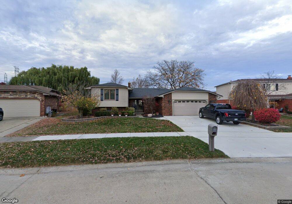
44132 Harsdale Dr Canton, MI 48187
Estimated Value: $401,281 - $429,000
--
Bed
3
Baths
2,152
Sq Ft
$193/Sq Ft
Est. Value
About This Home
This home is located at 44132 Harsdale Dr, Canton, MI 48187 and is currently estimated at $414,570, approximately $192 per square foot. 44132 Harsdale Dr is a home located in Wayne County with nearby schools including Canton High School, Discovery Middle School, and Salem High School.
Ownership History
Date
Name
Owned For
Owner Type
Purchase Details
Closed on
Nov 18, 2024
Sold by
Jeffers Phillip N and Jeffers Aimee G
Bought by
Phillip N Jeffers And Aimee G Jeffers Trust and Jeffers
Current Estimated Value
Purchase Details
Closed on
Aug 12, 2016
Sold by
Watkins Charles E and Watkins Shirley A
Bought by
Jeffers Phillip
Home Financials for this Owner
Home Financials are based on the most recent Mortgage that was taken out on this home.
Original Mortgage
$238,525
Interest Rate
3.48%
Mortgage Type
VA
Create a Home Valuation Report for This Property
The Home Valuation Report is an in-depth analysis detailing your home's value as well as a comparison with similar homes in the area
Home Values in the Area
Average Home Value in this Area
Purchase History
| Date | Buyer | Sale Price | Title Company |
|---|---|---|---|
| Phillip N Jeffers And Aimee G Jeffers Trust | -- | None Listed On Document | |
| Phillip N Jeffers And Aimee G Jeffers Trust | -- | None Listed On Document | |
| Jeffers Phillip | $250,000 | Title Source Inc |
Source: Public Records
Mortgage History
| Date | Status | Borrower | Loan Amount |
|---|---|---|---|
| Previous Owner | Jeffers Phillip | $238,525 |
Source: Public Records
Tax History Compared to Growth
Tax History
| Year | Tax Paid | Tax Assessment Tax Assessment Total Assessment is a certain percentage of the fair market value that is determined by local assessors to be the total taxable value of land and additions on the property. | Land | Improvement |
|---|---|---|---|---|
| 2025 | $2,462 | $198,400 | $0 | $0 |
| 2024 | $2,462 | $181,200 | $0 | $0 |
| 2023 | $2,347 | $161,200 | $0 | $0 |
| 2022 | $5,130 | $141,700 | $0 | $0 |
| 2021 | $4,978 | $139,800 | $0 | $0 |
| 2020 | $4,916 | $133,800 | $0 | $0 |
| 2019 | $4,825 | $122,450 | $0 | $0 |
| 2018 | $1,995 | $113,250 | $0 | $0 |
| 2017 | $5,030 | $112,300 | $0 | $0 |
| 2016 | $3,290 | $114,900 | $0 | $0 |
| 2015 | $8,106 | $102,910 | $0 | $0 |
| 2013 | $7,853 | $81,670 | $0 | $0 |
| 2010 | -- | $90,730 | $48,643 | $42,087 |
Source: Public Records
Map
Nearby Homes
- 437 Corinne Blvd
- 278 Cornell St
- 44150 Duchess Dr
- 1322 Saltz Ct
- 227 Edington Cir
- 44893 Fair Oaks Dr
- 288 Edington Cir Unit 61
- 603 Concord Dr Unit 67
- 45030 Glengarry Rd
- 550 Concord Dr Unit 75
- 42771 Lilley Pointe Dr Unit 154
- 5887 Northford
- 42789 Lilley Pointe Dr Unit 146
- 1494 Ranier Blvd
- 1822 N Sheldon Rd
- 42697 Redfern St
- 43592 Champlain Ct
- 1710 Longfellow Dr
- 58560 Stuart Dr
- 678 Kings Way
- 44118 Harsdale Dr
- 44146 Harsdale Dr Unit Bldg-Unit
- 44146 Harsdale Dr
- 43925 Palisades Dr
- 43913 Palisades Dr
- 43941 Palisades Dr
- 44104 Harsdale Dr
- 44160 Harsdale Dr
- 44001 Palisades Dr
- 43901 Palisades Dr
- 44111 Harsdale Dr
- 44174 Harsdale Dr
- 44031 Palisades Dr
- 43877 Palisades Dr
- 44089 Harsdale Dr
- 44155 Harsdale Dr
- 44043 Palisades Dr
- 44067 Harsdale Dr
- 43865 Palisades Dr
- 44062 Harsdale Dr