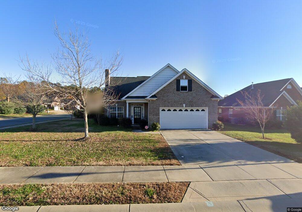
4414 Gwen Hartis Ct Unit 120 Monroe, NC 28110
Estimated Value: $484,806 - $533,000
4
Beds
3
Baths
2,047
Sq Ft
$251/Sq Ft
Est. Value
About This Home
This home is located at 4414 Gwen Hartis Ct Unit 120, Monroe, NC 28110 and is currently estimated at $513,202, approximately $250 per square foot. 4414 Gwen Hartis Ct Unit 120 is a home located in Union County with nearby schools including Sardis Elementary School, Porter Ridge Middle School, and Porter Ridge High School.
Ownership History
Date
Name
Owned For
Owner Type
Purchase Details
Closed on
Oct 27, 2020
Sold by
Snuggs H Marks H and Snuggs Melissa King
Bought by
Floresca Allen Bill
Current Estimated Value
Home Financials for this Owner
Home Financials are based on the most recent Mortgage that was taken out on this home.
Original Mortgage
$318,250
Outstanding Balance
$283,197
Interest Rate
2.8%
Mortgage Type
New Conventional
Estimated Equity
$230,005
Purchase Details
Closed on
Aug 24, 2007
Sold by
Sardis Properties Llc
Bought by
Snuggs H Mark and Snuggs Melissa
Home Financials for this Owner
Home Financials are based on the most recent Mortgage that was taken out on this home.
Original Mortgage
$256,900
Interest Rate
6.65%
Mortgage Type
Unknown
Create a Home Valuation Report for This Property
The Home Valuation Report is an in-depth analysis detailing your home's value as well as a comparison with similar homes in the area
Home Values in the Area
Average Home Value in this Area
Purchase History
| Date | Buyer | Sale Price | Title Company |
|---|---|---|---|
| Floresca Allen Bill | $340,000 | Investors Title Insurance Co | |
| Snuggs H Mark | $257,000 | None Available |
Source: Public Records
Mortgage History
| Date | Status | Borrower | Loan Amount |
|---|---|---|---|
| Open | Floresca Allen Bill | $318,250 | |
| Previous Owner | Snuggs H Mark | $256,900 |
Source: Public Records
Tax History Compared to Growth
Tax History
| Year | Tax Paid | Tax Assessment Tax Assessment Total Assessment is a certain percentage of the fair market value that is determined by local assessors to be the total taxable value of land and additions on the property. | Land | Improvement |
|---|---|---|---|---|
| 2024 | $2,006 | $313,800 | $62,200 | $251,600 |
| 2023 | $1,984 | $313,800 | $62,200 | $251,600 |
| 2022 | $1,984 | $313,800 | $62,200 | $251,600 |
| 2021 | $1,984 | $313,800 | $62,200 | $251,600 |
| 2020 | $1,668 | $213,900 | $39,000 | $174,900 |
| 2019 | $1,668 | $213,900 | $39,000 | $174,900 |
| 2018 | $0 | $213,900 | $39,000 | $174,900 |
| 2017 | $1,778 | $213,900 | $39,000 | $174,900 |
| 2016 | $1,743 | $213,900 | $39,000 | $174,900 |
| 2015 | $1,770 | $213,900 | $39,000 | $174,900 |
| 2014 | $1,686 | $236,100 | $34,000 | $202,100 |
Source: Public Records
Map
Nearby Homes
- 5205 Sustar Dr
- 5508 Burning Ridge Dr
- 4311 Ethel Sustar Dr
- 5706 Sustar Dr
- 3900 Crimson Wing Dr
- 2842 Gray Fox Rd
- 0 W Highway 74
- 3030 Paddington Dr
- 1009 Glen Hollow Dr
- 2006 Paddington Dr
- 2026 Union Grove Ln
- 1010 Glen Hollow Dr
- 1009 Kemp Rd
- 1005 Kemp Rd
- 3319 Creek Trail Rd
- 3619 Wesley Chapel Stouts Rd
- 2003 Sweet Gum Ct
- 3702 Arthur St
- 3612 Esther St
- 3613 Arthur St
- 4414 Gwen Hartis Ct
- 4412 Gwen Hartis Ct
- 4500 Gwen Hartis Ct
- 4406 Gwen Hartis Ct
- 5417 Sustar Dr Unit Lot 118
- 4415 Gwen Hartis Ct
- 4504 Gwen Hartis Ct
- 4413 Gwen Hartis Ct
- 4501 Gwen Hartis Ct
- 4402 Gwen Hartis Ct Unit 123
- 4402 Gwen Hartis Ct
- 5416 Sustar Dr
- 4411 Gwen Hartis Ct
- 5413 Sustar Dr Unit 117
- 4503 Gwen Hartis Ct
- 4409 Gwen Hartis Ct
- 4506 Gwen Hartis Ct
- 5414 Sustar Dr
- 4407 Gwen Hartis Ct Unit 127
- 5409 Sustar Dr Unit 116