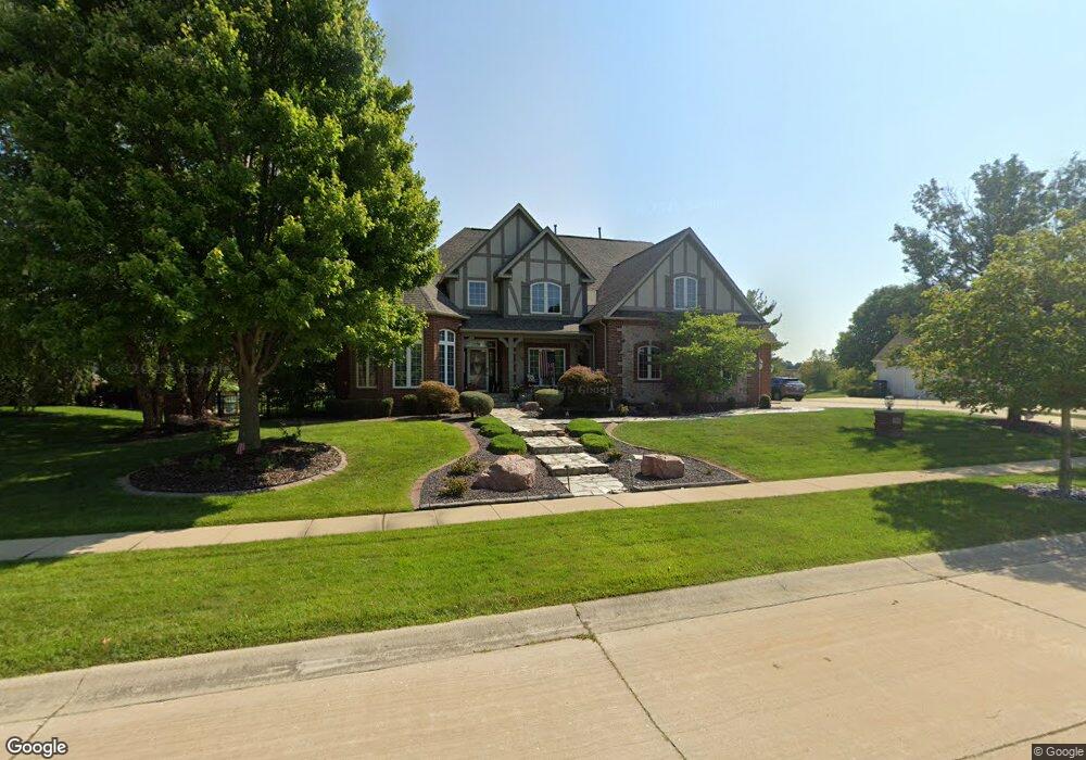
4414 Southford Trace Dr Champaign, IL 61822
Estimated Value: $711,000 - $875,000
--
Bed
--
Bath
--
Sq Ft
0.41
Acres
About This Home
This home is located at 4414 Southford Trace Dr, Champaign, IL 61822 and is currently estimated at $817,864. 4414 Southford Trace Dr is a home located in Champaign County with nearby schools including Centennial High School, Countryside School, and Swann Special Care Center-Elem/Secondary School.
Ownership History
Date
Name
Owned For
Owner Type
Purchase Details
Closed on
Jul 15, 2011
Sold by
Byers Stephen J and Byers Ginger A
Bought by
Banghart Teresa M
Current Estimated Value
Purchase Details
Closed on
Sep 18, 2008
Sold by
Corley Kevin S and Corley Bonnie K
Bought by
Byers Stephen J and Byers Ginger A
Home Financials for this Owner
Home Financials are based on the most recent Mortgage that was taken out on this home.
Original Mortgage
$417,000
Interest Rate
5.94%
Mortgage Type
Purchase Money Mortgage
Create a Home Valuation Report for This Property
The Home Valuation Report is an in-depth analysis detailing your home's value as well as a comparison with similar homes in the area
Home Values in the Area
Average Home Value in this Area
Purchase History
| Date | Buyer | Sale Price | Title Company |
|---|---|---|---|
| Banghart Teresa M | $715,000 | Burnet Title | |
| Byers Stephen J | $690,000 | None Available |
Source: Public Records
Mortgage History
| Date | Status | Borrower | Loan Amount |
|---|---|---|---|
| Previous Owner | Byers Stephen J | $417,000 |
Source: Public Records
Tax History Compared to Growth
Tax History
| Year | Tax Paid | Tax Assessment Tax Assessment Total Assessment is a certain percentage of the fair market value that is determined by local assessors to be the total taxable value of land and additions on the property. | Land | Improvement |
|---|---|---|---|---|
| 2024 | $23,080 | $280,430 | $48,590 | $231,840 |
| 2023 | $23,080 | $258,940 | $44,870 | $214,070 |
| 2022 | $21,963 | $241,550 | $41,860 | $199,690 |
| 2021 | $21,451 | $237,280 | $41,120 | $196,160 |
| 2020 | $21,257 | $234,930 | $40,710 | $194,220 |
| 2019 | $20,630 | $231,000 | $40,030 | $190,970 |
| 2018 | $20,597 | $231,000 | $40,030 | $190,970 |
| 2017 | $20,189 | $226,290 | $40,030 | $186,260 |
| 2016 | $18,504 | $226,290 | $40,030 | $186,260 |
| 2015 | $18,962 | $226,290 | $40,030 | $186,260 |
| 2014 | $18,818 | $226,290 | $40,030 | $186,260 |
| 2013 | $18,653 | $226,290 | $40,030 | $186,260 |
Source: Public Records
Map
Nearby Homes
- 4410 Southford Trace Dr
- 1904 Mullikin Dr
- 4406 Crossgate Dr
- 2004 Emerald Dr
- 4700 Chestnut Grove Dr
- 4502 Graves Ct
- 4203 Curtis Meadow Dr
- 2104 Wiggins St
- 4712 Watermark Dr
- 4309 Stonebridge Ct
- 4703 W Kirby Ave
- 2009 Savanna Dr
- 4004 Golf Creek Dr
- 1621 English Oak Dr
- 5008 Emmas Way
- 2107 Max Run Dr
- 1806 Bentbrook Dr
- 2317 Joseph St
- 1504 Wyndemere Point Dr
- 4111 Farhills Dr
- 4305 Southford Trace Dr
- 4412 Southford Trace Dr
- 4416 Southford Trace Dr
- 4407 Brittany Trail Dr
- 4415 Southford Trace Dr
- 4417 Southford Trace Dr
- 4413 Southford Trace Dr
- 4405 Brittany Trail Dr
- 4411 Southford Trace Dr
- 4408 Southford Trace Dr
- 4403 Brittany Trail Dr
- 4412 Brittany Trail Dr
- 4410 Brittany Trail Dr
- 4503 Brittany Trail Dr
- 4501 Southford Trace Dr
- 4408 Brittany Trail Dr
- 1906 Mullikin Dr
- 4406 Southford Trace Dr
- 4406 Brittany Trail Dr
- 4401 Brittany Trail Dr