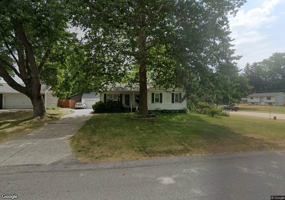
4414 Westgate Dr NW Comstock Park, MI 49321
Estimated Value: $278,000 - $297,535
3
Beds
1
Bath
1,016
Sq Ft
$285/Sq Ft
Est. Value
About This Home
This home is located at 4414 Westgate Dr NW, Comstock Park, MI 49321 and is currently estimated at $289,634, approximately $285 per square foot. 4414 Westgate Dr NW is a home located in Kent County with nearby schools including Stoney Creek Elementary School, Pine Island Elementary School, and Mill Creek Middle School.
Ownership History
Date
Name
Owned For
Owner Type
Purchase Details
Closed on
Jun 1, 2011
Sold by
Meinke Scott Allen
Bought by
Meinke Laura Ann
Current Estimated Value
Purchase Details
Closed on
Aug 31, 1998
Bought by
Grusnis>S Meinke M and Meinke Laura A
Purchase Details
Closed on
Feb 8, 1996
Bought by
Meinke M Grusnis>M Grusnis L and Meinke Laura A
Purchase Details
Closed on
Apr 7, 1995
Bought by
Grusnis M and Meinke Laura A
Purchase Details
Closed on
Apr 1, 1981
Bought by
Meyer J and Meinke Laura A
Create a Home Valuation Report for This Property
The Home Valuation Report is an in-depth analysis detailing your home's value as well as a comparison with similar homes in the area
Home Values in the Area
Average Home Value in this Area
Purchase History
| Date | Buyer | Sale Price | Title Company |
|---|---|---|---|
| Meinke Laura Ann | -- | None Available | |
| Grusnis>S Meinke M | $93,500 | -- | |
| Meinke M Grusnis>M Grusnis L | -- | -- | |
| Grusnis M | $64,800 | -- | |
| Meyer J | $46,500 | -- |
Source: Public Records
Tax History Compared to Growth
Tax History
| Year | Tax Paid | Tax Assessment Tax Assessment Total Assessment is a certain percentage of the fair market value that is determined by local assessors to be the total taxable value of land and additions on the property. | Land | Improvement |
|---|---|---|---|---|
| 2025 | $1,943 | $143,100 | $0 | $0 |
| 2024 | $1,943 | $122,300 | $0 | $0 |
| 2023 | $1,857 | $102,000 | $0 | $0 |
| 2022 | $2,333 | $91,900 | $0 | $0 |
| 2021 | $2,276 | $87,400 | $0 | $0 |
| 2020 | $1,705 | $79,100 | $0 | $0 |
| 2019 | $2,042 | $67,600 | $0 | $0 |
| 2018 | $2,003 | $67,600 | $0 | $0 |
| 2017 | $1,948 | $62,800 | $0 | $0 |
| 2016 | $1,887 | $59,300 | $0 | $0 |
| 2015 | -- | $59,300 | $0 | $0 |
| 2013 | -- | $53,700 | $0 | $0 |
Source: Public Records
Map
Nearby Homes
- 452 Springfield St NW
- 510 Clark St NW
- 4678 Westshire Dr NW
- 4154 Woodrush Ln NW Unit 65
- 4581 Westshire Dr NW
- 4010 Woodrush Ln NW Unit 40
- 276 Mabel St NW Unit 54
- 4422 Division Ave N
- 211 York View Place NW
- Wilshire Plan at The Range
- Remington Plan at The Range
- Linden Plan at The Range
- Enclave Plan at The Range
- Croswell Plan at The Range
- Cascade Plan at The Range
- Carson Plan at The Range
- Avery Plan at The Range
- Ashton Plan at The Range
- Andover Plan at The Range
- 981 Ellerston St NW
- 4428 Westgate Dr NW
- 4415 Westgate Ave NW
- 335 Lamoreaux Dr NW
- 4440 Westgate Dr NW
- 335 Lamoreaux Dr NW
- 4427 Westgate Ave NW
- 4415 Westgate Dr NW
- 4427 Westgate Dr NW
- 360 Lamoreaux Dr NW
- 4389 Fink Ave NW
- 4439 Westgate Dr NW
- 362 Netherfield St NW
- 380 Lamoreaux Dr NW
- 346 Netherfield St NW
- 325 Lamoreaux Dr NW
- 4451 Westgate Dr NW
- 4375 Fink Ave NW
- 401 Lamoreaux Dr NW
- 334 Netherfield St NW
- 4384 Fink Ave NW