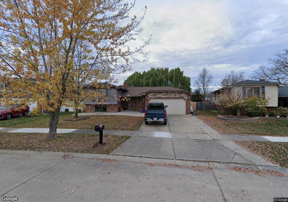
44146 Harsdale Dr Unit Bldg-Unit Canton, MI 48187
Estimated Value: $393,000 - $433,000
--
Bed
3
Baths
2,159
Sq Ft
$193/Sq Ft
Est. Value
About This Home
This home is located at 44146 Harsdale Dr Unit Bldg-Unit, Canton, MI 48187 and is currently estimated at $415,667, approximately $192 per square foot. 44146 Harsdale Dr Unit Bldg-Unit is a home located in Wayne County with nearby schools including Canton High School, Discovery Middle School, and Salem High School.
Ownership History
Date
Name
Owned For
Owner Type
Purchase Details
Closed on
Jul 6, 2018
Sold by
Hajibrahim Crisantos and Hazime Denise
Bought by
Drmg Inc
Current Estimated Value
Purchase Details
Closed on
Mar 2, 2018
Sold by
Hassan Khaled
Bought by
Hajibrahun Crisantos
Home Financials for this Owner
Home Financials are based on the most recent Mortgage that was taken out on this home.
Original Mortgage
$165,000
Interest Rate
4.22%
Mortgage Type
New Conventional
Purchase Details
Closed on
Oct 8, 2015
Sold by
Anderson John and Anderson Amy
Bought by
Hassan Khaled
Purchase Details
Closed on
Apr 28, 2004
Sold by
Tylutki John S and Tylutki Kaisri
Bought by
Anderson John
Create a Home Valuation Report for This Property
The Home Valuation Report is an in-depth analysis detailing your home's value as well as a comparison with similar homes in the area
Home Values in the Area
Average Home Value in this Area
Purchase History
| Date | Buyer | Sale Price | Title Company |
|---|---|---|---|
| Drmg Inc | -- | None Available | |
| Hajibrahun Crisantos | $220,000 | Title One Inc | |
| Hassan Khaled | $190,000 | Eit Title | |
| Anderson John | $219,900 | First Michigan Title Inc |
Source: Public Records
Mortgage History
| Date | Status | Borrower | Loan Amount |
|---|---|---|---|
| Previous Owner | Hajibrahun Crisantos | $165,000 |
Source: Public Records
Tax History Compared to Growth
Tax History
| Year | Tax Paid | Tax Assessment Tax Assessment Total Assessment is a certain percentage of the fair market value that is determined by local assessors to be the total taxable value of land and additions on the property. | Land | Improvement |
|---|---|---|---|---|
| 2025 | $5,060 | $192,000 | $0 | $0 |
| 2024 | $5,060 | $175,400 | $0 | $0 |
| 2023 | $4,821 | $156,100 | $0 | $0 |
| 2022 | $7,551 | $137,300 | $0 | $0 |
| 2021 | $7,321 | $135,400 | $0 | $0 |
| 2020 | $7,227 | $129,700 | $0 | $0 |
| 2019 | $7,144 | $118,710 | $0 | $0 |
| 2018 | $1,946 | $110,470 | $0 | $0 |
| 2017 | $4,917 | $109,600 | $0 | $0 |
| 2016 | $4,421 | $112,200 | $0 | $0 |
| 2015 | $7,918 | $100,500 | $0 | $0 |
| 2013 | $7,671 | $79,790 | $0 | $0 |
| 2010 | -- | $86,050 | $46,795 | $39,255 |
Source: Public Records
Map
Nearby Homes
- 437 Corinne Blvd
- 278 Cornell St
- 44150 Duchess Dr
- 1322 Saltz Ct
- 227 Edington Cir
- 44893 Fair Oaks Dr
- 288 Edington Cir Unit 61
- 603 Concord Dr Unit 67
- 45030 Glengarry Rd
- 550 Concord Dr Unit 75
- 42771 Lilley Pointe Dr Unit 154
- 5887 Northford
- 42789 Lilley Pointe Dr Unit 146
- 1494 Ranier Blvd
- 1822 N Sheldon Rd
- 42697 Redfern St
- 43592 Champlain Ct
- 1710 Longfellow Dr
- 58560 Stuart Dr
- 678 Kings Way
- 44146 Harsdale Dr
- 44160 Harsdale Dr
- 44132 Harsdale Dr
- 44174 Harsdale Dr
- 44001 Palisades Dr
- 44031 Palisades Dr
- 44118 Harsdale Dr
- 43941 Palisades Dr
- 43925 Palisades Dr
- 44043 Palisades Dr
- 44188 Harsdale Dr
- 44111 Harsdale Dr
- 43913 Palisades Dr
- 44104 Harsdale Dr
- 44155 Harsdale Dr
- 44055 Palisades Dr
- 44089 Harsdale Dr
- 43901 Palisades Dr
- 44177 Harsdale Dr
- 44202 Harsdale Dr