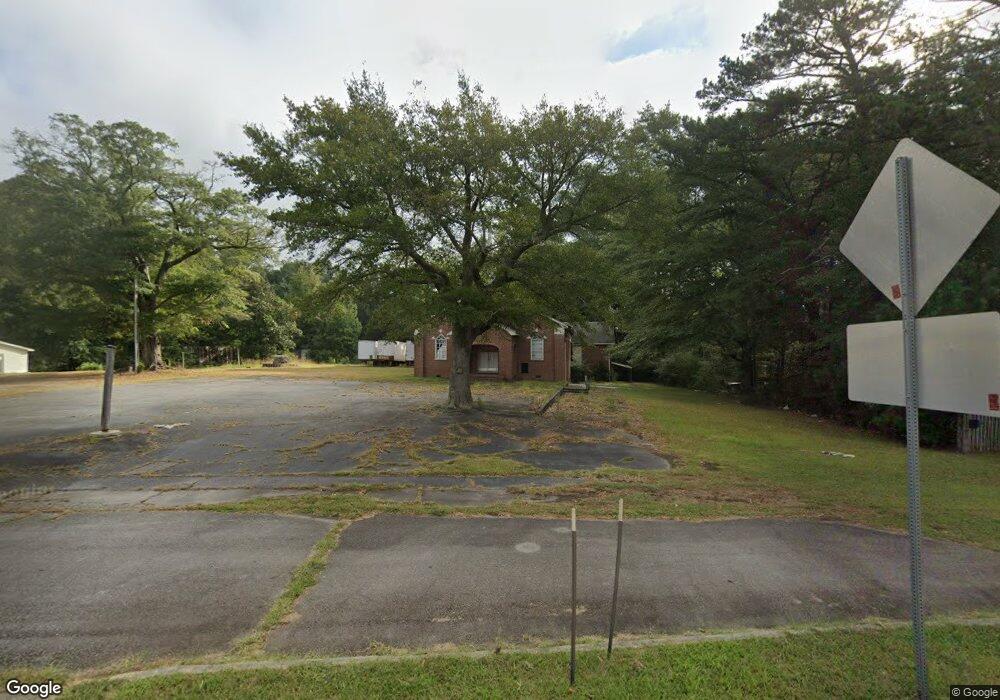
4415 N Highway 27 Carrollton, GA 30117
Estimated Value: $89,502 - $537,000
2
Beds
1
Bath
1,781
Sq Ft
$181/Sq Ft
Est. Value
About This Home
This home is located at 4415 N Highway 27, Carrollton, GA 30117 and is currently estimated at $322,126, approximately $180 per square foot. 4415 N Highway 27 is a home located in Carroll County with nearby schools including Mt. Zion Elementary School, Mt. Zion Middle School, and Mt. Zion High School.
Ownership History
Date
Name
Owned For
Owner Type
Purchase Details
Closed on
Jul 8, 2009
Sold by
Harmony Baptist Church Of
Bought by
Wallace Reese
Current Estimated Value
Purchase Details
Closed on
Jul 8, 2007
Sold by
Not Provided
Bought by
Wallace Reese
Purchase Details
Closed on
Apr 22, 1997
Sold by
Shaw Life Estate
Bought by
Shaw Max
Purchase Details
Closed on
Jul 20, 1943
Bought by
Shaw Life Estate
Create a Home Valuation Report for This Property
The Home Valuation Report is an in-depth analysis detailing your home's value as well as a comparison with similar homes in the area
Home Values in the Area
Average Home Value in this Area
Purchase History
| Date | Buyer | Sale Price | Title Company |
|---|---|---|---|
| Wallace Reese | $225,000 | -- | |
| Wallace Reese | $225,000 | -- | |
| Shaw Max | -- | -- | |
| Harmony Baptist Chur | $65,000 | -- | |
| Shaw J Max | -- | -- | |
| Shaw Life Estate | -- | -- |
Source: Public Records
Tax History Compared to Growth
Tax History
| Year | Tax Paid | Tax Assessment Tax Assessment Total Assessment is a certain percentage of the fair market value that is determined by local assessors to be the total taxable value of land and additions on the property. | Land | Improvement |
|---|---|---|---|---|
| 2024 | $498 | $22,016 | $20,008 | $2,008 |
| 2023 | $498 | $18,015 | $16,006 | $2,009 |
| 2022 | $183 | $7,278 | $5,658 | $1,620 |
| 2021 | $158 | $6,147 | $4,527 | $1,620 |
| 2020 | $136 | $5,315 | $4,115 | $1,200 |
| 2019 | $138 | $5,315 | $4,115 | $1,200 |
| 2018 | $140 | $5,315 | $4,115 | $1,200 |
| 2017 | $495 | $18,793 | $3,578 | $15,215 |
| 2016 | $495 | $18,793 | $3,578 | $15,215 |
| 2015 | $1,268 | $45,332 | $30,200 | $15,133 |
| 2014 | $1,273 | $45,333 | $30,200 | $15,133 |
Source: Public Records
Map
Nearby Homes
- 405 Adler Point
- 112 Turkey Creek Trail
- 406 Holly Springs Rd
- 4748 Us Highway 27
- 469 Lee Williams Rd
- 14 Cole Lake Rd
- 68 Tyler Ln
- 174 Katie Ln
- 142 Tyler Ln
- 898 Bowdon Junction Rd
- 676 Hog Liver Rd
- 00 Hog Liver Rd Unit 346
- 0 Hog Liver Rd Unit 148331
- 0 Hog Liver Rd Unit 10630257
- 0 Hog Liver Rd Unit 7671087
- 0 Hog Liver Rd Unit 10614601
- 0 Hog Liver Rd Unit 10630818
- The Thomas 2 Plan at Lambert Overlook
- The Thomas Plan at Lambert Overlook
- The Brook Plan at Lambert Overlook
- 4401 N Highway 27
- 125 Holly Springs Rd
- 4373 N Highway 27
- 20 Reid Rd
- 00 Lee Williams Rd
- 0 Bowdon Junction Rd Unit 143869
- 0 Bowdon Junction Rd Unit 7161633
- 0 Bowdon Junction Rd Unit 10121383
- 0 Bowdon Junction Rd Unit 7122869
- 0 Bowdon Junction Rd Unit 3158310
- 0 Bowdon Junction Rd Unit 7019818
- 0 Bowdon Junction Rd Unit 8896311
- 0 Bowdon Junction Rd Unit 8610538
- 0 Bowdon Junction Rd Unit 8536389
- 0 Bowdon Junction Rd Unit 8375066
- 0 Bowdon Junction Rd Unit 8432508
- 0 Bowdon Junction Rd Unit 8536392
- 0 Bowdon Junction Rd Unit 8336451
- 0 Bowdon Junction Rd Unit 8432465
- 26 Reid Rd