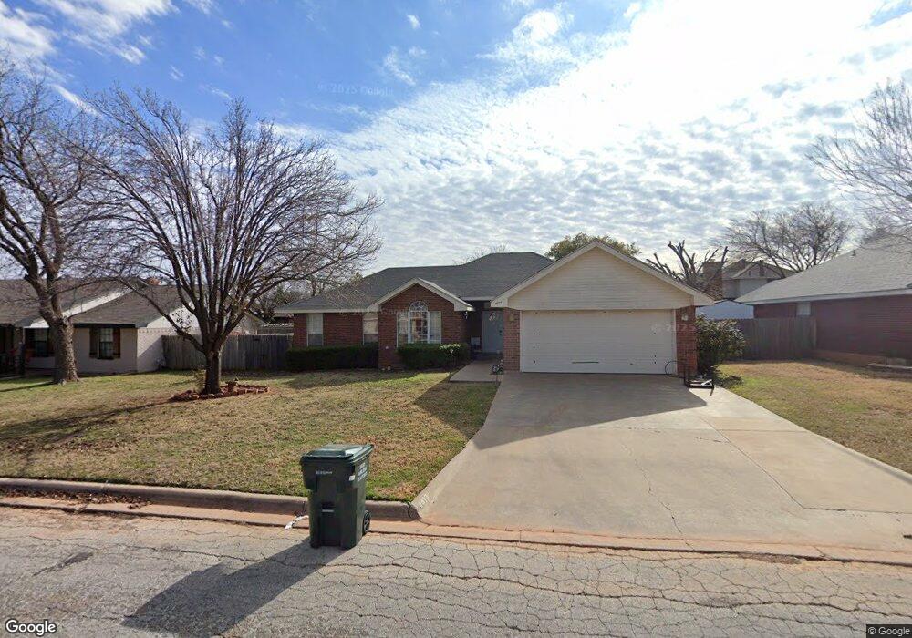
4417 Cole Dr Abilene, TX 79606
Far Southside NeighborhoodEstimated Value: $251,000 - $291,000
4
Beds
2
Baths
1,800
Sq Ft
$147/Sq Ft
Est. Value
About This Home
This home is located at 4417 Cole Dr, Abilene, TX 79606 and is currently estimated at $264,499, approximately $146 per square foot. 4417 Cole Dr is a home located in Taylor County with nearby schools including Wylie West Early Childhood Center, Wylie West Intermediate School, and Wylie West Elementary School.
Ownership History
Date
Name
Owned For
Owner Type
Purchase Details
Closed on
Jun 6, 2014
Sold by
Hussey Jeremy and Hussey Rebecca
Bought by
Scioto Properties Sp 16 Llc
Current Estimated Value
Purchase Details
Closed on
Aug 18, 2011
Sold by
Fournier Richard M and Fournier Cara L
Bought by
Hussey Rebecca and Hussey Jeremy W
Home Financials for this Owner
Home Financials are based on the most recent Mortgage that was taken out on this home.
Original Mortgage
$146,585
Interest Rate
4.65%
Mortgage Type
VA
Purchase Details
Closed on
Mar 24, 2005
Sold by
Hill Michael L and Hill Carla D
Bought by
Fournier Richard M and Fournier Cara L
Home Financials for this Owner
Home Financials are based on the most recent Mortgage that was taken out on this home.
Original Mortgage
$9,240
Interest Rate
5.78%
Mortgage Type
Future Advance Clause Open End Mortgage
Create a Home Valuation Report for This Property
The Home Valuation Report is an in-depth analysis detailing your home's value as well as a comparison with similar homes in the area
Home Values in the Area
Average Home Value in this Area
Purchase History
| Date | Buyer | Sale Price | Title Company |
|---|---|---|---|
| Scioto Properties Sp 16 Llc | -- | None Available | |
| Hussey Rebecca | -- | None Available | |
| Fournier Richard M | -- | None Available |
Source: Public Records
Mortgage History
| Date | Status | Borrower | Loan Amount |
|---|---|---|---|
| Previous Owner | Hussey Rebecca | $146,585 | |
| Previous Owner | Fournier Richard M | $9,240 | |
| Previous Owner | Fournier Richard M | $118,800 |
Source: Public Records
Tax History Compared to Growth
Tax History
| Year | Tax Paid | Tax Assessment Tax Assessment Total Assessment is a certain percentage of the fair market value that is determined by local assessors to be the total taxable value of land and additions on the property. | Land | Improvement |
|---|---|---|---|---|
| 2025 | $5,514 | $217,829 | $22,500 | $195,329 |
| 2023 | $5,514 | $226,453 | $14,625 | $211,828 |
| 2022 | $4,606 | $195,210 | $14,625 | $180,585 |
| 2021 | $4,322 | $167,784 | $14,625 | $153,159 |
| 2020 | $4,311 | $164,631 | $14,625 | $150,006 |
| 2019 | $4,311 | $160,047 | $13,500 | $146,547 |
| 2018 | $3,929 | $156,955 | $13,500 | $143,455 |
| 2017 | $3,740 | $155,084 | $13,500 | $141,584 |
| 2016 | $3,556 | $147,450 | $13,500 | $133,950 |
| 2015 | $2,496 | $146,998 | $13,500 | $133,498 |
| 2014 | $2,496 | $145,238 | $0 | $0 |
Source: Public Records
Map
Nearby Homes
- 7710 John Carroll Dr
- 4634 Beall Blvd
- 7501 White Blvd
- 5001 Buffalo Gap Rd
- 4833 Meadow Dr
- 3809 Mark Ct
- 6642 Buffalo Gap Rd
- 7801 Old Forrest Hill Rd
- 5002 Meadow Dr
- 7967 Bonnie Cir
- 8073 Bonnie Cir
- 5114 Rossland Rd
- 4034 Forrest Hill Rd
- 6890 Buffalo Gap Rd
- 4410 Sierra Sunset
- 7118 Sable Cir
- 6856 Buffao Gap Rd
- 3676 Yamini Dr
- 6781 Hillside Ct
- 5084 Fernie St
- 4425 Cole Dr
- 4409 Cole Dr
- 7558 Ruby Esther Cir
- 7550 Ruby Esther Cir
- 7566 Ruby Esther Cir
- 4433 Cole Dr
- 7542 Ruby Esther Cir
- 4402 Cole Dr
- 7574 Ruby Esther Cir
- 4426 Cole Dr
- 4434 Cole Dr
- 7582 Ruby Esther Cir
- 7509 Thompson Pkwy
- 7557 Ruby Esther Cir
- 7565 Ruby Esther Cir
- 4449 Cole Dr
- 7501 Thompson Pkwy
- 7517 Thompson Pkwy
- 7549 Ruby Esther Cir
- 7602 Ruby Esther Cir