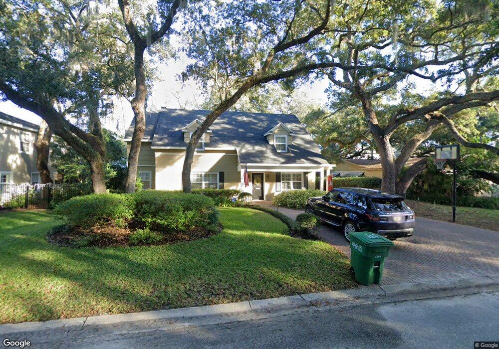
4419 W Watrous Ave Tampa, FL 33629
Culbreath Bayou NeighborhoodEstimated Value: $899,442 - $1,276,000
4
Beds
3
Baths
2,888
Sq Ft
$370/Sq Ft
Est. Value
About This Home
This home is located at 4419 W Watrous Ave, Tampa, FL 33629 and is currently estimated at $1,068,111, approximately $369 per square foot. 4419 W Watrous Ave is a home located in Hillsborough County with nearby schools including Mabry Elementary School, Coleman Middle School, and Plant High School.
Ownership History
Date
Name
Owned For
Owner Type
Purchase Details
Closed on
Jul 23, 1998
Sold by
Heiss John L and Heiss S
Bought by
Sutton Wallace E and Sutton Teresa M
Current Estimated Value
Purchase Details
Closed on
Sep 15, 1995
Sold by
Reed J Larrie and Reed Mary Knauf
Bought by
Heiss John L and Heiss Kathleen S
Home Financials for this Owner
Home Financials are based on the most recent Mortgage that was taken out on this home.
Original Mortgage
$200,000
Interest Rate
7.76%
Create a Home Valuation Report for This Property
The Home Valuation Report is an in-depth analysis detailing your home's value as well as a comparison with similar homes in the area
Home Values in the Area
Average Home Value in this Area
Purchase History
| Date | Buyer | Sale Price | Title Company |
|---|---|---|---|
| Sutton Wallace E | $323,000 | -- | |
| Heiss John L | $233,000 | -- |
Source: Public Records
Mortgage History
| Date | Status | Borrower | Loan Amount |
|---|---|---|---|
| Open | Sutton Wallace E | $372,000 | |
| Closed | Sutton Wallace E | $391,200 | |
| Closed | Sutton Wallace E | $380,000 | |
| Previous Owner | Heiss John L | $200,000 | |
| Closed | Sutton Wallace E | $0 | |
| Closed | Sutton Wallace E | $32,300 |
Source: Public Records
Tax History Compared to Growth
Tax History
| Year | Tax Paid | Tax Assessment Tax Assessment Total Assessment is a certain percentage of the fair market value that is determined by local assessors to be the total taxable value of land and additions on the property. | Land | Improvement |
|---|---|---|---|---|
| 2024 | $6,478 | $374,092 | -- | -- |
| 2023 | $6,319 | $363,196 | $0 | $0 |
| 2022 | $6,153 | $352,617 | $0 | $0 |
| 2021 | $6,081 | $342,347 | $0 | $0 |
| 2020 | $8,018 | $438,152 | $0 | $0 |
| 2019 | $5,833 | $325,911 | $0 | $0 |
| 2018 | $5,792 | $319,834 | $0 | $0 |
| 2017 | $5,711 | $416,905 | $0 | $0 |
| 2016 | $5,545 | $306,813 | $0 | $0 |
| 2015 | $5,559 | $304,680 | $0 | $0 |
| 2014 | $5,499 | $302,262 | $0 | $0 |
| 2013 | -- | $297,795 | $0 | $0 |
Source: Public Records
Map
Nearby Homes
- 4309 W Beachway Dr
- 1206 S Suffolk Dr
- 4512 S Ferncroft Cir
- 1207 S Druid Ln
- 4519 W Culbreath Ave
- 4306 W Jetton Ave
- 4502 W Sylvan Ramble St
- 1506 S Sheridan Forest Dr
- 4523 W Rosemere Rd
- 4305 W Zelar St
- 1229 S Roxmere Rd
- 4701 W Clear Ave
- 1511 S Sheridan Forest Dr
- 4708 W Neptune St
- 817 S West Shore Blvd
- 4215 W Culbreath Ave
- 4806 W Beachway Dr
- 4712 W Clear Ave
- 4616 W Estrella St
- 1003 S Lois Ave
- 4421 W Watrous Ave
- 4417 W Watrous Ave
- 4314 W Beachway Dr
- 4312 W Beachway Dr
- 4415 W Watrous Ave
- 4420 W Watrous Ave
- 4422 W Watrous Ave
- 4501 W Watrous Ave
- 4418 W Watrous Ave
- 4310 W Beachway Dr
- 4502 W Beachway Dr
- 4413 W Watrous Ave
- 4502 W Watrous Ave
- 4414 W Watrous Ave
- 4308 W Beachway Dr
- 4503 S Ferncroft Cir
- 4504 W Beachway Dr
- 4503 W Watrous Ave
- 4315 W Beachway Dr
- 4504 W Watrous Ave