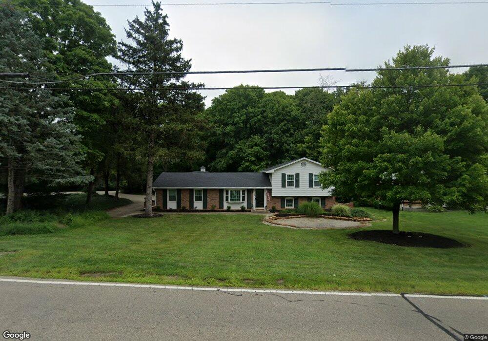
442 Britton Ln Monroe, OH 45050
Estimated Value: $290,000 - $358,000
3
Beds
3
Baths
1,656
Sq Ft
$190/Sq Ft
Est. Value
About This Home
This home is located at 442 Britton Ln, Monroe, OH 45050 and is currently estimated at $315,288, approximately $190 per square foot. 442 Britton Ln is a home located in Butler County with nearby schools including Monroe Primary School, Monroe Elementary School, and Monroe Junior High School.
Ownership History
Date
Name
Owned For
Owner Type
Purchase Details
Closed on
Jun 23, 2015
Sold by
Heck Deborah L and Dirksen David M
Bought by
Dirksen Stephen T and Dirksen David M
Current Estimated Value
Purchase Details
Closed on
Dec 26, 2013
Sold by
Dirksen David P and Dirksen Joanne L
Bought by
Dirksen David P and The Dirksen Family Trust
Purchase Details
Closed on
Jan 12, 1999
Sold by
Deer Run At Monroe Woods Partnership
Bought by
Barger Mary Elizabeth
Create a Home Valuation Report for This Property
The Home Valuation Report is an in-depth analysis detailing your home's value as well as a comparison with similar homes in the area
Home Values in the Area
Average Home Value in this Area
Purchase History
| Date | Buyer | Sale Price | Title Company |
|---|---|---|---|
| Dirksen Stephen T | -- | Attorney | |
| Dirksen David P | -- | None Available | |
| Barger Mary Elizabeth | $139,800 | -- |
Source: Public Records
Tax History
| Year | Tax Paid | Tax Assessment Tax Assessment Total Assessment is a certain percentage of the fair market value that is determined by local assessors to be the total taxable value of land and additions on the property. | Land | Improvement |
|---|---|---|---|---|
| 2025 | $3,868 | $83,520 | $12,990 | $70,530 |
| 2024 | $3,868 | $83,520 | $12,990 | $70,530 |
| 2023 | $3,843 | $84,920 | $12,990 | $71,930 |
| 2022 | $3,143 | $60,180 | $12,990 | $47,190 |
| 2021 | $3,029 | $60,180 | $12,990 | $47,190 |
| 2020 | $3,137 | $60,180 | $12,990 | $47,190 |
| 2019 | $3,785 | $55,200 | $12,440 | $42,760 |
| 2018 | $3,106 | $55,200 | $12,440 | $42,760 |
| 2017 | $3,172 | $55,200 | $12,440 | $42,760 |
| 2016 | $3,011 | $50,240 | $12,440 | $37,800 |
| 2015 | $2,391 | $50,240 | $12,440 | $37,800 |
| 2014 | $2,192 | $50,240 | $12,440 | $37,800 |
| 2013 | $2,192 | $46,220 | $12,440 | $33,780 |
Source: Public Records
Map
Nearby Homes
- 415 Brookhurst Dr
- 195 Brittony Woods Dr
- 316 Wellington Ct
- 180 Wexford Dr
- 100 N Main St
- 921 Heritage Green Dr Unit 9302
- 1416 Wilderness Way Unit 7300
- 1753 Weatherstone Cir Unit 13G6
- 220 Gatehouse Ct
- 75 Teil Tree Ct
- 852 Willowbrook Dr
- 132 Village Ct
- VANDERBURGH Plan at Caravel
- SEBASTIAN Plan at Caravel
- ASH LAWN Plan at Caravel
- BENNETT Plan at Caravel
- LYNDHURST Plan at Caravel
- CRESTWOOD Plan at Caravel
- ALDRIDGE Plan at Caravel
- 6893 Gaspar Trail
- 432 Britton Ln
- 508 Britton Ln
- 465 Hickory Hill Ct
- 443 Britton Ln
- 518 Britton Ln
- 433 Britton Ln
- 420 Britton Ln
- 509 Britton Ln
- 425 Britton Ln
- 531 Britton Ln
- 528 Britton Ln
- 360 Winding Brook Ln
- 519 Britton Ln
- 415 Britton Ln
- 25 Deneen Ave
- 410 Britton Ln
- 460 Hickory Hill Ct
- 24 Deneen Ave
- 538 Britton Ln
- 405 Britton Ln
Your Personal Tour Guide
Ask me questions while you tour the home.