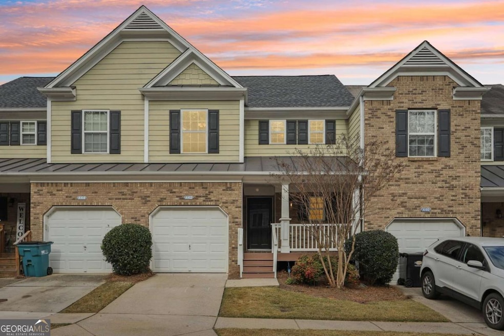
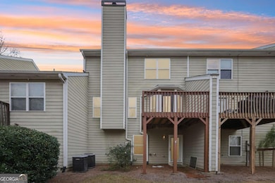
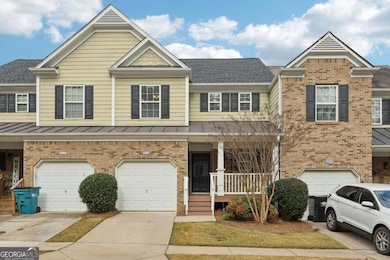
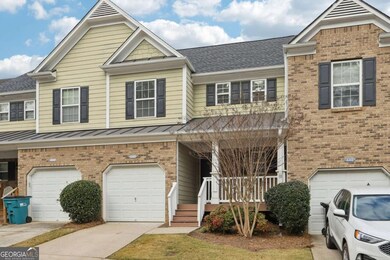
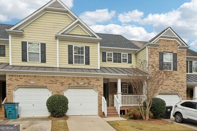
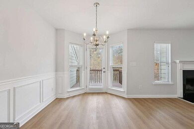
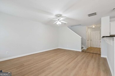
442 Colonial Walk Woodstock, GA 30189
Sutallee NeighborhoodEstimated Value: $348,716 - $366,000
3
Beds
4
Baths
2,971
Sq Ft
$120/Sq Ft
Est. Value
About This Home
This home is located at 442 Colonial Walk, Woodstock, GA 30189 and is currently estimated at $357,358, approximately $120 per square foot. 442 Colonial Walk is a home located in Cherokee County with nearby schools including Boston Elementary School, E. T. Booth Middle School, and Etowah High School.
Ownership History
Date
Name
Owned For
Owner Type
Purchase Details
Closed on
Jul 31, 2008
Sold by
Mcbride & Son Hms Atlanta Llc
Bought by
Kasson Scott M
Current Estimated Value
Home Financials for this Owner
Home Financials are based on the most recent Mortgage that was taken out on this home.
Original Mortgage
$160,573
Outstanding Balance
$105,905
Interest Rate
6.43%
Mortgage Type
FHA
Estimated Equity
$251,453
Create a Home Valuation Report for This Property
The Home Valuation Report is an in-depth analysis detailing your home's value as well as a comparison with similar homes in the area
Home Values in the Area
Average Home Value in this Area
Purchase History
Date | Buyer | Sale Price | Title Company |
---|---|---|---|
Kasson Scott M | $163,200 | -- |
Source: Public Records
Mortgage History
Date | Status | Borrower | Loan Amount |
---|---|---|---|
Open | Kasson Scott M | $160,573 |
Source: Public Records
Tax History Compared to Growth
Tax History
Year | Tax Paid | Tax Assessment Tax Assessment Total Assessment is a certain percentage of the fair market value that is determined by local assessors to be the total taxable value of land and additions on the property. | Land | Improvement |
---|---|---|---|---|
2024 | $3,303 | $143,448 | $28,000 | $115,448 |
2023 | $3,382 | $145,304 | $28,000 | $117,304 |
2022 | $2,932 | $124,156 | $20,000 | $104,156 |
2021 | $2,731 | $104,932 | $20,000 | $84,932 |
2020 | $2,511 | $95,344 | $19,200 | $76,144 |
2019 | $2,150 | $79,800 | $8,400 | $71,400 |
2018 | $2,030 | $74,160 | $8,400 | $65,760 |
2017 | $2,028 | $183,600 | $10,000 | $63,440 |
2016 | $1,840 | $163,800 | $9,600 | $55,920 |
2015 | $1,486 | $132,100 | $7,600 | $45,240 |
2014 | $1,331 | $118,700 | $7,600 | $39,880 |
Source: Public Records
Map
Nearby Homes
- 313 Maltibe Dr
- 146 Sunset Ln
- 7119 Big Woods Dr
- 507 Huntgate Rd
- 477 Victoria Rd
- 617 Driftwood Dr
- 306 N Briar Ridge
- 7307 Carriage Creek Rd
- 1028 Deer Hollow Dr
- 104 Rose Cottage Ln Unit 65
- 0 Black Oak Trail Unit 10267626
- 0 Black Oak Trail Unit 7303191
- 1001 Deer Hollow Dr
- 1031 Camden Ln
- 2006 Hawthorne Way
- 1001 Braelin Ct
- 418 Allatoona Trail
- 112 Countryside Ct
- 819 Victoria Place
- 308 Mainsail Ln
- 440 Colonial Walk
- 444 Colonial Walk
- 446 Colonial Walk
- 438 Colonial Walk
- 450 Colonial Walk
- 434 Colonial Walk
- 452 Colonial Walk
- 432 Colonial Walk
- 451 Colonial Walk
- 451 Colonial Walk Unit 124
- 451 Colonial Walk
- 449 Colonial Walk
- 447 Colonial Walk
- 447 Colonial Walk Unit 447
- 453 Colonial Walk
- 445 Colonial Walk
- 454 Colonial Walk
- 457 Colonial Walk
- 443 Colonial Walk
- 459 Colonial Walk