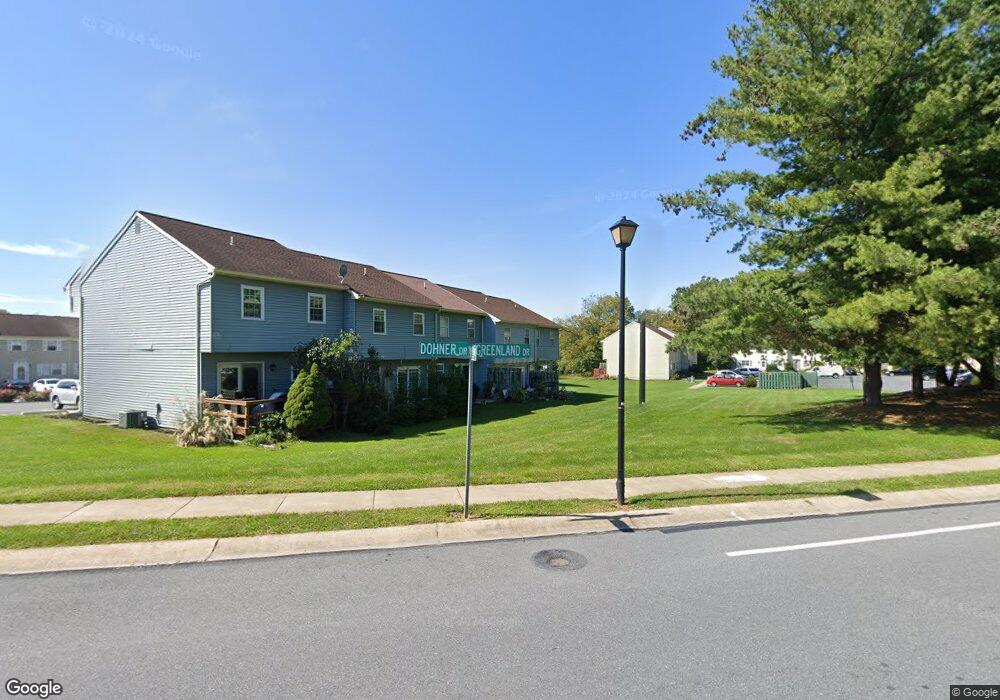
442 Dohner Dr Unit 2024 Lancaster, PA 17602
Fertility NeighborhoodEstimated Value: $232,462 - $255,000
3
Beds
2
Baths
1,240
Sq Ft
$197/Sq Ft
Est. Value
About This Home
This home is located at 442 Dohner Dr Unit 2024, Lancaster, PA 17602 and is currently estimated at $244,116, approximately $196 per square foot. 442 Dohner Dr Unit 2024 is a home located in Lancaster County with nearby schools including Smoketown Elementary School, Gerald G. Huesken Middle School, and Conestoga Valley High School.
Ownership History
Date
Name
Owned For
Owner Type
Purchase Details
Closed on
Jun 22, 2018
Sold by
Earle Sylvester D
Bought by
Earle Sylvester D and Earle Erica
Current Estimated Value
Purchase Details
Closed on
Jun 29, 2007
Sold by
Suarez Nelson A and Suarez Wanda J
Bought by
Earle Sylvester D
Home Financials for this Owner
Home Financials are based on the most recent Mortgage that was taken out on this home.
Original Mortgage
$2,000
Outstanding Balance
$1,243
Interest Rate
6.39%
Mortgage Type
Stand Alone Second
Estimated Equity
$242,873
Purchase Details
Closed on
Feb 14, 2000
Sold by
Hud
Bought by
Suarez Nelson A and Suarez Wanda J
Home Financials for this Owner
Home Financials are based on the most recent Mortgage that was taken out on this home.
Original Mortgage
$73,926
Interest Rate
8.21%
Mortgage Type
FHA
Purchase Details
Closed on
Dec 1, 1999
Sold by
Price Kevin R
Bought by
Norwest Mtg Inc
Create a Home Valuation Report for This Property
The Home Valuation Report is an in-depth analysis detailing your home's value as well as a comparison with similar homes in the area
Home Values in the Area
Average Home Value in this Area
Purchase History
| Date | Buyer | Sale Price | Title Company |
|---|---|---|---|
| Earle Sylvester D | -- | None Available | |
| Earle Sylvester D | $146,900 | None Available | |
| Suarez Nelson A | $74,000 | -- | |
| Norwest Mtg Inc | $3,028 | -- |
Source: Public Records
Mortgage History
| Date | Status | Borrower | Loan Amount |
|---|---|---|---|
| Open | Earle Sylvester D | $2,000 | |
| Previous Owner | Suarez Nelson A | $73,926 |
Source: Public Records
Tax History Compared to Growth
Tax History
| Year | Tax Paid | Tax Assessment Tax Assessment Total Assessment is a certain percentage of the fair market value that is determined by local assessors to be the total taxable value of land and additions on the property. | Land | Improvement |
|---|---|---|---|---|
| 2025 | $2,274 | $112,300 | $19,900 | $92,400 |
| 2024 | $2,274 | $112,300 | $19,900 | $92,400 |
| 2023 | $2,221 | $112,300 | $19,900 | $92,400 |
| 2022 | $2,166 | $112,300 | $19,900 | $92,400 |
| 2021 | $2,089 | $112,300 | $19,900 | $92,400 |
| 2020 | $2,089 | $112,300 | $19,900 | $92,400 |
| 2019 | $2,044 | $112,300 | $19,900 | $92,400 |
| 2018 | $2,816 | $112,300 | $19,900 | $92,400 |
| 2017 | $2,358 | $108,900 | $21,200 | $87,700 |
| 2016 | $2,329 | $108,900 | $21,200 | $87,700 |
| 2015 | $595 | $108,900 | $21,200 | $87,700 |
| 2014 | $1,520 | $108,900 | $21,200 | $87,700 |
Source: Public Records
Map
Nearby Homes
- 455 Garland Cir
- 71 Black Oak Dr Unit 71
- 502 Country Meadows Dr
- 248 Wolgemuth Dr
- 1886 Conard Rd
- 166 Huntingwood Dr
- 25 Homestead Dr
- 1827 Krystle Dr
- 2 Resch Ln
- 1731 Windy Hill Rd
- 92 Glendale Dr
- 1716 Newport Dr
- 129 S Eastland Dr
- 2315 Old Philadelphia Pike
- 97 Duncan St
- 1742 Old Philadelphia Pike
- 14 Kennedy St Unit 170
- 806 Lightfoot Dr
- 1664 Old Philadelphia Pike
- 1660 Old Philadelphia Pike
- 444 Dohner Dr Unit 2024
- 446 Dohner Dr
- 440 Dohner Dr Unit 25
- 448 Dohner Dr Unit 21
- 438 Dohner Dr Unit 2530
- 450 Dohner Dr Unit 2024
- 436 Dohner Dr Unit 27
- 434 Dohner Dr Unit 28
- 432 Dohner Dr
- 430 Dohner Dr Unit 30
- 452 Dohner Dr
- 454 Dohner Dr
- 456 Dohner Dr
- 428 Dohner Dr
- 426 Dohner Dr
- 421 Daisy Ln
- 424 Dohner Dr
- 422 Dohner Dr Unit 34
- 458 Dohner Dr
- 420 Dohner Dr Unit 3135