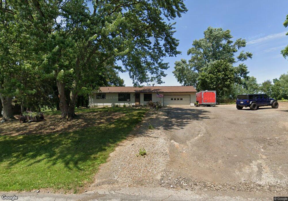
442 E Messner Rd Wooster, OH 44691
Estimated Value: $251,912 - $316,000
3
Beds
1
Bath
1,503
Sq Ft
$193/Sq Ft
Est. Value
About This Home
This home is located at 442 E Messner Rd, Wooster, OH 44691 and is currently estimated at $290,228, approximately $193 per square foot. 442 E Messner Rd is a home located in Wayne County with nearby schools including Triway High School, Moreland School, and Sunny Meadow.
Ownership History
Date
Name
Owned For
Owner Type
Purchase Details
Closed on
Nov 25, 2015
Sold by
Zappone Brandi L
Bought by
Zappone Ii Ramon S
Current Estimated Value
Purchase Details
Closed on
Nov 16, 2006
Sold by
Zapppone Ramon S and Zappone Brandi L
Bought by
Zappone Ii Ramon S and Zappone Brandi L
Home Financials for this Owner
Home Financials are based on the most recent Mortgage that was taken out on this home.
Original Mortgage
$116,500
Interest Rate
6.41%
Mortgage Type
New Conventional
Purchase Details
Closed on
Sep 24, 2003
Sold by
Zappone Chandler Doris A
Bought by
Zappone Ii Ramon S
Home Financials for this Owner
Home Financials are based on the most recent Mortgage that was taken out on this home.
Original Mortgage
$73,000
Interest Rate
6.33%
Mortgage Type
Unknown
Create a Home Valuation Report for This Property
The Home Valuation Report is an in-depth analysis detailing your home's value as well as a comparison with similar homes in the area
Purchase History
| Date | Buyer | Sale Price | Title Company |
|---|---|---|---|
| Zappone Ii Ramon S | -- | Attorney | |
| Zappone Ii Ramon S | -- | Lawyers Title | |
| Zappone Ii Ramon S | $150,000 | Wayne County Title |
Source: Public Records
Mortgage History
| Date | Status | Borrower | Loan Amount |
|---|---|---|---|
| Previous Owner | Zappone Ii Ramon S | $116,500 | |
| Previous Owner | Zappone Ii Ramon S | $73,000 |
Source: Public Records
Tax History
| Year | Tax Paid | Tax Assessment Tax Assessment Total Assessment is a certain percentage of the fair market value that is determined by local assessors to be the total taxable value of land and additions on the property. | Land | Improvement |
|---|---|---|---|---|
| 2025 | $2,376 | $69,480 | $15,330 | $54,150 |
| 2024 | $2,376 | $69,480 | $15,330 | $54,150 |
| 2023 | $2,394 | $69,480 | $15,330 | $54,150 |
| 2022 | $1,792 | $47,590 | $10,500 | $37,090 |
| 2021 | $1,795 | $47,590 | $10,500 | $37,090 |
| 2020 | $1,817 | $47,590 | $10,500 | $37,090 |
| 2019 | $1,498 | $38,060 | $9,660 | $28,400 |
| 2018 | $1,525 | $38,060 | $9,660 | $28,400 |
| 2017 | $1,412 | $38,060 | $9,660 | $28,400 |
| 2016 | $1,338 | $33,100 | $8,400 | $24,700 |
| 2015 | $1,307 | $33,100 | $8,400 | $24,700 |
| 2014 | $1,308 | $33,100 | $8,400 | $24,700 |
| 2013 | $1,308 | $32,910 | $7,560 | $25,350 |
Source: Public Records
Map
Nearby Homes
- 2535 Millersburg Rd
- 3419 Fredericksburg Rd
- 8383 Hoy Rd
- 3065 Dover Rd
- 2430 S Columbus Rd
- 4348 Buss Rd
- 0 Heyl Rd
- 9718 James Rd
- 3315 Sylvan Rd
- 3682 Blachleyville Rd
- 140 Ohio St
- 219 Mulberry St
- 4859 Prosperity Way
- 5 E Melrose Unit 5
- 227 N Walnut St
- 223 E Larwill St
- 3299 Crestview Dr
- 230 Clark Ave
- 423 N Market St
- 419 Nold Ave
- 364 E Messner Rd
- 502 E Messner Rd
- 337 E Messner Rd
- 469 E Messner Rd
- 578 E Messner Rd
- 531 E Messner Rd
- 641 E Messner Rd
- 668 E Messner Rd
- 5353 Millersburg Rd
- 5453 Millersburg Rd
- 5487 Millersburg Rd
- 5531 Millersburg Rd
- 2 E Messner Rd
- 744 E Messner Rd
- 5430 Prairie Ln
- 5492 Millersburg Rd
- 777 E Messner Rd
- 800 E Messner Rd
- 5615 Millersburg Rd
- 822 E Messner Rd
Your Personal Tour Guide
Ask me questions while you tour the home.