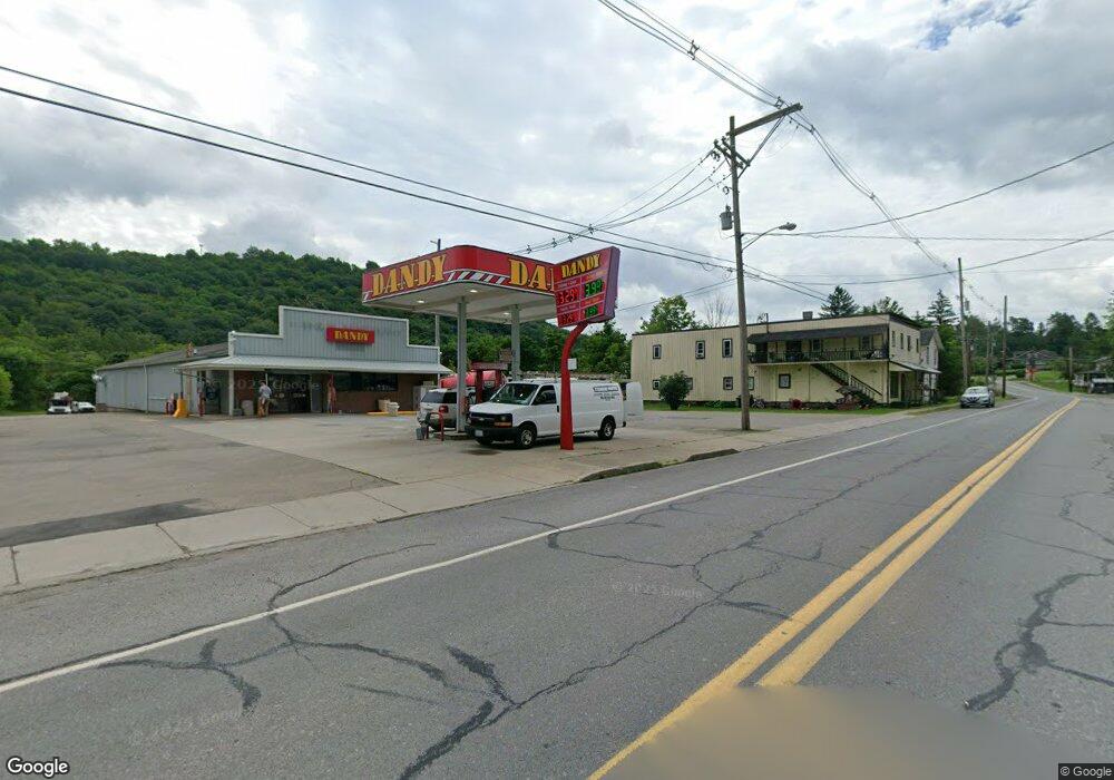
442 Front St New Albany, PA 18833
Estimated Value: $147,667
--
Bed
4
Baths
3,181
Sq Ft
$46/Sq Ft
Est. Value
About This Home
This home is located at 442 Front St, New Albany, PA 18833 and is currently estimated at $147,667, approximately $46 per square foot. 442 Front St is a home located in Bradford County with nearby schools including Wyalusing Valley Elementary School and Wyalusing Valley Junior/Senior High School.
Ownership History
Date
Name
Owned For
Owner Type
Purchase Details
Closed on
Jun 19, 2013
Sold by
Shoemaker Richard D and Shoemaker Roberta W
Bought by
Dandy Property Management Llc
Current Estimated Value
Purchase Details
Closed on
Jul 29, 2008
Sold by
Bahr Michael E and Bahr Nancy J
Bought by
Shoemaker Richard D and Shoemaker Roberta W
Home Financials for this Owner
Home Financials are based on the most recent Mortgage that was taken out on this home.
Original Mortgage
$70,000
Interest Rate
6.47%
Mortgage Type
FHA
Create a Home Valuation Report for This Property
The Home Valuation Report is an in-depth analysis detailing your home's value as well as a comparison with similar homes in the area
Home Values in the Area
Average Home Value in this Area
Purchase History
| Date | Buyer | Sale Price | Title Company |
|---|---|---|---|
| Dandy Property Management Llc | $75,000 | None Available | |
| Shoemaker Richard D | $45,000 | None Available |
Source: Public Records
Mortgage History
| Date | Status | Borrower | Loan Amount |
|---|---|---|---|
| Previous Owner | Shoemaker Richard D | $70,000 |
Source: Public Records
Tax History Compared to Growth
Tax History
| Year | Tax Paid | Tax Assessment Tax Assessment Total Assessment is a certain percentage of the fair market value that is determined by local assessors to be the total taxable value of land and additions on the property. | Land | Improvement |
|---|---|---|---|---|
| 2025 | $723 | $9,350 | $0 | $0 |
| 2024 | $695 | $9,350 | $0 | $0 |
| 2023 | $695 | $9,350 | $0 | $0 |
| 2022 | $705 | $9,350 | $0 | $0 |
| 2021 | $679 | $9,350 | $0 | $0 |
| 2020 | $674 | $9,350 | $0 | $0 |
| 2019 | $672 | $9,350 | $0 | $0 |
| 2018 | $639 | $9,350 | $0 | $0 |
| 2017 | $610 | $9,350 | $0 | $0 |
| 2016 | -- | $9,350 | $0 | $0 |
| 2015 | -- | $9,350 | $0 | $0 |
| 2014 | $874 | $9,350 | $0 | $0 |
Source: Public Records
Map
Nearby Homes
- 11 Leesway Ln
- 3272 Pelton Hill Rd
- 0 Stevenson Hill Rd
- 7706 Route 220
- 1498 Gainer Hill Rd
- 0 Cummiskey Rd
- 486 Laurel Ln
- 189 Dog Farm Rd
- PARCEL 0017 Route 220 Hwy
- 115 Headley Ave
- 122 Headley Ave
- 152 Carpenter St
- 181 E Cherry St
- 167 Payne Run Ln
- 1998 Brocktown Rd
- 1146 Eagle Rock Rd
- 1164 Rosenberry Hill Rd
- 99 E Laurel St
- 49 Bear Run Ln
- 182 Brookside Dr
