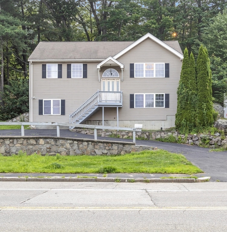
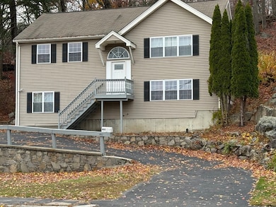
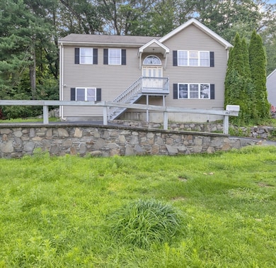
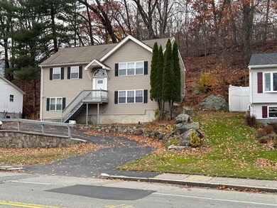
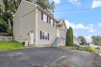
442 Lake Ave Worcester, MA 01604
Grafton Hill NeighborhoodHighlights
- Medical Services
- Property is near public transit
- Jogging Path
- Deck
- No HOA
- Park
About This Home
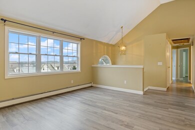
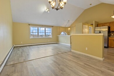
Charming and sun-filled Colonial home available for rent in a sought-after Worcester neighborhood! This beautifully maintained residence offers 4 spacious bedrooms and 2 baths, featuring gleaming hardwood floors throughout. The modern kitchen with a breakfast bar and stainless steel appliances flows seamlessly into the dining room with lovely built-ins. Conveniently located near major highways, public transportation, shopping, restaurants, parks, and entertainment, Close to UMASS Don’t miss this fantastic rental opportunity!

Home Details
Home Type
- Single Family
Est. Annual Taxes
- $5,835
Year Built
- Built in 2000
Parking
- 3 Car Parking Spaces
Home Design
- Entry on the 1st floor
Kitchen
- Oven
- Range
- ENERGY STAR Qualified Refrigerator
- Dishwasher
- Disposal
Bedrooms and Bathrooms
- 4 Bedrooms
- 2 Full Bathrooms
Laundry
- ENERGY STAR Qualified Dryer
- ENERGY STAR Qualified Washer
Location
- Property is near public transit
- Property is near schools
Utilities
- No Cooling
- Heating System Uses Natural Gas
Additional Features
- Deck
- 6,000 Sq Ft Lot
Listing and Financial Details
- Security Deposit $3,500
- Property Available on 11/15/25
- Rent includes water, sewer
- Assessor Parcel Number M:41 B:005 L:8991,3424550
Community Details
Overview
- No Home Owners Association
Amenities
- Medical Services
- Shops
- Coin Laundry
Recreation
- Park
- Jogging Path
Pet Policy
- Pets Allowed
Map
Source: MLS Property Information Network (MLS PIN)
MLS Number: 73453796
APN: WORC-000041-000005-000089-000091
Disclaimer: Certain information contained herein is derived from information provided by parties other than Homes.com. All information provided is deemed reliable, but is not guaranteed to be accurate and should be independently verified.
![]() The property listing data and information, or the Images, set forth herein were provided to MLS Property Information Network, Inc. from third party sources, including sellers, lessors and public records, and were compiled by MLS Property Information Network, Inc. The property listing data and information, and the Images, are for the personal, non-commercial use of consumers having a good faith interest in purchasing or leasing listed properties of the type displayed to them and may not be used for any purpose other than to identify prospective properties which such consumers may have a good faith interest in purchasing or leasing. MLS Property Information Network, Inc. and its subscribers disclaim any and all representations and warranties as to the accuracy of the property listing data and information, or as to the accuracy of any of the Images, set forth herein.
The property listing data and information, or the Images, set forth herein were provided to MLS Property Information Network, Inc. from third party sources, including sellers, lessors and public records, and were compiled by MLS Property Information Network, Inc. The property listing data and information, and the Images, are for the personal, non-commercial use of consumers having a good faith interest in purchasing or leasing listed properties of the type displayed to them and may not be used for any purpose other than to identify prospective properties which such consumers may have a good faith interest in purchasing or leasing. MLS Property Information Network, Inc. and its subscribers disclaim any and all representations and warranties as to the accuracy of the property listing data and information, or as to the accuracy of any of the Images, set forth herein.
- 23 Canna Dr
- 3 Bay Edge Dr
- 14 Bay Edge Ln
- 7 Atlas St
- 68 Bay View Dr
- 334 Bridle Path
- 62 Edgemere Blvd
- 589 Sunderland Rd
- 31 Crane St
- 33 Lakeside Dr
- 1199 Grafton St Unit 93
- 1195 Grafton St Unit 3
- 1201 Grafton St Unit 73
- 1203 Grafton St Unit 38
- 270 Sunderland Rd Unit 37
- 270 Sunderland Rd Unit 77
- 270 Sunderland Rd Unit 67
- 11 Margin St
- 340 Sunderland Rd Unit 23
- 15 Lakeside Dr
- 384 Sunderland Rd Unit 12
- 384 Sunderland Rd Unit 25
- 378 Sunderland Rd Unit 7
- 4 Westborough St
- 1168 Grafton St
- 138 Orton Street Extension
- 376 Sunderland Rd Unit 19
- 29 Duncannon Ave
- 14 Ferraro St Unit 1
- 376 Sunderland Rd
- 15 Burghardt St Unit B
- 10 Beverly Cove
- 48 Pointe Rok Dr Unit 48G
- 3 Flagg Rd
- 45 Kinglet Dr Unit A
- 42 Fenwood Rd
- 468 Massasoit Rd Unit Top floor
- 17 Farrar Ave Unit 2
- 542 Grafton St Unit 2
- 100 Flint Pond Cir