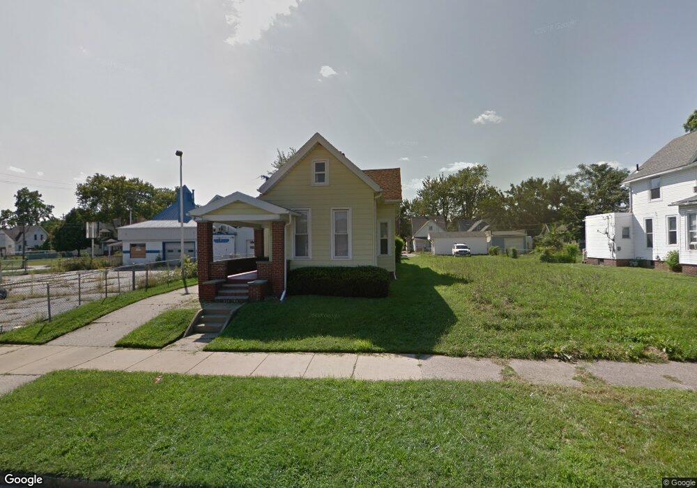
442 Langdon St Toledo, OH 43609
Southside NeighborhoodEstimated Value: $60,000 - $70,000
3
Beds
1
Bath
1,648
Sq Ft
$40/Sq Ft
Est. Value
About This Home
This home is located at 442 Langdon St, Toledo, OH 43609 and is currently estimated at $65,598, approximately $39 per square foot. 442 Langdon St is a home located in Lucas County with nearby schools including Marshall Stemm Academy, Jesup W. Scott High School, and Summit Academy - Toledo.
Ownership History
Date
Name
Owned For
Owner Type
Purchase Details
Closed on
Dec 21, 2006
Sold by
Cuneo Patsy L and Cuneo William
Bought by
Walker Charlene
Current Estimated Value
Home Financials for this Owner
Home Financials are based on the most recent Mortgage that was taken out on this home.
Original Mortgage
$31,920
Outstanding Balance
$22,210
Interest Rate
9.5%
Mortgage Type
Purchase Money Mortgage
Estimated Equity
$43,388
Purchase Details
Closed on
Jan 31, 2003
Sold by
Cuneo Patsy L and Cuneo William
Bought by
Cuneo Patsy L and Rosiak Nancy
Purchase Details
Closed on
Aug 16, 1990
Sold by
Pirrwitz P E and W E
Create a Home Valuation Report for This Property
The Home Valuation Report is an in-depth analysis detailing your home's value as well as a comparison with similar homes in the area
Home Values in the Area
Average Home Value in this Area
Purchase History
| Date | Buyer | Sale Price | Title Company |
|---|---|---|---|
| Walker Charlene | $39,900 | Chicago Title Insurance Co | |
| Cuneo Patsy L | -- | -- | |
| -- | -- | -- |
Source: Public Records
Mortgage History
| Date | Status | Borrower | Loan Amount |
|---|---|---|---|
| Open | Walker Charlene | $31,920 |
Source: Public Records
Tax History Compared to Growth
Tax History
| Year | Tax Paid | Tax Assessment Tax Assessment Total Assessment is a certain percentage of the fair market value that is determined by local assessors to be the total taxable value of land and additions on the property. | Land | Improvement |
|---|---|---|---|---|
| 2024 | $445 | $12,460 | $1,785 | $10,675 |
| 2023 | $922 | $12,600 | $1,400 | $11,200 |
| 2022 | $932 | $12,600 | $1,400 | $11,200 |
| 2021 | $940 | $12,600 | $1,400 | $11,200 |
| 2020 | $1,021 | $12,355 | $1,365 | $10,990 |
| 2019 | $1,009 | $12,355 | $1,365 | $10,990 |
| 2018 | $997 | $12,355 | $1,365 | $10,990 |
| 2017 | $1,041 | $12,075 | $1,330 | $10,745 |
| 2016 | $1,025 | $34,500 | $3,800 | $30,700 |
| 2015 | $1,010 | $34,500 | $3,800 | $30,700 |
| 2014 | $760 | $12,080 | $1,330 | $10,750 |
| 2013 | $760 | $12,080 | $1,330 | $10,750 |
Source: Public Records
Map
Nearby Homes
- 428 Havre St
- 714 Walbridge Ave
- 511 Congress St
- 325 Chapin St
- 323 Langdon St
- 641 South Ave
- 702 Boalt St
- 620 South Ave
- 872 Prouty Ave
- 816 Orchard St
- 642 Orchard St
- 713 Orchard St
- 925 Colburn St
- 616 Thayer St
- 578 Prouty Ave
- 616 Pleasant Place
- 765 Redwood Ave
- 763 Redwood Ave
- 708 Bowman St
- 930 Orchard St
- 434 Langdon St
- 434 Langdon St Unit 2
- 816 South Ave
- 816 South Ave
- 430 Langdon St
- 820 South Ave
- 435 Chapin St
- 428 Langdon St
- 433 Chapin St
- 439 Chapin St
- 426 Langdon St
- 437 Langdon St
- 822 South Ave
- 429 Chapin St
- 433 Langdon St
- 431 Chapin St
- 424 Langdon St
- 425 Chapin St
- 423 Langdon St
- 423 Langdon St Unit 1