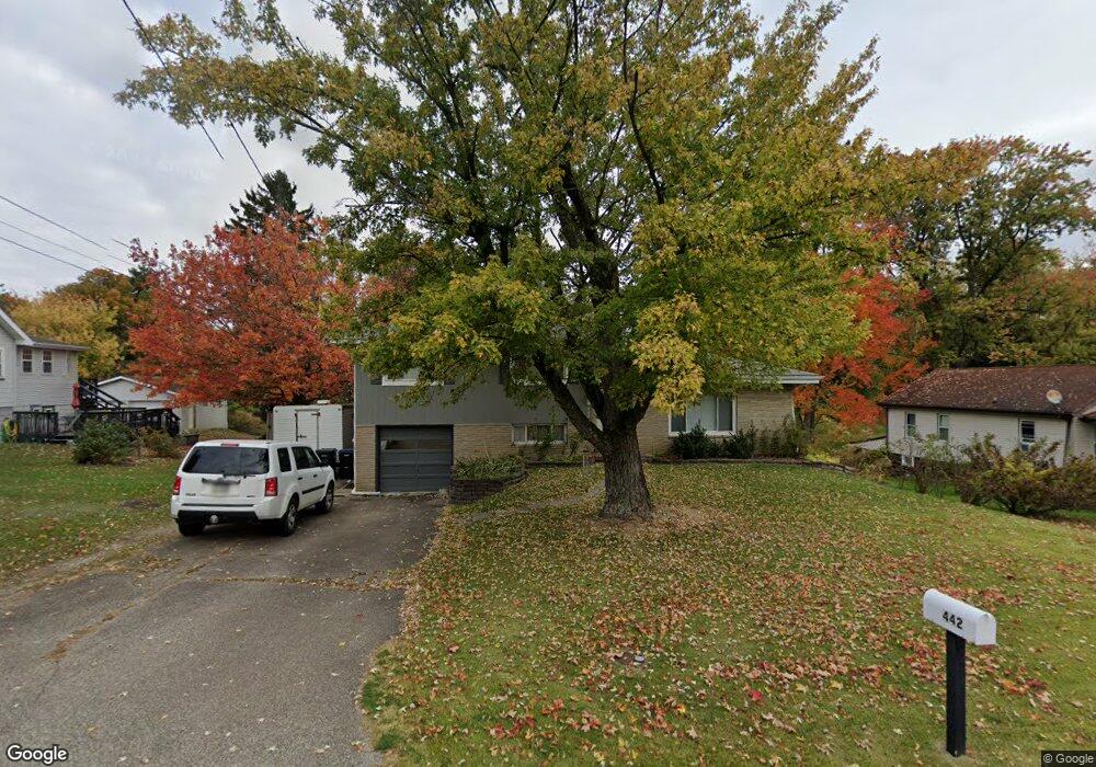
442 Moon Clinton Rd Coraopolis, PA 15108
Estimated Value: $251,000 - $285,015
3
Beds
1
Bath
1,574
Sq Ft
$165/Sq Ft
Est. Value
About This Home
This home is located at 442 Moon Clinton Rd, Coraopolis, PA 15108 and is currently estimated at $260,254, approximately $165 per square foot. 442 Moon Clinton Rd is a home located in Allegheny County with nearby schools including Moon Area High School, Montessori Children's Community, and St James Elementary School.
Ownership History
Date
Name
Owned For
Owner Type
Purchase Details
Closed on
Jul 12, 2006
Sold by
Gass John H
Bought by
Hunter John H
Current Estimated Value
Home Financials for this Owner
Home Financials are based on the most recent Mortgage that was taken out on this home.
Original Mortgage
$93,700
Outstanding Balance
$55,689
Interest Rate
6.67%
Mortgage Type
New Conventional
Estimated Equity
$204,565
Create a Home Valuation Report for This Property
The Home Valuation Report is an in-depth analysis detailing your home's value as well as a comparison with similar homes in the area
Home Values in the Area
Average Home Value in this Area
Purchase History
| Date | Buyer | Sale Price | Title Company |
|---|---|---|---|
| Hunter John H | $125,000 | -- |
Source: Public Records
Mortgage History
| Date | Status | Borrower | Loan Amount |
|---|---|---|---|
| Open | Hunter John H | $93,700 |
Source: Public Records
Tax History Compared to Growth
Tax History
| Year | Tax Paid | Tax Assessment Tax Assessment Total Assessment is a certain percentage of the fair market value that is determined by local assessors to be the total taxable value of land and additions on the property. | Land | Improvement |
|---|---|---|---|---|
| 2025 | $4,198 | $134,300 | $36,700 | $97,600 |
| 2024 | $4,198 | $134,300 | $36,700 | $97,600 |
| 2023 | $4,048 | $134,300 | $36,700 | $97,600 |
| 2022 | $4,048 | $134,300 | $36,700 | $97,600 |
| 2021 | $4,048 | $134,300 | $36,700 | $97,600 |
| 2020 | $3,947 | $134,300 | $36,700 | $97,600 |
| 2019 | $3,839 | $134,300 | $36,700 | $97,600 |
| 2018 | $635 | $134,300 | $36,700 | $97,600 |
| 2017 | $3,630 | $134,300 | $36,700 | $97,600 |
| 2016 | $635 | $134,300 | $36,700 | $97,600 |
| 2015 | $635 | $134,300 | $36,700 | $97,600 |
| 2014 | $3,535 | $134,300 | $36,700 | $97,600 |
Source: Public Records
Map
Nearby Homes
- 135 Pear Orchard Rd
- 203 Ascot Ct
- 204 Ascot Ct
- 209 Lockheed Dr
- 174 Lockheed Dr
- 176 Lockheed Dr
- 178 Lockheed Dr
- 179 Lockheed Dr
- 182 Lockheed Dr
- 162 Foxwood Rd
- 506 Isabella Ct
- 511 Isabella Ct
- 191 Rosemont Dr
- 134 Becks Run Rd
- 115 Elm Ln
- 824 Balmoral Ct
- 326 College Park Dr Unit 41
- 221 Springer Dr
- Eisenhower Plan at Victoria Ridge
- Cleveland Plan at Victoria Ridge
- 444 Moon Clinton Rd
- 440 Moon Clinton Rd
- 438 Moon Clinton Rd
- 446 Moon Clinton Rd
- 441 Moon Clinton Rd
- 436 Moon Clinton Rd
- 448 Moon Clinton Rd
- 147 Pear Orchard Rd
- 145 Pear Orchard Rd
- 139 Pear Orchard Rd
- 137 Pear Orchard Rd
- 451 Moon Clinton Rd
- 425 Moon Clinton Rd
- 426 Moon Clinton Rd
- 423 Moon Clinton Rd
- 119 Pear Orchard Rd
- 150 Pear Orchard Rd
- 148 Pear Orchard Rd
- 152 Pear Orchard Rd
- 456 Moon Clinton Rd