Estimated Value: $171,000 - $274,000
--
Bed
--
Bath
--
Sq Ft
4,487
Sq Ft Lot
About This Home
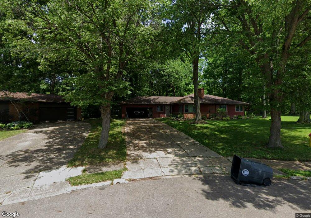
This home is located at 442 Mowbray Rd, Akron, OH 44333 and is currently estimated at $222,500. 442 Mowbray Rd is a home located in Summit County with nearby schools including Fairlawn Lutheran School, Our Lady Of The Elms Elementary School, and St. Hilary Elementary School.
Ownership History
Date
Name
Owned For
Owner Type
Purchase Details
Closed on
Mar 15, 2019
Sold by
Bollinger Edward H
Bought by
Spoonster Kiernen A
Current Estimated Value
Home Financials for this Owner
Home Financials are based on the most recent Mortgage that was taken out on this home.
Original Mortgage
$142,500
Outstanding Balance
$109,038
Interest Rate
4.4%
Mortgage Type
New Conventional
Estimated Equity
$113,462
Create a Home Valuation Report for This Property
The Home Valuation Report is an in-depth analysis detailing your home's value as well as a comparison with similar homes in the area
Home Values in the Area
Average Home Value in this Area
Purchase History
| Date | Buyer | Sale Price | Title Company |
|---|---|---|---|
| Spoonster Kiernen A | $150,000 | Village Title Agency Llc |
Source: Public Records
Mortgage History
| Date | Status | Borrower | Loan Amount |
|---|---|---|---|
| Open | Spoonster Kiernen A | $142,500 |
Source: Public Records
Tax History Compared to Growth
Tax History
| Year | Tax Paid | Tax Assessment Tax Assessment Total Assessment is a certain percentage of the fair market value that is determined by local assessors to be the total taxable value of land and additions on the property. | Land | Improvement |
|---|---|---|---|---|
| 2025 | $263 | $5,775 | $5,775 | -- |
| 2024 | $263 | $5,775 | $5,775 | -- |
| 2023 | $263 | $5,775 | $5,775 | $0 |
| 2022 | $276 | $4,620 | $4,620 | $0 |
| 2021 | $277 | $4,620 | $4,620 | $0 |
| 2020 | $272 | $4,620 | $4,620 | $0 |
| 2019 | $648 | $9,900 | $4,540 | $5,360 |
| 2018 | $639 | $9,900 | $4,540 | $5,360 |
| 2017 | $652 | $9,900 | $4,540 | $5,360 |
| 2016 | $653 | $9,900 | $4,540 | $5,360 |
| 2015 | $652 | $9,900 | $4,540 | $5,360 |
| 2014 | $646 | $9,900 | $4,540 | $5,360 |
| 2013 | $647 | $10,150 | $4,540 | $5,610 |
Source: Public Records
Map
Nearby Homes
- 2267 Woodpark Rd
- 2331 Woodpark Rd
- 441 Sandhurst Rd
- 807 Willow Creek Dr
- 863 Willow Creek Dr
- 2096 Hidden Hollow Ln Unit 51
- 2514 Carson Rd
- 2079 Wyndham Rd
- 720 Winding Way Unit 45
- 2121 Brookshire Rd
- 2560 Sand Run Pkwy
- 257 Sand Run Rd
- 2595 Sand Run Pkwy
- 881 Hampton Ridge Dr
- 177 Caladonia Ave
- 320 Caladonia Ave
- 770 Hunters Trail
- 835 Sutton Place
- 736 Hampton Ridge Dr Unit 736
- 128 Overwood Rd
- 442 Mowbray Rd
- 445 Mowbray Rd
- 436 Mowbray Rd
- 441 Mowbray Rd
- 428 Mowbray Rd
- 431 Mowbray Rd
- 419 Mowbray Rd
- 409 Mowbray Rd
- 412 Mowbray Rd
- 399 Mowbray Rd
- 400 Mowbray Rd
- 2261 Woodpark Rd
- 2255 Woodpark Rd
- 2299 Burnham Rd
- 389 Mowbray Rd
- 2273 Woodpark Rd
- 2249 Woodpark Rd
- 2281 Woodpark Rd
- 2307 Burnham Rd
- 2300 Burnham Rd