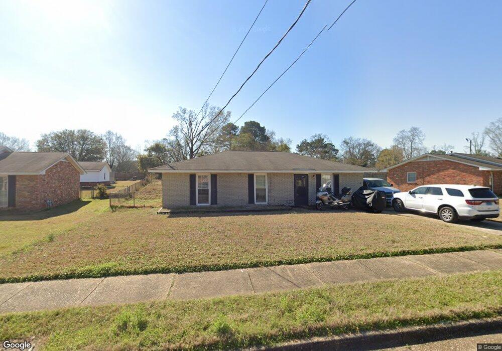
442 Mulligan Dr Montgomery, AL 36117
East Montgomery NeighborhoodEstimated Value: $119,000 - $137,947
3
Beds
2
Baths
1,232
Sq Ft
$102/Sq Ft
Est. Value
About This Home
This home is located at 442 Mulligan Dr, Montgomery, AL 36117 and is currently estimated at $125,487, approximately $101 per square foot. 442 Mulligan Dr is a home located in Montgomery County with nearby schools including Wares Ferry Road Elementary School, Goodwyn Middle School, and Dr. Percy L. Julian High School.
Ownership History
Date
Name
Owned For
Owner Type
Purchase Details
Closed on
Aug 26, 2009
Sold by
Gravatt Michelle L and Ray Michelle
Bought by
Williams Napoleon
Current Estimated Value
Home Financials for this Owner
Home Financials are based on the most recent Mortgage that was taken out on this home.
Original Mortgage
$91,315
Outstanding Balance
$59,233
Interest Rate
5.11%
Mortgage Type
Purchase Money Mortgage
Estimated Equity
$66,254
Purchase Details
Closed on
Nov 13, 2007
Sold by
Ray James D and Ray Michelle
Bought by
Ray Michelle
Home Financials for this Owner
Home Financials are based on the most recent Mortgage that was taken out on this home.
Original Mortgage
$85,500
Interest Rate
6.29%
Mortgage Type
Purchase Money Mortgage
Create a Home Valuation Report for This Property
The Home Valuation Report is an in-depth analysis detailing your home's value as well as a comparison with similar homes in the area
Home Values in the Area
Average Home Value in this Area
Purchase History
| Date | Buyer | Sale Price | Title Company |
|---|---|---|---|
| Williams Napoleon | -- | None Available | |
| Ray Michelle | $162,000 | First American Title Ins Co |
Source: Public Records
Mortgage History
| Date | Status | Borrower | Loan Amount |
|---|---|---|---|
| Open | Williams Napoleon | $91,315 | |
| Previous Owner | Ray Michelle | $85,500 |
Source: Public Records
Tax History Compared to Growth
Tax History
| Year | Tax Paid | Tax Assessment Tax Assessment Total Assessment is a certain percentage of the fair market value that is determined by local assessors to be the total taxable value of land and additions on the property. | Land | Improvement |
|---|---|---|---|---|
| 2025 | $542 | $11,810 | $1,500 | $10,310 |
| 2024 | $529 | $11,540 | $1,500 | $10,040 |
| 2023 | $529 | $10,720 | $1,500 | $9,220 |
| 2022 | $282 | $8,860 | $1,500 | $7,360 |
| 2021 | $248 | $7,920 | $0 | $0 |
| 2020 | $248 | $7,900 | $1,500 | $6,400 |
| 2019 | $255 | $8,100 | $1,500 | $6,600 |
| 2018 | $283 | $7,720 | $1,500 | $6,220 |
| 2017 | $210 | $13,720 | $3,000 | $10,720 |
| 2014 | $210 | $6,860 | $1,500 | $5,360 |
| 2013 | -- | $8,010 | $1,500 | $6,510 |
Source: Public Records
Map
Nearby Homes
- 6228 Hinchcliff Rd
- 6120 Hinchcliff Rd
- 6214 Gladstone Dr
- 6119 Hinchcliff Rd
- 6204 Lycoming Rd
- 310 Kroy Dr
- 6316 Pinebrook Dr
- 0000 N Burbank Dr
- 225 Townsend Dr
- 6408 Pinebrook Dr
- 6427 Pinebrook Dr
- 740 Havelock Ln
- 6241 Wares Ferry Rd
- 6201 Dalford Dr
- 6272 Nature Dr
- 6037 Burbank Crossing Loop
- 5922 Havenwood Dr
- 6520 Pinebrook Dr
- 767 N Burbank Dr
- 6515 Ridgeview Ln
- 438 Mulligan Dr
- 446 Mulligan Dr
- 430 Mulligan Dr
- 450 Mulligan Dr
- 6232 Hinchcliff Rd
- 449 Mulligan Dr
- 424 Mulligan Dr
- 441 Mulligan Dr
- 454 Mulligan Dr
- 437 Mulligan Dr
- 6107 Gladstone Dr
- 6240 Hinchcliff Rd
- 433 Mulligan Dr
- 416 Mulligan Dr
- 457 Mulligan Dr
- 6212 Hinchcliff Rd
- 429 Mulligan Dr
- 458 Mulligan Dr
- 6111 Gladstone Dr
- 6220 Hinchcliff Rd