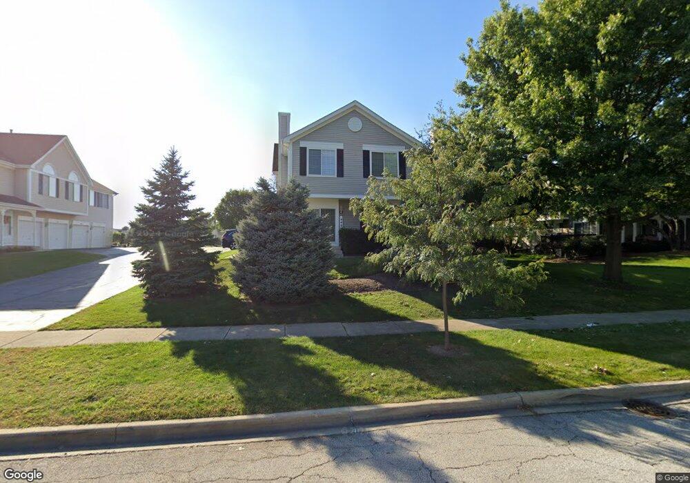
442 Sandhurst Ln Unit 2 South Elgin, IL 60177
Estimated Value: $253,000 - $267,000
2
Beds
2
Baths
1,220
Sq Ft
$214/Sq Ft
Est. Value
About This Home
This home is located at 442 Sandhurst Ln Unit 2, South Elgin, IL 60177 and is currently estimated at $261,293, approximately $214 per square foot. 442 Sandhurst Ln Unit 2 is a home located in Kane County with nearby schools including Fox Meadow Elementary School, Kenyon Woods Middle School, and South Elgin High School.
Ownership History
Date
Name
Owned For
Owner Type
Purchase Details
Closed on
Dec 5, 2003
Sold by
Fergus Sean Patrick and Fergus Jennifer Louise
Bought by
Wilson Carmen M and Antepenko Derek R
Current Estimated Value
Home Financials for this Owner
Home Financials are based on the most recent Mortgage that was taken out on this home.
Original Mortgage
$130,800
Outstanding Balance
$58,997
Interest Rate
5.5%
Mortgage Type
Purchase Money Mortgage
Estimated Equity
$202,296
Purchase Details
Closed on
Jun 24, 1999
Sold by
Glass Robert C and Glass Audra S
Bought by
Fergus Sean P and Fergus Jennifer L
Home Financials for this Owner
Home Financials are based on the most recent Mortgage that was taken out on this home.
Original Mortgage
$108,300
Interest Rate
7.54%
Create a Home Valuation Report for This Property
The Home Valuation Report is an in-depth analysis detailing your home's value as well as a comparison with similar homes in the area
Home Values in the Area
Average Home Value in this Area
Purchase History
| Date | Buyer | Sale Price | Title Company |
|---|---|---|---|
| Wilson Carmen M | $163,500 | Chicago Title Insurance Comp | |
| Fergus Sean P | $114,000 | -- |
Source: Public Records
Mortgage History
| Date | Status | Borrower | Loan Amount |
|---|---|---|---|
| Open | Wilson Carmen M | $130,800 | |
| Previous Owner | Fergus Sean P | $108,300 | |
| Closed | Wilson Carmen M | $24,525 |
Source: Public Records
Tax History Compared to Growth
Tax History
| Year | Tax Paid | Tax Assessment Tax Assessment Total Assessment is a certain percentage of the fair market value that is determined by local assessors to be the total taxable value of land and additions on the property. | Land | Improvement |
|---|---|---|---|---|
| 2024 | $4,814 | $68,999 | $17,175 | $51,824 |
| 2023 | $4,559 | $62,335 | $15,516 | $46,819 |
| 2022 | $4,375 | $56,839 | $14,148 | $42,691 |
| 2021 | $4,105 | $53,140 | $13,227 | $39,913 |
| 2020 | $3,810 | $48,916 | $12,627 | $36,289 |
| 2019 | $3,658 | $46,596 | $12,028 | $34,568 |
| 2018 | $3,572 | $43,896 | $11,331 | $32,565 |
| 2017 | $3,380 | $41,498 | $10,712 | $30,786 |
| 2016 | $3,199 | $38,499 | $9,938 | $28,561 |
| 2015 | -- | $35,288 | $9,109 | $26,179 |
| 2014 | -- | $32,718 | $8,997 | $23,721 |
| 2013 | -- | $33,581 | $9,234 | $24,347 |
Source: Public Records
Map
Nearby Homes
- 435 Sandhurst Ln Unit 3
- 1458 Woodland Dr
- 8N594 S Mclean Blvd
- 1419 S Pembroke Dr
- 1370 Marleigh Ln
- 126 Kingsport Dr
- 590 Fenwick Ln
- 671 Fieldcrest Dr
- 387 S Pointe Ave
- 281 Kingsport Dr
- 283 Kingsport Dr
- 285 Kingsport Dr
- 287 Kingsport Dr
- 289 Kingsport Dr
- 291 Kingsport Dr
- 286 Kingsport Dr
- 282 Kingsport Dr
- 280 Kingsport Dr
- 301 Kingsport Dr
- 303 Kingsport Dr
- 440 Sandhurst Ln Unit 1
- 446 Sandhurst Ln Unit 4
- 444 Sandhurst Ln Unit 3
- 420 Sandhurst Ln
- 484 Sandhurst Ln Unit C
- 480 Sandhurst Ln Unit 1
- 431 Sandhurst Ln Unit 1
- 424 Sandhurst Ln Unit 3
- 422 Sandhurst Ln Unit 2
- 426 Sandhurst Ln Unit 4
- 461 Sandhurst Ln Unit 1
- 411 Sandhurst Ln Unit 1
- 400 Sandhurst Ln Unit 1
- 441 Hobart Dr
- 433 Hobart Dr
- 404 Sandhurst Ln Unit 3
- 402 Sandhurst Ln Unit 2
- 406 Sandhurst Ln Unit 4
- 506 Sandhurst Ln Unit 4
- 504 Sandhurst Ln Unit 3