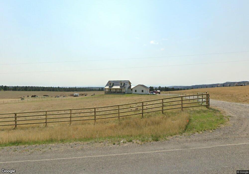
4420 Clapper Flat Rd Laurel, MT 59044
Estimated Value: $566,000 - $1,008,000
4
Beds
3
Baths
2,373
Sq Ft
$351/Sq Ft
Est. Value
About This Home
This home is located at 4420 Clapper Flat Rd, Laurel, MT 59044 and is currently estimated at $833,786, approximately $351 per square foot. 4420 Clapper Flat Rd is a home located in Yellowstone County with nearby schools including Fred W. Graff School, West School, and Laurel Middle School.
Ownership History
Date
Name
Owned For
Owner Type
Purchase Details
Closed on
Sep 4, 2014
Sold by
Anderson Douglas L and Anderson Phyllis L
Bought by
Anderson Douglas L and Anderson Phyllis L
Current Estimated Value
Purchase Details
Closed on
Jun 17, 2010
Sold by
Fitch Jeffrey T and Fitch Heidi J
Bought by
Anderson Curt L and Latray Anderson Heather N
Create a Home Valuation Report for This Property
The Home Valuation Report is an in-depth analysis detailing your home's value as well as a comparison with similar homes in the area
Purchase History
| Date | Buyer | Sale Price | Title Company |
|---|---|---|---|
| Anderson Douglas L | -- | None Available | |
| Anderson Curt L | -- | None Available |
Source: Public Records
Tax History
| Year | Tax Paid | Tax Assessment Tax Assessment Total Assessment is a certain percentage of the fair market value that is determined by local assessors to be the total taxable value of land and additions on the property. | Land | Improvement |
|---|---|---|---|---|
| 2025 | $4,338 | $774,331 | $68,601 | $705,730 |
| 2024 | $4,338 | $641,499 | $63,389 | $578,110 |
| 2023 | $4,302 | $641,499 | $63,389 | $578,110 |
| 2022 | $3,369 | $510,724 | $0 | $0 |
| 2021 | $3,537 | $510,724 | $0 | $0 |
| 2020 | $3,208 | $451,408 | $0 | $0 |
| 2019 | $3,073 | $451,408 | $0 | $0 |
| 2018 | $3,228 | $425,471 | $0 | $0 |
| 2017 | $2,850 | $425,471 | $0 | $0 |
| 2016 | $2,540 | $378,570 | $0 | $0 |
| 2015 | $2,494 | $378,570 | $0 | $0 |
| 2014 | $2,127 | $171,904 | $0 | $0 |
Source: Public Records
Map
Nearby Homes
- 3203 Chief Looking Glass Trl Rd
- 3103 Chief Looking Glass Rd
- 115 Red and King Gulch Rd
- 5930 Chief Buffalo Horn Trail
- TBD Coombs Flat Road - Lot 4
- TBD Coombs Flat Road - Lot 3
- 1712 Paynes Place
- TBD Coombs Flat Road - Lot 2
- 1960 Coyote Ridge Rd N
- TBD Lot 2 Lori Rae Ln
- TBD Lot 1 Lori Rae Ln
- TBD Coombs Flat Road - Lot 1
- 1735 Lobo Dr
- 1014 Rochelle Ln
- TBD Wold Rd
- 1013 W 12th St
- 1254 W Beartooth Dr
- 1109 10th Ave
- 1216 W 12th Street Cir
- 1631 Valley Dr
- TBD Clapper Flat Rd
- 0 Clapper Flat Rd
- 4610 Clapper Flat Rd
- 3280 Chief White Bird Trail
- 4646 Clapper Flat Rd
- 3024 Chief White Bird Trail
- 3203 Chief Looking Glass Rd
- 3111 Chief Looking Glass Rd
- 2980 Chief White Bird Trail
- 000 Chief Looking Glass Rd
- 5015 Clapper Flat Rd
- 2860 Chief White Bird Trail
- 00 Chief White Bird Trail
- 0 Chief White Bird Trail
- 3300 Chief Looking Glass Rd
- 2800 Chief White Bird Trail
- 3205 Red and King Gulch Rd
- 3355 Red and King Gulch Rd
- 3166 Chief Looking Glass Rd
- 5065 Clapper Flat Rd
Your Personal Tour Guide
Ask me questions while you tour the home.