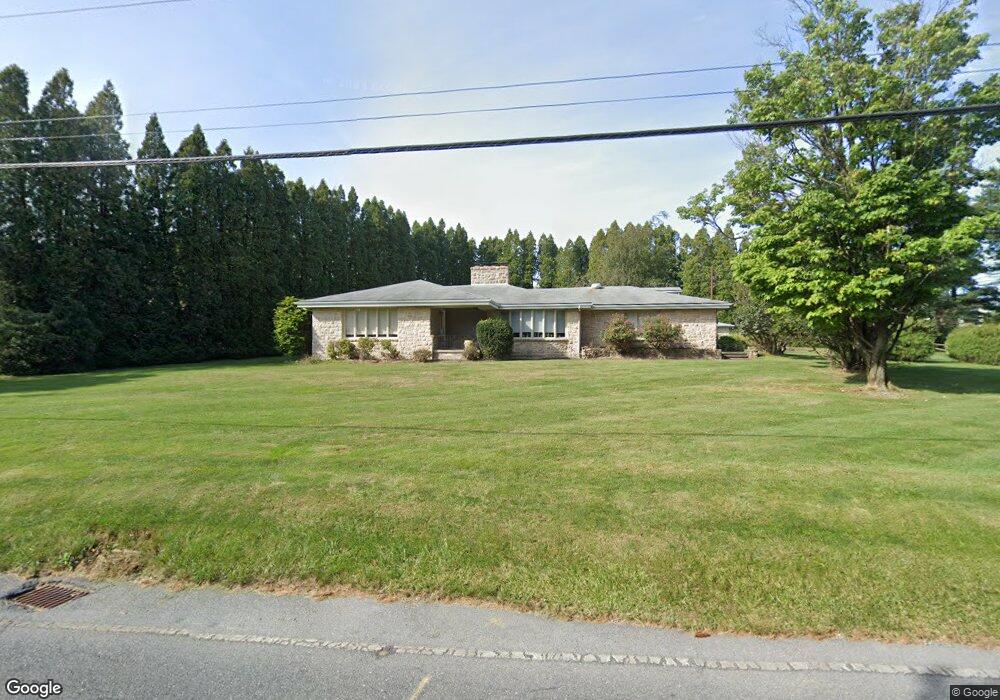
4420 Fargreen Rd Harrisburg, PA 17110
Estimated Value: $290,000 - $339,000
3
Beds
2
Baths
1,605
Sq Ft
$200/Sq Ft
Est. Value
About This Home
This home is located at 4420 Fargreen Rd, Harrisburg, PA 17110 and is currently estimated at $321,321, approximately $200 per square foot. 4420 Fargreen Rd is a home located in Dauphin County with nearby schools including Thomas W. Holtzman Jr. Elementary School, Sara Lindemuth Elementary School, and Susquehanna Township Middle School.
Ownership History
Date
Name
Owned For
Owner Type
Purchase Details
Closed on
Oct 7, 2004
Sold by
Smeltz Vicki
Bought by
Coronado Grace
Current Estimated Value
Home Financials for this Owner
Home Financials are based on the most recent Mortgage that was taken out on this home.
Original Mortgage
$136,000
Outstanding Balance
$67,670
Interest Rate
5.84%
Mortgage Type
New Conventional
Estimated Equity
$253,651
Create a Home Valuation Report for This Property
The Home Valuation Report is an in-depth analysis detailing your home's value as well as a comparison with similar homes in the area
Home Values in the Area
Average Home Value in this Area
Purchase History
| Date | Buyer | Sale Price | Title Company |
|---|---|---|---|
| Coronado Grace | $170,000 | -- |
Source: Public Records
Mortgage History
| Date | Status | Borrower | Loan Amount |
|---|---|---|---|
| Open | Coronado Grace | $136,000 |
Source: Public Records
Tax History Compared to Growth
Tax History
| Year | Tax Paid | Tax Assessment Tax Assessment Total Assessment is a certain percentage of the fair market value that is determined by local assessors to be the total taxable value of land and additions on the property. | Land | Improvement |
|---|---|---|---|---|
| 2025 | $4,945 | $136,100 | $38,200 | $97,900 |
| 2024 | $4,458 | $136,100 | $38,200 | $97,900 |
| 2023 | $4,275 | $136,100 | $38,200 | $97,900 |
| 2022 | $4,222 | $136,100 | $38,200 | $97,900 |
| 2021 | $4,148 | $136,100 | $38,200 | $97,900 |
| 2020 | $4,148 | $136,100 | $38,200 | $97,900 |
| 2019 | $4,056 | $136,100 | $38,200 | $97,900 |
| 2018 | $3,832 | $136,100 | $38,200 | $97,900 |
| 2017 | $3,832 | $136,100 | $38,200 | $97,900 |
| 2016 | $0 | $136,100 | $38,200 | $97,900 |
| 2015 | -- | $136,100 | $38,200 | $97,900 |
| 2014 | -- | $136,100 | $38,200 | $97,900 |
Source: Public Records
Map
Nearby Homes
- 1300 Mountain Laurel Cir
- 4529 Custer Terrace
- 1108 Linglestown Rd
- 4536 Custer Terrace
- 4528 Laurelwood Dr
- 4333 Linglestown Rd
- 4700 Laurel Dr
- 123 Hiddenwood Dr
- 4113 Cotswold Dr
- 1813 Holly Dr
- 403 Redbud Ct
- 2001 Mount Vernon Cir
- 4495 Bolton Notch Place
- 1817 Dogwood Rd
- 4317 Beaufort Hunt Dr
- 0 Montfort Dr
- 1411 Montfort Dr
- Brookfield Plan at Mountaindale
- Westbrooke Plan at Mountaindale
- Kingston Plan at Mountaindale
- 1317 Mountain Laurel Cir
- 1316 Mountain Laurel Cir
- 4416 Fargreen Rd
- 4424 Fargreen Rd
- 4423 Fargreen Rd
- 4421 Fargreen Rd
- 4421 Fargreen Rd
- 4421 Fargreen Rd
- 1313 Mountain Laurel Cir
- 1312 Mountain Laurel Cir
- 4417 Fargreen Rd
- 1312 Laurel Point Cir
- 1309 Mountain Laurel Cir
- 1308 Mountain Laurel Cir
- 4425 Fargreen Rd
- 1308 Laurel Point Cir
- 1307 Laurel Den Cir Unit L22
- 1305 Laurel Den Cir Unit L21
- 1305 Mountain Laurel Cir
- 4500 Fargreen Rd