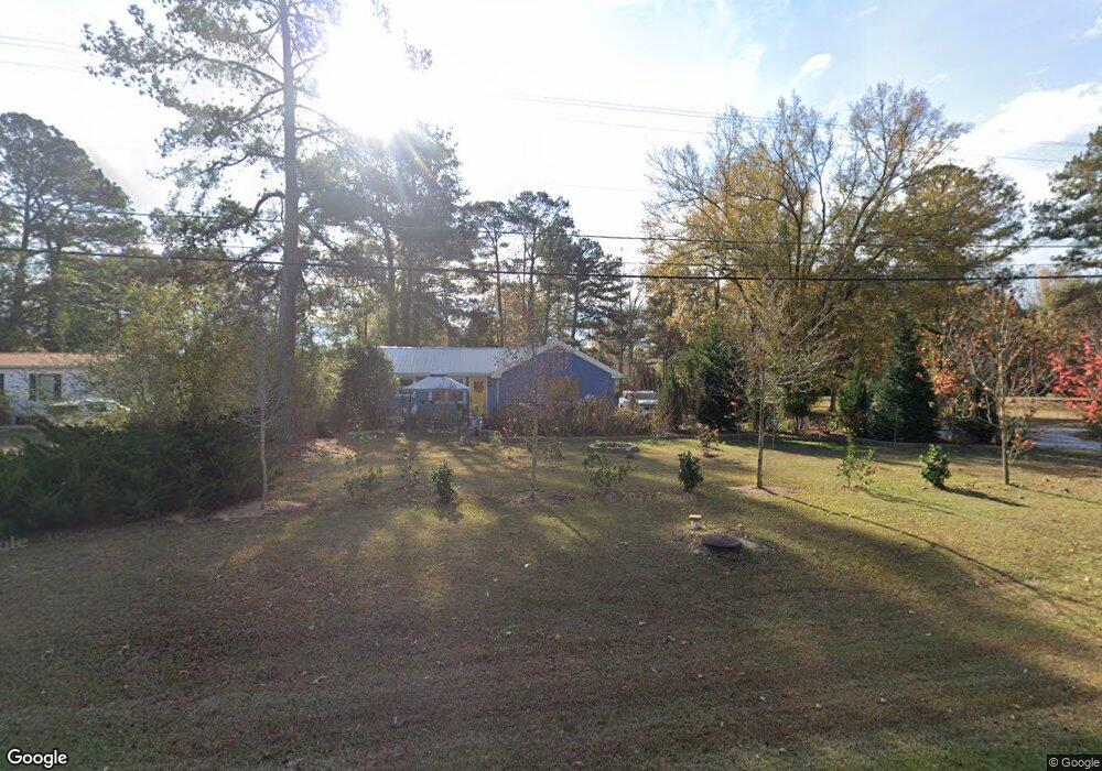
4421 Union Point Hwy Union Point, GA 30669
Estimated Value: $75,000 - $182,000
--
Bed
1
Bath
866
Sq Ft
$140/Sq Ft
Est. Value
About This Home
This home is located at 4421 Union Point Hwy, Union Point, GA 30669 and is currently estimated at $120,815, approximately $139 per square foot. 4421 Union Point Hwy is a home with nearby schools including Greene County High School.
Ownership History
Date
Name
Owned For
Owner Type
Purchase Details
Closed on
Aug 7, 2018
Sold by
Holcomb Emma Dean
Bought by
Rocha-Cuevas Magaly E
Current Estimated Value
Home Financials for this Owner
Home Financials are based on the most recent Mortgage that was taken out on this home.
Original Mortgage
$35,000
Interest Rate
4.5%
Mortgage Type
Mortgage Modification
Purchase Details
Closed on
Jun 2, 1997
Sold by
Hollis Montine
Bought by
Holcomb Emma Dean
Purchase Details
Closed on
Jan 1, 1960
Bought by
Hollis Montine
Create a Home Valuation Report for This Property
The Home Valuation Report is an in-depth analysis detailing your home's value as well as a comparison with similar homes in the area
Home Values in the Area
Average Home Value in this Area
Purchase History
| Date | Buyer | Sale Price | Title Company |
|---|---|---|---|
| Rocha-Cuevas Magaly E | $35,000 | -- | |
| Holcomb Emma Dean | $6,000 | -- | |
| Hollis Montine | -- | -- |
Source: Public Records
Mortgage History
| Date | Status | Borrower | Loan Amount |
|---|---|---|---|
| Closed | Rocha-Cuevas Magaly E | $35,000 |
Source: Public Records
Tax History Compared to Growth
Tax History
| Year | Tax Paid | Tax Assessment Tax Assessment Total Assessment is a certain percentage of the fair market value that is determined by local assessors to be the total taxable value of land and additions on the property. | Land | Improvement |
|---|---|---|---|---|
| 2025 | $1,079 | $38,100 | $6,600 | $31,500 |
| 2024 | $1,024 | $35,780 | $6,600 | $29,180 |
| 2023 | $765 | $35,040 | $6,600 | $28,440 |
| 2022 | $732 | $32,724 | $6,600 | $26,124 |
| 2021 | $712 | $29,884 | $6,600 | $23,284 |
| 2020 | $558 | $19,600 | $6,480 | $13,120 |
| 2019 | $459 | $19,600 | $6,480 | $13,120 |
| 2018 | $438 | $19,600 | $6,480 | $13,120 |
| 2017 | $520 | $19,622 | $6,480 | $13,142 |
| 2016 | $539 | $20,234 | $6,480 | $13,754 |
| 2015 | $506 | $20,234 | $6,480 | $13,754 |
| 2014 | $509 | $19,869 | $6,480 | $13,389 |
Source: Public Records
Map
Nearby Homes
- 0 S Rhodes St Unit 10618488
- 1241 Old Siloam Rd
- 0 Washington Hwy Unit 7276060
- 1041 Hillcrest Dr
- 215 Hunter St
- 202 Veazey St
- 324 N Rhodes St
- 1581 Highway 77 S Hwy
- 1581 Highway 77 S
- 112 Hendry St
- 0 Woodland Ct Unit 10543600
- 0 Old Union Point Rd Unit 1 10557753
- 1251 Brick House Rd
- 1251 Brickhouse Rd
- 1251 Adams Rd
- 5401 Union Point Hwy
- 1201 Buffalo Lick Rd
- 0 Buffalo Lick Rd Unit 10551234
- 0 Buffalo Lick Rd Unit 10551325
- 1860 Washington Hwy
- 4431 Lamb Ave
- 1030 Country Club Dr
- 1030 Country Club Dr
- 4441 Lamb Ave
- 1040 Country Club Ln
- 4461 Lamb Ave
- 1050 Country Club Dr
- 1011 Country Club Dr
- 1031 Country Club Dr
- 1031 Country Club Dr
- 1051 Country Club Dr
- 1080 Country Club Dr
- 3661 Old Union Point Rd
- 1120 Country Club Dr
- 4561 Lamb Ave
- 1111 Country Club Dr
- 1130 Country Club Dr
- 1131 Country Club Dr
- 316 S Rhodes St
- 1140 Country Club Dr