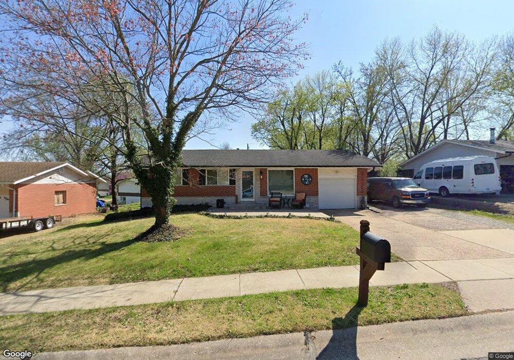
4422 Mattis Rd Saint Louis, MO 63128
Estimated Value: $194,000 - $305,000
2
Beds
2
Baths
925
Sq Ft
$270/Sq Ft
Est. Value
About This Home
This home is located at 4422 Mattis Rd, Saint Louis, MO 63128 and is currently estimated at $249,950, approximately $270 per square foot. 4422 Mattis Rd is a home located in St. Louis County with nearby schools including Trautwein Elementary School, Washington Middle School, and Mehlville High School.
Ownership History
Date
Name
Owned For
Owner Type
Purchase Details
Closed on
Mar 8, 2001
Sold by
Thirion Dina J and Thirion Jo Dina
Bought by
Gaines Lester Nick and Owens John
Current Estimated Value
Purchase Details
Closed on
Oct 24, 1997
Sold by
Mitchell Paul W and Mitchell Marie Anna
Bought by
Thirion Dina J
Home Financials for this Owner
Home Financials are based on the most recent Mortgage that was taken out on this home.
Original Mortgage
$94,581
Outstanding Balance
$15,036
Interest Rate
7.33%
Estimated Equity
$234,914
Create a Home Valuation Report for This Property
The Home Valuation Report is an in-depth analysis detailing your home's value as well as a comparison with similar homes in the area
Home Values in the Area
Average Home Value in this Area
Purchase History
| Date | Buyer | Sale Price | Title Company |
|---|---|---|---|
| Gaines Lester Nick | -- | -- | |
| Thirion Dina J | -- | -- |
Source: Public Records
Mortgage History
| Date | Status | Borrower | Loan Amount |
|---|---|---|---|
| Open | Thirion Dina J | $94,581 |
Source: Public Records
Tax History Compared to Growth
Tax History
| Year | Tax Paid | Tax Assessment Tax Assessment Total Assessment is a certain percentage of the fair market value that is determined by local assessors to be the total taxable value of land and additions on the property. | Land | Improvement |
|---|---|---|---|---|
| 2025 | $2,400 | $38,000 | $14,190 | $23,810 |
| 2024 | $2,400 | $35,570 | $11,020 | $24,550 |
| 2023 | $2,369 | $35,570 | $11,020 | $24,550 |
| 2022 | $2,123 | $32,000 | $11,020 | $20,980 |
| 2021 | $2,055 | $32,000 | $11,020 | $20,980 |
| 2020 | $1,824 | $26,980 | $9,460 | $17,520 |
| 2019 | $1,819 | $26,980 | $9,460 | $17,520 |
| 2018 | $1,702 | $22,770 | $7,890 | $14,880 |
| 2017 | $1,700 | $22,770 | $7,890 | $14,880 |
| 2016 | $1,730 | $22,250 | $7,890 | $14,360 |
| 2015 | $1,590 | $22,250 | $7,890 | $14,360 |
| 2014 | $1,895 | $26,340 | $5,000 | $21,340 |
Source: Public Records
Map
Nearby Homes
- 4724 Tarlton Dr
- 4525 Eli Dr Unit D
- 37 Kassebaum Ln Unit 207
- 4501 Eli Dr Unit I
- 33 Kassebaum Ln Unit 305
- 4642 Theiss Rd
- 27 Kassebaum Ln Unit 202
- 27 Kassebaum Ln Unit 101
- 4700 Theiss Rd
- 4921 Kerth Rd
- 4334 Arrow Tree Dr Unit L
- 4334 Arrow Tree Dr Unit J
- 4829 Vermilion Dr
- 4719 Rutledge Way Dr
- 4818 Chapel Hill Dr
- 4643 Littlebury Dr
- 4508 Frederickton Ct
- 4449 Pinyon Jay Ct
- 4712 Mehl Ave
- 4740 Hedgemont Dr
- 4418 Mattis Rd
- 4426 Mattis Rd
- 4405 Patston Dr
- 4412 Mattis Rd
- 4411 Patston Dr
- 4432 Mattis Rd
- 4723 Tarlton Dr
- 4425 Mattis Rd
- 4417 Patston Dr
- 4429 Mattis Rd
- 4435 Mattis Rd
- 4415 Mattis Rd
- 4423 Patston Dr
- 4404 Patston Dr
- 4716 Tarlton Dr
- 4440 Mattis Rd
- 4708 Tarlton Dr
- 4732 Tarlton Dr
- 4416 Patston Dr
- 4702 Tarlton Dr