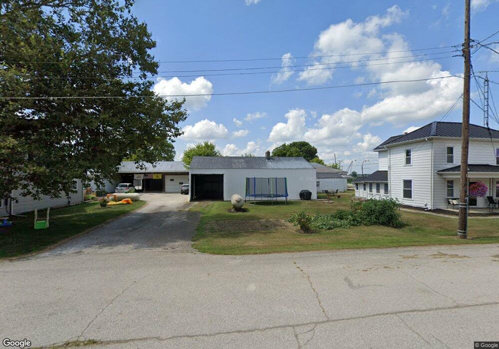
4423 Main St Radnor, OH 43066
Estimated Value: $235,432 - $341,000
3
Beds
1
Bath
1,788
Sq Ft
$150/Sq Ft
Est. Value
About This Home
This home is located at 4423 Main St, Radnor, OH 43066 and is currently estimated at $267,608, approximately $149 per square foot. 4423 Main St is a home with nearby schools including Buckeye Valley High School.
Ownership History
Date
Name
Owned For
Owner Type
Purchase Details
Closed on
Jun 15, 2009
Sold by
Clark Susan L
Bought by
Clark Daniel L and Clark Danny
Current Estimated Value
Purchase Details
Closed on
Feb 10, 1999
Sold by
Shoaf Lloyd H
Bought by
Clark Danny and Clark Susan L
Home Financials for this Owner
Home Financials are based on the most recent Mortgage that was taken out on this home.
Original Mortgage
$50,000
Outstanding Balance
$12,018
Interest Rate
6.92%
Mortgage Type
Commercial
Estimated Equity
$255,590
Create a Home Valuation Report for This Property
The Home Valuation Report is an in-depth analysis detailing your home's value as well as a comparison with similar homes in the area
Home Values in the Area
Average Home Value in this Area
Purchase History
| Date | Buyer | Sale Price | Title Company |
|---|---|---|---|
| Clark Daniel L | -- | Attorney | |
| Clark Danny | $56,800 | -- |
Source: Public Records
Mortgage History
| Date | Status | Borrower | Loan Amount |
|---|---|---|---|
| Open | Clark Danny | $50,000 |
Source: Public Records
Tax History
| Year | Tax Paid | Tax Assessment Tax Assessment Total Assessment is a certain percentage of the fair market value that is determined by local assessors to be the total taxable value of land and additions on the property. | Land | Improvement |
|---|---|---|---|---|
| 2024 | $2,143 | $57,970 | $6,410 | $51,560 |
| 2023 | $2,142 | $57,970 | $6,410 | $51,560 |
| 2022 | $1,395 | $33,360 | $5,990 | $27,370 |
| 2021 | $1,396 | $33,360 | $5,990 | $27,370 |
| 2020 | $1,401 | $33,360 | $5,990 | $27,370 |
| 2019 | $1,194 | $28,040 | $5,220 | $22,820 |
| 2018 | $1,211 | $28,040 | $5,220 | $22,820 |
| 2017 | $1,087 | $25,380 | $6,340 | $19,040 |
| 2016 | $1,190 | $25,380 | $6,340 | $19,040 |
| 2015 | $1,243 | $25,380 | $6,340 | $19,040 |
| 2014 | $1,187 | $25,380 | $6,340 | $19,040 |
| 2013 | $1,218 | $25,380 | $6,340 | $19,040 |
Source: Public Records
Map
Nearby Homes
- 4389 State Route 203
- 3935 N Section Line Rd
- 0 Norton Rd
- 0 Norton Rd Unit 226007710
- 6412 Troy Rd
- 1817 Lawrence Rd
- 0 Mink Street Rd Unit 226007139
- 6685 State Route 37 W
- 715 Tyler Rd
- 130 Cedar Creek St
- 7688 Ohio 257
- 5734 U S Highway 23 N
- 5718 U S Highway 23 N
- 240 Glemsbury Dr
- 0 Marsh Rd Unit 226008897
- 6011 Houseman Rd
- 2131 Farmland Dr
- 3734 Warrensburg Rd
- 406 North St
- 3680 Warrensburg Rd
- 4403 Main St
- 4387 Main St
- 4417 State Route 203
- 4375 Main St
- 4364 Taylor St
- 4374 Taylor St
- 4442 Radnor Rd
- 4385 State Route 203
- 4377 State Route 203
- 2818 Ohio 203
- 0 Ohio 203 Unit 2541789
- 0 Ohio 203 Unit 2512380
- 0 Ohio 203 Unit LT 6 2217845
- 0 Ohio 203 Unit LT 3 2214068
- 0 Ohio 203 Unit 1 2206147
- 0 Ohio 203
- 4369 Taylor St
- 4277 Radnor Rd
- 4387 Taylor St
- 4390 State Route 203
Your Personal Tour Guide
Ask me questions while you tour the home.