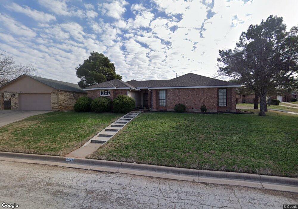
4425 Beall Blvd Abilene, TX 79606
Far Southside NeighborhoodEstimated Value: $252,611 - $263,000
3
Beds
2
Baths
1,887
Sq Ft
$136/Sq Ft
Est. Value
About This Home
This home is located at 4425 Beall Blvd, Abilene, TX 79606 and is currently estimated at $257,153, approximately $136 per square foot. 4425 Beall Blvd is a home located in Taylor County with nearby schools including Wylie West Early Childhood Center, Wylie West Intermediate School, and Wylie West Elementary School.
Ownership History
Date
Name
Owned For
Owner Type
Purchase Details
Closed on
Jun 29, 2007
Sold by
Lang Eddie M and Lang Donna C
Bought by
Westfall Edward
Current Estimated Value
Home Financials for this Owner
Home Financials are based on the most recent Mortgage that was taken out on this home.
Original Mortgage
$99,200
Outstanding Balance
$60,992
Interest Rate
6.19%
Mortgage Type
New Conventional
Estimated Equity
$196,161
Purchase Details
Closed on
Sep 8, 2005
Sold by
Vanhoy Robert W and Vanhoy Tess B
Bought by
Lang Eddie and Lang Donna
Home Financials for this Owner
Home Financials are based on the most recent Mortgage that was taken out on this home.
Original Mortgage
$22,564
Interest Rate
5.78%
Mortgage Type
Future Advance Clause Open End Mortgage
Create a Home Valuation Report for This Property
The Home Valuation Report is an in-depth analysis detailing your home's value as well as a comparison with similar homes in the area
Home Values in the Area
Average Home Value in this Area
Purchase History
| Date | Buyer | Sale Price | Title Company |
|---|---|---|---|
| Westfall Edward | -- | None Available | |
| Lang Eddie | -- | None Available |
Source: Public Records
Mortgage History
| Date | Status | Borrower | Loan Amount |
|---|---|---|---|
| Open | Westfall Edward | $99,200 | |
| Previous Owner | Lang Eddie | $22,564 |
Source: Public Records
Tax History Compared to Growth
Tax History
| Year | Tax Paid | Tax Assessment Tax Assessment Total Assessment is a certain percentage of the fair market value that is determined by local assessors to be the total taxable value of land and additions on the property. | Land | Improvement |
|---|---|---|---|---|
| 2025 | $3,566 | $223,510 | -- | -- |
| 2023 | $3,566 | $184,719 | $0 | $0 |
| 2022 | $3,962 | $167,926 | $0 | $0 |
| 2021 | $3,933 | $152,660 | $16,907 | $135,753 |
| 2020 | $3,856 | $147,249 | $16,907 | $130,342 |
| 2019 | $3,850 | $142,600 | $15,606 | $126,994 |
| 2018 | $3,512 | $140,297 | $15,606 | $124,691 |
| 2017 | $3,351 | $138,960 | $15,606 | $123,354 |
| 2016 | $3,278 | $135,937 | $15,606 | $120,331 |
| 2015 | $2,682 | $134,949 | $15,606 | $119,343 |
| 2014 | $2,682 | $133,627 | $0 | $0 |
Source: Public Records
Map
Nearby Homes
- 7710 John Carroll Dr
- 4634 Beall Blvd
- 5001 Buffalo Gap Rd
- 6642 Buffalo Gap Rd
- 4410 Sierra Sunset
- 8073 Bonnie Cir
- 7967 Bonnie Cir
- 4658 Vista Del Sol
- 3809 Mark Ct
- 7501 White Blvd
- 4833 Meadow Dr
- 8201 Cimarron Trail
- 7801 Old Forrest Hill Rd
- 5084 Fernie St
- 8326 Cimarron Trail
- 5114 Fernie St
- 5114 Rossland Rd
- 5002 Meadow Dr
- 4901 Crystal Creek
- 7705 Randy Ave