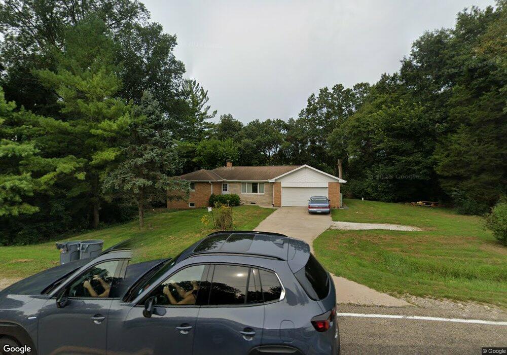
4425 N Koerner Rd Peoria, IL 61615
North Peoria NeighborhoodEstimated Value: $211,000 - $263,000
3
Beds
2
Baths
1,236
Sq Ft
$194/Sq Ft
Est. Value
About This Home
This home is located at 4425 N Koerner Rd, Peoria, IL 61615 and is currently estimated at $239,385, approximately $193 per square foot. 4425 N Koerner Rd is a home located in Peoria County with nearby schools including Charter Oak Primary School, Mark W. Bills Middle School, and Richwoods High School.
Ownership History
Date
Name
Owned For
Owner Type
Purchase Details
Closed on
Feb 2, 2023
Sold by
Shull James R and Shull Margaret V
Bought by
Gilles Nicholas J and Gilles Catharyn E
Current Estimated Value
Home Financials for this Owner
Home Financials are based on the most recent Mortgage that was taken out on this home.
Original Mortgage
$152,000
Outstanding Balance
$146,940
Interest Rate
6%
Mortgage Type
New Conventional
Estimated Equity
$92,445
Create a Home Valuation Report for This Property
The Home Valuation Report is an in-depth analysis detailing your home's value as well as a comparison with similar homes in the area
Home Values in the Area
Average Home Value in this Area
Purchase History
| Date | Buyer | Sale Price | Title Company |
|---|---|---|---|
| Gilles Nicholas J | $190,000 | -- |
Source: Public Records
Mortgage History
| Date | Status | Borrower | Loan Amount |
|---|---|---|---|
| Open | Gilles Nicholas J | $152,000 |
Source: Public Records
Tax History Compared to Growth
Tax History
| Year | Tax Paid | Tax Assessment Tax Assessment Total Assessment is a certain percentage of the fair market value that is determined by local assessors to be the total taxable value of land and additions on the property. | Land | Improvement |
|---|---|---|---|---|
| 2024 | $4,815 | $67,140 | $15,490 | $51,650 |
| 2023 | $4,569 | $61,030 | $14,080 | $46,950 |
| 2022 | $3,588 | $57,660 | $13,100 | $44,560 |
| 2021 | $3,530 | $55,450 | $12,600 | $42,850 |
| 2020 | $3,559 | $55,450 | $12,600 | $42,850 |
| 2019 | $3,466 | $55,450 | $12,600 | $42,850 |
| 2018 | $3,444 | $56,510 | $12,840 | $43,670 |
| 2017 | $3,497 | $57,660 | $13,100 | $44,560 |
| 2016 | $3,294 | $57,660 | $13,100 | $44,560 |
| 2015 | $3,249 | $55,450 | $12,600 | $42,850 |
| 2014 | $3,515 | $55,910 | $12,710 | $43,200 |
| 2013 | -- | $55,350 | $12,580 | $42,770 |
Source: Public Records
Map
Nearby Homes
- 4121 N Koerner Rd
- 0000 W Southport Rd
- 7021 W Southport Rd
- 5009 W Newcastle Dr
- 5926 W Ridgecrest Cir
- 5945 W Ridgecrest Dr
- 5614 N Withershin Point
- 5504 N Pepperwood Ct
- 0 W Sable Way Unit PA1200152
- 5900 N Bent Oak Ln Unit 107
- 4520 W Sable Way
- 5405 W Teal Wood Ct
- 5621 W Timber Oak Ct
- 4904 N Deermeadow Dr
- 4103 Sandridge Ct
- 6110 N Oak Leaf Ct
- 5723 W Deer Park Dr
- 5622 W Woodbriar Ln
- 5624 W Woodbriar Ln
- 5727 W Deer Park Dr
- 4414 N Koerner Rd
- 4410 N Koerner Rd
- 4405 N Koerner Rd
- 4510 N Koerner Rd
- 4338 N Koerner Rd
- 4353 N Koerner Rd
- 4606 N Koerner Rd
- 4347 N Koerner Rd
- 4324 N Koerner Rd
- 4339 N Koerner Rd
- 4611 N Koerner Rd
- 4630 N Koerner Rd
- 4626 N Koerner Rd
- 4704 N Koerner Rd
- 4709 N Koerner Rd
- 4315 N Koerner Rd
- 4327 N Padua Ln
- 4309 N Koerner Rd
- 4720 N Koerner Rd
- 4600 N Mount Carmel Way