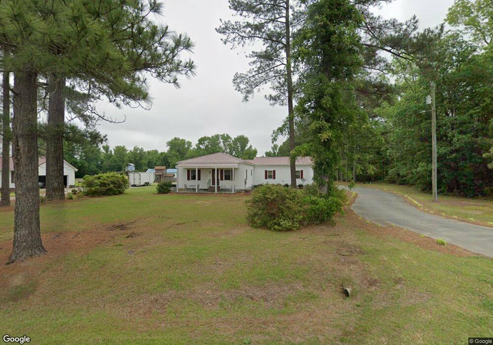
4426 Eason Rd La Grange, NC 28551
Estimated Value: $185,000
2
Beds
2
Baths
1,158
Sq Ft
$160/Sq Ft
Est. Value
About This Home
This home is located at 4426 Eason Rd, La Grange, NC 28551 and is currently estimated at $185,000, approximately $159 per square foot. 4426 Eason Rd is a home located in Lenoir County with nearby schools including La Grange Elementary School, E.B. Frink Middle School, and North Lenoir High School.
Ownership History
Date
Name
Owned For
Owner Type
Purchase Details
Closed on
Jan 19, 2021
Sold by
Jones Bethany L and Jones Jimmy
Bought by
Daniels Russell Carter and Jones Daniels Emily
Current Estimated Value
Purchase Details
Closed on
Aug 27, 2020
Sold by
Jones Bethany L and Jones Jimmy
Bought by
Daughety James Lafayette and Daughety Laura Jones
Purchase Details
Closed on
Aug 19, 2020
Sold by
Leneave Leona V
Bought by
Daughety James Lafayette and Daughety Laura Jones
Purchase Details
Closed on
Nov 19, 2019
Sold by
Leneave Leona B
Bought by
Jones Bethany L
Purchase Details
Closed on
Sep 4, 2008
Sold by
Leneave Leona Vinson and Leneave James N
Bought by
Jones Bethany Leneave and Jones Jimmy
Create a Home Valuation Report for This Property
The Home Valuation Report is an in-depth analysis detailing your home's value as well as a comparison with similar homes in the area
Home Values in the Area
Average Home Value in this Area
Purchase History
| Date | Buyer | Sale Price | Title Company |
|---|---|---|---|
| Daniels Russell Carter | -- | None Available | |
| Daughety James Lafayette | -- | None Available | |
| Daughety James Lafayette | -- | None Available | |
| Jones Bethany L | -- | None Available | |
| Jones Bethany Leneave | -- | None Available |
Source: Public Records
Tax History Compared to Growth
Tax History
| Year | Tax Paid | Tax Assessment Tax Assessment Total Assessment is a certain percentage of the fair market value that is determined by local assessors to be the total taxable value of land and additions on the property. | Land | Improvement |
|---|---|---|---|---|
| 2025 | $1,571 | $201,953 | $52,230 | $149,723 |
| 2024 | $932 | $91,075 | $43,367 | $47,708 |
| 2023 | $819 | $91,075 | $43,367 | $47,708 |
| 2022 | $819 | $233,637 | $17,200 | $216,437 |
| 2021 | $819 | $91,624 | $17,200 | $74,424 |
| 2020 | $839 | $84,588 | $36,880 | $47,708 |
| 2019 | $839 | $84,588 | $36,880 | $47,708 |
| 2018 | $826 | $84,588 | $36,880 | $47,708 |
| 2017 | $824 | $84,588 | $36,880 | $47,708 |
| 2014 | $862 | $176,048 | $123,960 | $52,088 |
| 2013 | -- | $176,048 | $123,960 | $52,088 |
| 2011 | -- | $176,048 | $123,960 | $52,088 |
Source: Public Records
Map
Nearby Homes
- 3733 Fields Station Rd
- Lot #2 Albert Sugg Rd
- 3821 Lindsey Ln
- 5130 Aldridge Store Rd
- 3216 Dexter Cir
- 3255 Caroline Nicole Dr
- 3730 Huntcliff Dr
- 3670 Drew Farmer Rd
- 3684 Drew Farmer Rd
- 3766 Huntcliff Dr
- 3696 Drew Farmer Rd
- 101 Forest Dr
- 3803 Huntcliff Dr
- 3711 Drew Farmer Rd
- 4310 Colie Rd
- 3254 Kelly Rd
- 3145 Lakewood Dr Unit 3155
- 303 E James St
- Hayden Plan at Blair Ridge
- Freeport Plan at Blair Ridge
- 4442 Eason Rd
- 4460 Eason Rd
- 4433 Eason Rd
- 4347 Eason Rd
- 4573 Eason Rd
- 4579 Eason Rd
- 4305 Eason Rd
- 4248 Eason Rd
- 4375 Damascus Rd
- 4365 Damascus Rd
- 4378 Damascus Rd
- 4356 Damascus Rd
- 4340 Damascus Rd
- 3755 Willie Measley Rd
- 3370 Ld Hardy Rd
- 3718 Willie Measley Rd
- 3400 Ld Hardy Rd
- 4019 Willie Measley Rd
- 3420 Ld Hardy Rd
- 3001 Ld Hardy Rd