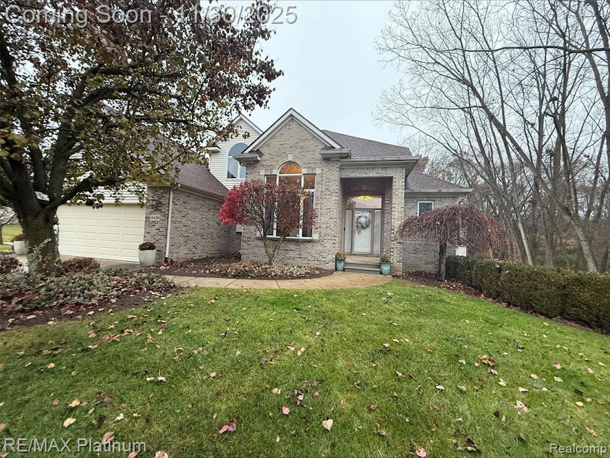
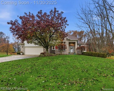
4428 Sundance Cir Howell, MI 48843
Estimated payment $2,884/month
Highlights
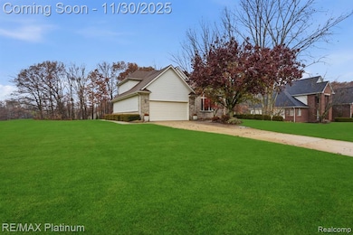
- 1 Acre Lot
- Covered Patio or Porch
- 3 Car Direct Access Garage
- Contemporary Architecture
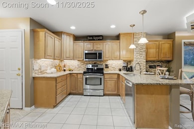
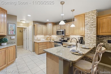
- Stainless Steel Appliances
- Forced Air Heating System
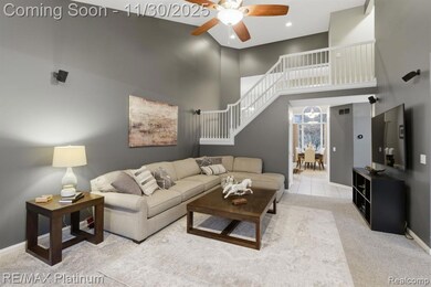
About This Home
Welcome home to 4428 Sundance Circle! This beautifully maintained 4-bedroom, 4-bath home is ideally situated in the heart of Howell. Located in the desirable Sundance Meadows subdivision, this neighborhood offers fantastic amenities—including a community park with tennis courts, basketball courts, and a playground—making it perfect for relaxation, recreation, and outdoor fun.
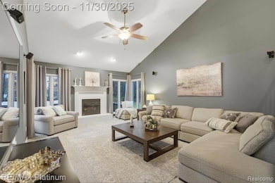
Step inside to discover bright, inviting spaces with thoughtful updates throughout. The home features a comfortable, functional layout designed for modern living, with plenty of natural light flowing through every room. A spacious three-car garage provides added convenience and ample storage.
This is a wonderful opportunity to own a well-cared-for home in one of Howell’s most sought-after neighborhoods.
Home Details
Home Type
- Single Family
Est. Annual Taxes
Year Built
- Built in 1999 | Remodeled in 2024
Lot Details
- 1 Acre Lot
- Lot Dimensions are 145x301
HOA Fees
- $19 Monthly HOA Fees
Home Design
- Contemporary Architecture
- Brick Exterior Construction
- Poured Concrete
- Asphalt Roof
- Vinyl Construction Material
Interior Spaces
- 2,362 Sq Ft Home
- 2-Story Property
- Gas Fireplace
- Carbon Monoxide Detectors
- Finished Basement
Kitchen
- Free-Standing Electric Range
- Microwave
- Dishwasher
- Stainless Steel Appliances
Bedrooms and Bathrooms
- 4 Bedrooms
Laundry
- Dryer
- Washer
Parking
- 3 Car Direct Access Garage
- Garage Door Opener
Outdoor Features
- Covered Patio or Porch
- Exterior Lighting
Location
- Ground Level
Utilities
- Forced Air Heating System
- Heating System Uses Natural Gas
- Natural Gas Water Heater
Listing and Financial Details
- Assessor Parcel Number 1026101017
Community Details
Overview
- Sundance Meadows Association, Phone Number (248) 379-8976
- Sundance Meadows Subdivision
Amenities
- Laundry Facilities
Map
Home Values in the Area
Average Home Value in this Area
Tax History
| Year | Tax Paid | Tax Assessment Tax Assessment Total Assessment is a certain percentage of the fair market value that is determined by local assessors to be the total taxable value of land and additions on the property. | Land | Improvement |
|---|---|---|---|---|
| 2025 | $2,929 | $205,000 | $0 | $0 |
| 2024 | $1,951 | $199,600 | $0 | $0 |
| 2023 | $1,864 | $166,800 | $0 | $0 |
| 2022 | $2,534 | $145,100 | $0 | $0 |
| 2021 | $2,471 | $145,100 | $0 | $0 |
| 2020 | $2,518 | $140,600 | $0 | $0 |
| 2019 | $2,481 | $138,900 | $0 | $0 |
| 2018 | $2,455 | $134,400 | $0 | $0 |
| 2017 | $2,419 | $127,300 | $0 | $0 |
| 2016 | $2,406 | $118,800 | $0 | $0 |
| 2014 | $2,188 | $111,500 | $0 | $0 |
| 2012 | $2,188 | $97,100 | $0 | $0 |
Purchase History
| Date | Type | Sale Price | Title Company |
|---|---|---|---|
| Quit Claim Deed | -- | -- | |
| Corporate Deed | $287,550 | -- | |
| Quit Claim Deed | -- | Select Title Company | |
| Corporate Deed | $34,000 | Select Title Company | |
| Warranty Deed | $4,000 | Select Title Company |
Source: Realcomp
MLS Number: 20251055598
APN: 10-26-101-017
Disclaimer: Certain information contained herein is derived from information provided by parties other than Homes.com. All information provided is deemed reliable, but is not guaranteed to be accurate and should be independently verified.
![]() IDX provided courtesy of Realcomp II Ltd. via Ten-X and MLS
IDX provided courtesy of Realcomp II Ltd. via Ten-X and MLS
Copyright 2025 Realcomp II Ltd. Shareholders
IDX information is provided exclusively for consumers' personal, noncommercial use and may not be used for any purpose other than to identify prospective properties consumers may be interested in purchasing. The accuracy of all information, regardless of source, is not guaranteed or warranted. All information should be independently verified.
Listing Information presented by local MLS brokerage: Ten-X, local REALTOR®- Arlene Richardson - (888)-952-6393
- 2214 White Hawk Trail
- 4009 Cactus Flower Ct
- 2763 Clivedon Rd
- 2568 W Coon Lake Rd
- 2921 Clivedon Rd
- 2878 Clivedon Rd
- 1 Brighton Rd
- 0000 Brighton Rd
- 2705 Black Eagle Ridge Unit 49
- 150 Brighton Rd
- 883 Hurley Dr
- 3031 Cedar Point Rd
- 1286 Gray Fox Ct
- 4681 Roya Trail
- 04 Prince Edward Dr
- 05 Prince Edward Dr
- 3760 Southwick Dr
- 1982 E Coon Lake Rd
- 2105 Webster Park Dr
- 4789 Lakeshire Dr
- 2860 E Coon Lake Rd
- 316 Chevalier Dr
- 105 Nicole Ct
- 88 Normandy Dr
- 934 Hadden Ave
- 4071 Homestead Dr
- 307 Holly Hills Dr
- 711 Cattail Ln
- 522 Fleming St
- 810 Cattail Ln
- 727-739 E Sibley St
- 635 E Unadilla St
- 240 Park St
- 105 E Main St
- 116 Jewett St
- 430 E Clinton St Unit .2
- 401 S Highlander Way
- 1103 S Latson Rd
- 1025 Westbury Blvd
- 3677-3998 Audrey Rae Ln
