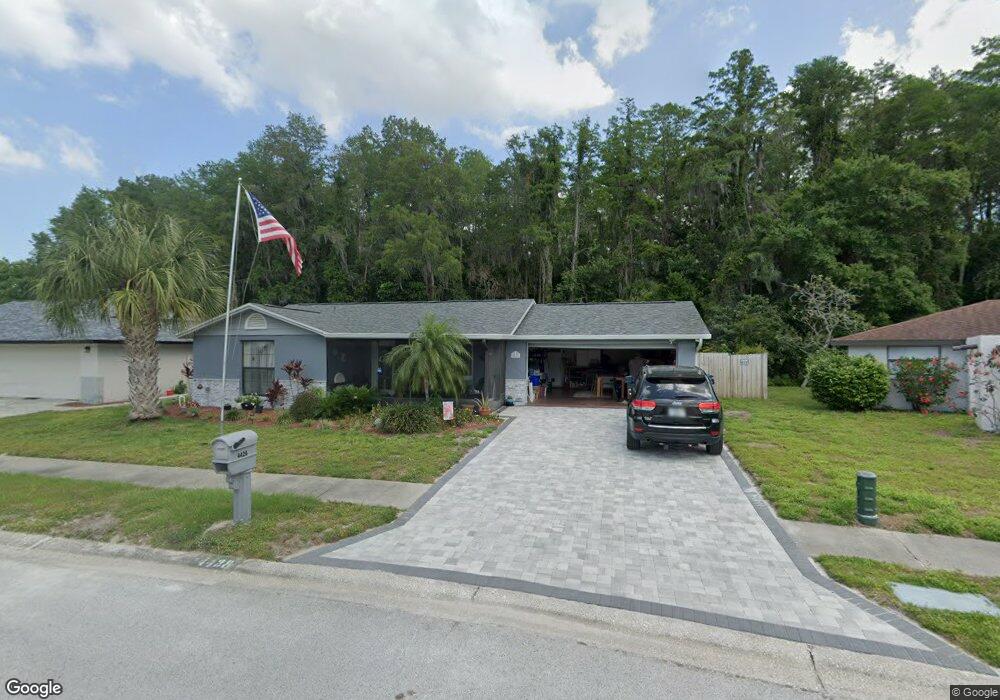
4428 Whitetail Ln New Port Richey, FL 34653
Seven Springs NeighborhoodEstimated Value: $332,000 - $412,000
3
Beds
3
Baths
1,816
Sq Ft
$201/Sq Ft
Est. Value
About This Home
This home is located at 4428 Whitetail Ln, New Port Richey, FL 34653 and is currently estimated at $364,964, approximately $200 per square foot. 4428 Whitetail Ln is a home located in Pasco County with nearby schools including Deer Park Elementary School, River Ridge High School, and River Ridge Middle School.
Ownership History
Date
Name
Owned For
Owner Type
Purchase Details
Closed on
Oct 19, 2022
Sold by
Morrow Charles and Morrow Patricia A
Bought by
Morrow Patricia A
Current Estimated Value
Purchase Details
Closed on
Oct 29, 2015
Sold by
Mahoney Hazel M and Mahoney Patrick F
Bought by
Morrow Patricia A
Home Financials for this Owner
Home Financials are based on the most recent Mortgage that was taken out on this home.
Original Mortgage
$144,000
Interest Rate
3.89%
Mortgage Type
New Conventional
Purchase Details
Closed on
Dec 13, 2001
Sold by
Marshall Ben J and Marshall Barbara H
Bought by
Mahoney Patrick F and Mahoney Hazel M
Home Financials for this Owner
Home Financials are based on the most recent Mortgage that was taken out on this home.
Original Mortgage
$130,000
Interest Rate
6.5%
Mortgage Type
VA
Create a Home Valuation Report for This Property
The Home Valuation Report is an in-depth analysis detailing your home's value as well as a comparison with similar homes in the area
Home Values in the Area
Average Home Value in this Area
Purchase History
| Date | Buyer | Sale Price | Title Company |
|---|---|---|---|
| Morrow Patricia A | $100 | None Listed On Document | |
| Morrow Patricia A | $100 | None Listed On Document | |
| Morrow Patricia A | $183,900 | Attorney | |
| Mahoney Patrick F | $130,000 | -- |
Source: Public Records
Mortgage History
| Date | Status | Borrower | Loan Amount |
|---|---|---|---|
| Previous Owner | Morrow Patricia A | $144,000 | |
| Previous Owner | Mahoney Patrick F | $133,226 | |
| Previous Owner | Mahoney Patrick F | $130,000 |
Source: Public Records
Tax History Compared to Growth
Tax History
| Year | Tax Paid | Tax Assessment Tax Assessment Total Assessment is a certain percentage of the fair market value that is determined by local assessors to be the total taxable value of land and additions on the property. | Land | Improvement |
|---|---|---|---|---|
| 2025 | $3,999 | $270,290 | -- | -- |
| 2024 | $3,999 | $262,680 | -- | -- |
| 2023 | $3,851 | $255,030 | $39,959 | $215,071 |
| 2022 | $3,461 | $247,602 | $33,387 | $214,215 |
| 2021 | $3,199 | $192,885 | $29,921 | $162,964 |
| 2020 | $2,888 | $169,237 | $25,082 | $144,155 |
| 2019 | $2,652 | $151,909 | $21,982 | $129,927 |
| 2018 | $2,561 | $146,142 | $21,982 | $124,160 |
| 2017 | $2,413 | $135,917 | $20,742 | $115,175 |
| 2016 | $2,087 | $115,457 | $17,332 | $98,125 |
| 2015 | $978 | $87,794 | $0 | $0 |
| 2014 | $947 | $97,977 | $16,402 | $81,575 |
Source: Public Records
Map
Nearby Homes
- 4350 Sawgrass Blvd
- 4244 Raccoon Loop
- 4339 Riverwood Dr
- 4306 Riverwood Dr
- 4371 Otter Way
- 4236 Riverwood Dr
- 4622 Whitetail Ln
- 4219 Gray Squirrel Ln
- 4330 Tall Oak Ln
- 4611 Addax Dr
- 4519 Swallowtail Dr
- 4142 Sawgrass Blvd
- 4125 Riverwood Dr
- 4652 Swallowtail Dr
- 8041 Blue Finch Way
- 8110 Damara Dr
- 4448 Northampton Dr
- 4420 Northampton Dr
- 4237 Northampton Dr
- 4222 Northampton Dr
- 4434 Whitetail Ln
- 4440 Whitetail Ln
- 4420 Whitetail Ln
- 4429 Whitetail Ln
- 4448 Whitetail Ln
- 4434 Black Fox Dr
- 4425 Whitetail Ln
- 4417 Whitetail Ln
- 4454 Whitetail Ln
- 4421 Whitetail Ln
- 4416 Black Fox Dr
- 4439 Black Fox Dr
- 4462 Whitetail Ln
- 4406 Black Fox Dr
- 4431 Black Fox Dr
- 8510 Gum Tree Ave
- 4370 Black Fox Dr
- 4425 Black Fox Dr
- 4362 Black Fox Dr
- 8513 Gum Tree Ave