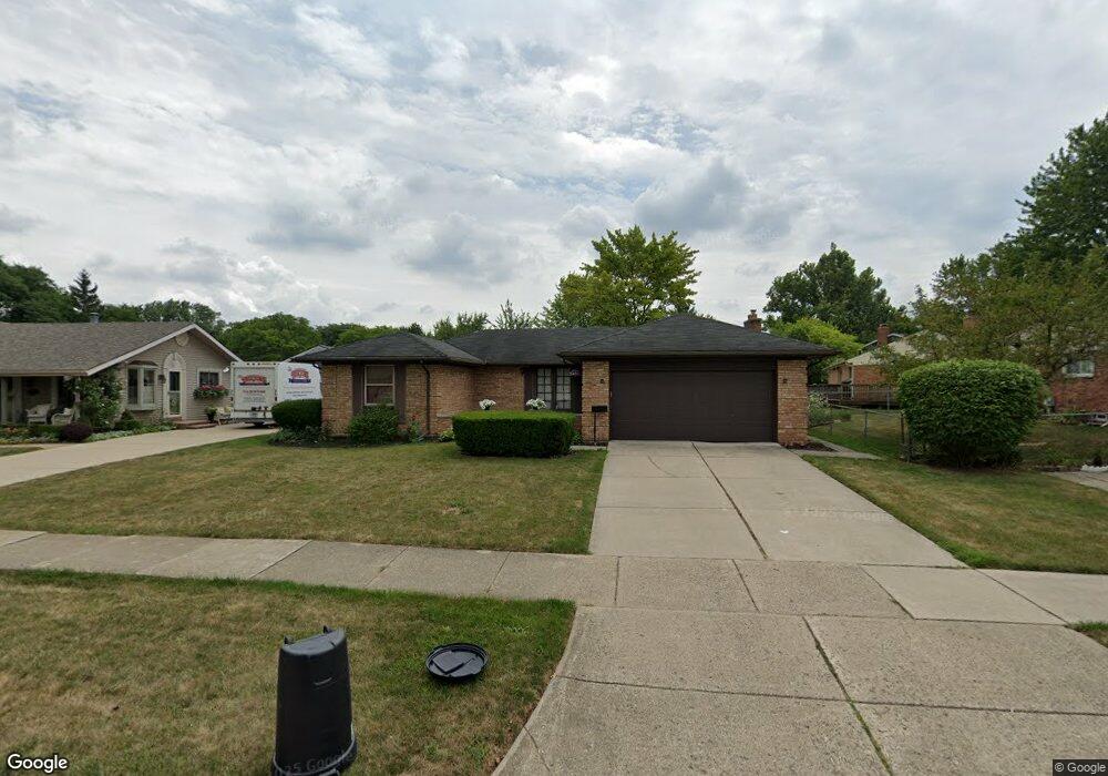
44287 N Umberland Cir Unit Bldg-Unit Canton, MI 48187
Estimated Value: $374,569 - $436,000
--
Bed
2
Baths
1,487
Sq Ft
$269/Sq Ft
Est. Value
About This Home
This home is located at 44287 N Umberland Cir Unit Bldg-Unit, Canton, MI 48187 and is currently estimated at $400,642, approximately $269 per square foot. 44287 N Umberland Cir Unit Bldg-Unit is a home located in Wayne County with nearby schools including Canton High School, Discovery Middle School, and Salem High School.
Ownership History
Date
Name
Owned For
Owner Type
Purchase Details
Closed on
May 31, 2018
Sold by
The Robertson Family Revocable Trust
Bought by
Raduna Viorel and Raduna Zoya
Current Estimated Value
Home Financials for this Owner
Home Financials are based on the most recent Mortgage that was taken out on this home.
Original Mortgage
$233,689
Outstanding Balance
$206,040
Interest Rate
5.5%
Mortgage Type
FHA
Estimated Equity
$194,602
Create a Home Valuation Report for This Property
The Home Valuation Report is an in-depth analysis detailing your home's value as well as a comparison with similar homes in the area
Home Values in the Area
Average Home Value in this Area
Purchase History
| Date | Buyer | Sale Price | Title Company |
|---|---|---|---|
| Raduna Viorel | $238,000 | None Available |
Source: Public Records
Mortgage History
| Date | Status | Borrower | Loan Amount |
|---|---|---|---|
| Open | Raduna Viorel | $233,689 |
Source: Public Records
Tax History Compared to Growth
Tax History
| Year | Tax Paid | Tax Assessment Tax Assessment Total Assessment is a certain percentage of the fair market value that is determined by local assessors to be the total taxable value of land and additions on the property. | Land | Improvement |
|---|---|---|---|---|
| 2025 | $2,223 | $153,900 | $0 | $0 |
| 2024 | $2,223 | $146,500 | $0 | $0 |
| 2023 | $2,119 | $128,600 | $0 | $0 |
| 2022 | $4,720 | $119,000 | $0 | $0 |
| 2021 | $4,575 | $115,700 | $0 | $0 |
| 2020 | $4,464 | $108,400 | $0 | $0 |
| 2019 | $4,385 | $103,650 | $0 | $0 |
| 2018 | $1,291 | $94,240 | $0 | $0 |
| 2017 | $3,443 | $93,000 | $0 | $0 |
| 2016 | $2,973 | $89,800 | $0 | $0 |
| 2015 | $7,095 | $82,290 | $0 | $0 |
| 2013 | $6,873 | $73,600 | $0 | $0 |
| 2010 | -- | $71,830 | $33,309 | $38,521 |
Source: Public Records
Map
Nearby Homes
- 6972 Harvard Ln
- 6907 Harvard Ln
- 6986 Harvard Ln Unit 129
- 44409 Newburyport Dr Unit 133
- 43875 Leeann Ln
- 44018 Bannockburn Dr
- 6877 Pittsford St
- 43783 Leeann Ln
- 835 Coldrose Way
- 44995 Quaker Hill Dr
- 43764 Hanford Rd
- 45139 Indian Creek Dr
- 44999 N Spring Dr
- 44609 Meadowcreek Ln Unit 24
- 43425 Warren Rd
- 6586 Carriage Hills Dr
- 44585 Nantucket Dr
- 6750 N Canton Center Rd
- 43737 Westminister Way
- 43625 Westminister Way
- 44287 N Umberland Cir
- 44273 N Umberland Cir
- 44301 Regis Ct
- 44327 Regis Ct
- 44238 Wiclif Ct
- 44252 Wiclif Ct
- 44259 N Umberland Cir
- 44335 Regis Ct
- 44288 N Umberland Cir
- 44224 Wiclif Ct
- 44302 N Umberland Cir
- 44256 N Umberland Cir
- 44266 Wiclif Ct
- 6921 Montfort Dr
- 44316 N Umberland Cir
- 44343 Regis Ct
- 6907 Montfort Dr
- 44242 N Umberland Cir
- 44310 S Umberland Cir
- 44370 N Umberland Cir