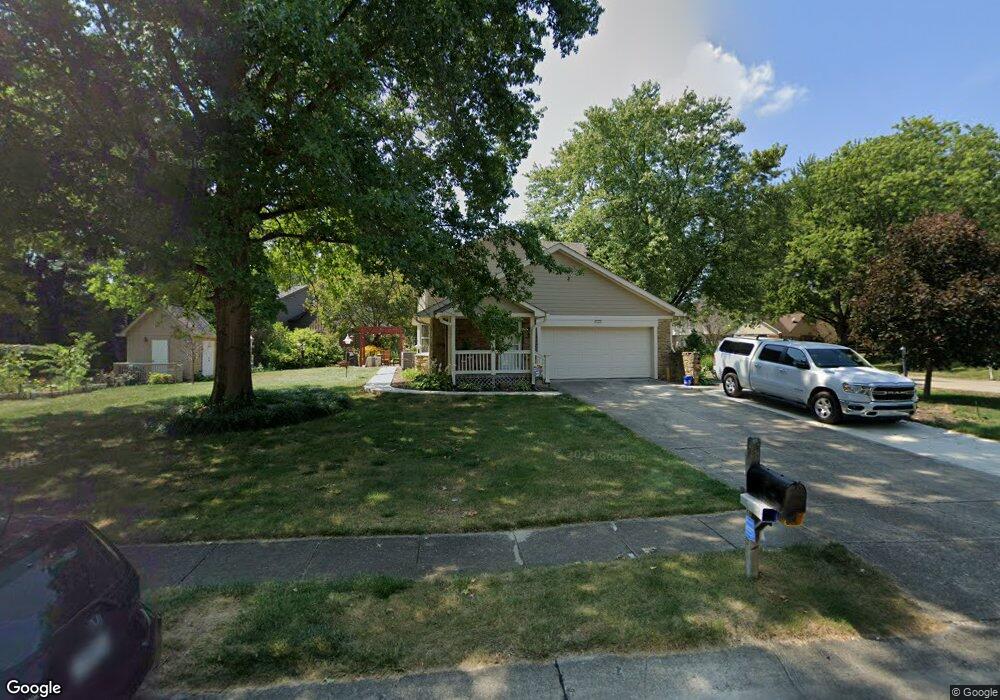
4429 Bristal Ln Carmel, IN 46033
East Carmel NeighborhoodEstimated Value: $527,306 - $579,000
4
Beds
3
Baths
3,362
Sq Ft
$164/Sq Ft
Est. Value
About This Home
This home is located at 4429 Bristal Ln, Carmel, IN 46033 and is currently estimated at $550,577, approximately $163 per square foot. 4429 Bristal Ln is a home located in Hamilton County with nearby schools including Mohawk Trails Elementary School, Clay Middle School, and Carmel High School.
Ownership History
Date
Name
Owned For
Owner Type
Purchase Details
Closed on
Jan 21, 2025
Sold by
Leonard David M and Leonard Jean A
Bought by
David And Jean Leonard Living Trust and Leonard
Current Estimated Value
Purchase Details
Closed on
Nov 9, 2009
Sold by
Hallam John E and Hallam Marietta
Bought by
Leonard David M and Leonard Jean A
Home Financials for this Owner
Home Financials are based on the most recent Mortgage that was taken out on this home.
Original Mortgage
$264,964
Interest Rate
5.05%
Mortgage Type
VA
Create a Home Valuation Report for This Property
The Home Valuation Report is an in-depth analysis detailing your home's value as well as a comparison with similar homes in the area
Home Values in the Area
Average Home Value in this Area
Purchase History
| Date | Buyer | Sale Price | Title Company |
|---|---|---|---|
| David And Jean Leonard Living Trust | -- | None Listed On Document | |
| Leonard David M | -- | First Title Of Indiana Inc |
Source: Public Records
Mortgage History
| Date | Status | Borrower | Loan Amount |
|---|---|---|---|
| Previous Owner | Leonard David M | $264,964 |
Source: Public Records
Tax History
| Year | Tax Paid | Tax Assessment Tax Assessment Total Assessment is a certain percentage of the fair market value that is determined by local assessors to be the total taxable value of land and additions on the property. | Land | Improvement |
|---|---|---|---|---|
| 2024 | $4,570 | $442,700 | $122,100 | $320,600 |
| 2023 | $4,570 | $425,100 | $94,600 | $330,500 |
| 2022 | $4,346 | $381,200 | $94,600 | $286,600 |
| 2021 | $3,708 | $328,400 | $94,600 | $233,800 |
| 2020 | $3,266 | $289,900 | $94,600 | $195,300 |
| 2019 | $3,252 | $288,700 | $76,700 | $212,000 |
| 2018 | $3,207 | $289,600 | $76,700 | $212,900 |
| 2017 | $3,179 | $287,100 | $76,700 | $210,400 |
| 2016 | $2,984 | $273,600 | $76,700 | $196,900 |
| 2014 | $2,633 | $256,100 | $70,900 | $185,200 |
| 2013 | $2,633 | $243,800 | $70,900 | $172,900 |
Source: Public Records
Map
Nearby Homes
- 13035 Wembly Rd
- 13474 Dallas Ln
- 4843 Essex Ct
- 12883 Harrison Dr
- 12406 Lancelot Ln
- 1419 Douglas Dr
- 4991 E Main St
- 1129 Fairbanks Dr
- 3713 Coventry Way
- 12112 Roxbury Place
- 12586 Sandstone Run
- 4734 Buckingham Ct
- 3240 Smokey Ridge Ct
- 5156 Puffin Place
- 441 Ash Dr
- 233 Brierley Way
- 5714 Opus Dr
- 712 E Main St
- 11830 N Gray Rd
- 12484 Pasture View Ct
Your Personal Tour Guide
Ask me questions while you tour the home.