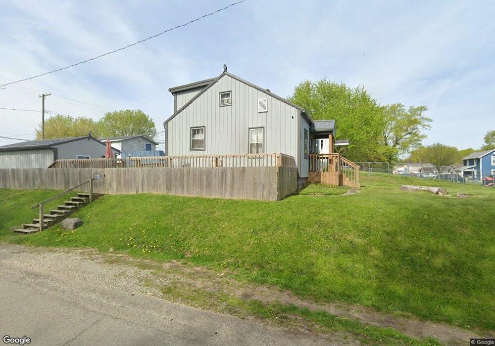
443 Allston Ave Newark, OH 43055
Estimated Value: $165,000 - $195,000
2
Beds
2
Baths
985
Sq Ft
$180/Sq Ft
Est. Value
About This Home
This home is located at 443 Allston Ave, Newark, OH 43055 and is currently estimated at $177,340, approximately $180 per square foot. 443 Allston Ave is a home located in Licking County with nearby schools including Carson Elementary School, Heritage Middle School, and Newark High School.
Ownership History
Date
Name
Owned For
Owner Type
Purchase Details
Closed on
Dec 22, 2020
Sold by
Mcknight Regina V
Bought by
Mcknight Charles Brian
Current Estimated Value
Purchase Details
Closed on
Jun 9, 1994
Sold by
Scarberry Rita J Linehan
Bought by
Mcknight Regina V
Home Financials for this Owner
Home Financials are based on the most recent Mortgage that was taken out on this home.
Original Mortgage
$49,492
Interest Rate
8.45%
Mortgage Type
FHA
Create a Home Valuation Report for This Property
The Home Valuation Report is an in-depth analysis detailing your home's value as well as a comparison with similar homes in the area
Home Values in the Area
Average Home Value in this Area
Purchase History
| Date | Buyer | Sale Price | Title Company |
|---|---|---|---|
| Mcknight Charles Brian | -- | None Available | |
| Mcknight Regina V | $49,900 | -- |
Source: Public Records
Mortgage History
| Date | Status | Borrower | Loan Amount |
|---|---|---|---|
| Closed | Mcknight Regina V | $49,492 |
Source: Public Records
Tax History Compared to Growth
Tax History
| Year | Tax Paid | Tax Assessment Tax Assessment Total Assessment is a certain percentage of the fair market value that is determined by local assessors to be the total taxable value of land and additions on the property. | Land | Improvement |
|---|---|---|---|---|
| 2024 | $1,651 | $46,170 | $8,330 | $37,840 |
| 2023 | $1,154 | $46,170 | $8,330 | $37,840 |
| 2022 | $1,060 | $26,360 | $5,430 | $20,930 |
| 2021 | $1,112 | $26,360 | $5,430 | $20,930 |
| 2020 | $761 | $26,360 | $5,430 | $20,930 |
| 2019 | $519 | $20,270 | $4,170 | $16,100 |
| 2018 | $519 | $0 | $0 | $0 |
| 2017 | $498 | $0 | $0 | $0 |
| 2016 | $1,121 | $0 | $0 | $0 |
| 2015 | $1,145 | $0 | $0 | $0 |
| 2014 | $1,467 | $0 | $0 | $0 |
| 2013 | $1,087 | $0 | $0 | $0 |
Source: Public Records
Map
Nearby Homes
- 460 Allston Ave
- 483 Allston Ave
- 506 Lexington Ave
- 424 Ridge Ave
- 491 Garfield Ave
- 554 Garfield Ave
- 240 N Wing St
- 408 Cedarcrest Ave
- 160 N Cedar St
- 167 Essex St
- 204 Hunter St
- 76 Oakwood Ave
- 81 Madison Ave
- 688 Russell Ave
- 136 Hunter St
- 284 Everett Ave
- 165 Edwards St
- 430 E Main St
- 194 Fielde Dr
- 203 Lawrence St
- 439 Allston Ave
- 455 Allston Ave
- 425 Oakwood Ave
- 421 Allston Ave
- 450 Arlington Ave
- 454 Arlington Ave
- 436 Arlington Ave
- 440 Allston Ave
- 465 Allston Ave
- 460 Arlington Ave
- 424 Allston Ave
- 426 Allston Ave
- 469 Allston Ave
- 464 Allston Ave
- 0 Arlington Ave
- 462 Arlington Ave
- 430 Arlington Ave
- 468 Allston Ave
- 417 Allston Ave
- 426 Arlington Ave