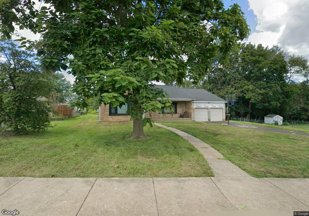
443 Erie Ave Telford, PA 18969
Estimated Value: $421,000 - $523,000
2
Beds
1
Bath
2,319
Sq Ft
$207/Sq Ft
Est. Value
About This Home
This home is located at 443 Erie Ave, Telford, PA 18969 and is currently estimated at $480,042, approximately $207 per square foot. 443 Erie Ave is a home located in Montgomery County with nearby schools including Franconia Elementary School, Indian Crest Middle School, and Souderton Area Senior High School.
Ownership History
Date
Name
Owned For
Owner Type
Purchase Details
Closed on
Apr 29, 2015
Sold by
Phillips Joanne
Bought by
Cruz Madeline and Bahmundi Jack L
Current Estimated Value
Home Financials for this Owner
Home Financials are based on the most recent Mortgage that was taken out on this home.
Original Mortgage
$153,000
Outstanding Balance
$118,207
Interest Rate
3.76%
Mortgage Type
New Conventional
Estimated Equity
$361,835
Purchase Details
Closed on
Aug 14, 1998
Sold by
Heckler Stanley and Heckler Kenneth
Bought by
Phillips Joanne
Create a Home Valuation Report for This Property
The Home Valuation Report is an in-depth analysis detailing your home's value as well as a comparison with similar homes in the area
Home Values in the Area
Average Home Value in this Area
Purchase History
| Date | Buyer | Sale Price | Title Company |
|---|---|---|---|
| Cruz Madeline | $170,000 | None Available | |
| Phillips Joanne | $119,900 | -- |
Source: Public Records
Mortgage History
| Date | Status | Borrower | Loan Amount |
|---|---|---|---|
| Open | Cruz Madeline | $153,000 |
Source: Public Records
Tax History Compared to Growth
Tax History
| Year | Tax Paid | Tax Assessment Tax Assessment Total Assessment is a certain percentage of the fair market value that is determined by local assessors to be the total taxable value of land and additions on the property. | Land | Improvement |
|---|---|---|---|---|
| 2025 | $7,076 | $157,080 | $67,650 | $89,430 |
| 2024 | $7,076 | $157,080 | $67,650 | $89,430 |
| 2023 | $6,764 | $157,080 | $67,650 | $89,430 |
| 2022 | $6,580 | $157,080 | $67,650 | $89,430 |
| 2021 | $6,453 | $157,080 | $67,650 | $89,430 |
| 2020 | $6,368 | $157,080 | $67,650 | $89,430 |
| 2019 | $6,300 | $157,080 | $67,650 | $89,430 |
| 2018 | $4,472 | $157,080 | $67,650 | $89,430 |
| 2017 | $6,078 | $157,080 | $67,650 | $89,430 |
| 2016 | $6,016 | $157,080 | $67,650 | $89,430 |
| 2015 | -- | $157,080 | $67,650 | $89,430 |
| 2014 | -- | $157,080 | $67,650 | $89,430 |
Source: Public Records
Map
Nearby Homes
- 103 Arlington Ln
- 554 Harleysville Pike
- 196 Penn Ave
- 171 Hopewell Ln Unit B
- 3443 Devlin Way
- 223 W Reliance Rd
- 478 Smokepipe Rd
- 119 121 E Broad St
- 227 Ridge Ave
- 340 S Main St
- 438 N Main St
- 44 Diamond St
- 314 Harleysville Pike
- 801 Evergreen Cir
- 805 Evergreen Cir
- 23 Orchard Cir
- 3 Carousel Dr
- 54 Reliance Ct
- 415 Wexford Way Unit D7
- 17 N 2nd St