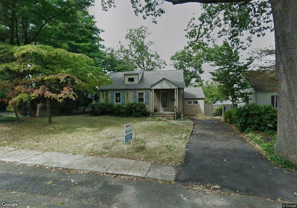
443 Harnell Ave Oakhurst, NJ 07755
Estimated Value: $544,000 - $713,000
3
Beds
1
Bath
992
Sq Ft
$663/Sq Ft
Est. Value
About This Home
This home is located at 443 Harnell Ave, Oakhurst, NJ 07755 and is currently estimated at $657,373, approximately $662 per square foot. 443 Harnell Ave is a home located in Monmouth County with nearby schools including Ocean Township High School, Bet Yaakov of the Jersey Shore, and St. Mary of the Assumption School.
Ownership History
Date
Name
Owned For
Owner Type
Purchase Details
Closed on
Feb 6, 2025
Sold by
Bennett Joan
Bought by
Lime Tree Holdings Llc
Current Estimated Value
Home Financials for this Owner
Home Financials are based on the most recent Mortgage that was taken out on this home.
Original Mortgage
$743,100
Outstanding Balance
$738,632
Interest Rate
6.85%
Mortgage Type
Construction
Estimated Equity
-$81,259
Purchase Details
Closed on
Jan 25, 2008
Sold by
Bennett Joan L and King Terrence
Bought by
King Terrence and Bennett Joan
Home Financials for this Owner
Home Financials are based on the most recent Mortgage that was taken out on this home.
Original Mortgage
$212,782
Interest Rate
5.76%
Mortgage Type
New Conventional
Create a Home Valuation Report for This Property
The Home Valuation Report is an in-depth analysis detailing your home's value as well as a comparison with similar homes in the area
Home Values in the Area
Average Home Value in this Area
Purchase History
| Date | Buyer | Sale Price | Title Company |
|---|---|---|---|
| Lime Tree Holdings Llc | $565,000 | None Listed On Document | |
| Lime Tree Holdings Llc | $565,000 | None Listed On Document | |
| King Terrence | -- | None Available |
Source: Public Records
Mortgage History
| Date | Status | Borrower | Loan Amount |
|---|---|---|---|
| Open | Lime Tree Holdings Llc | $743,100 | |
| Closed | Lime Tree Holdings Llc | $743,100 | |
| Previous Owner | King Terrence | $212,782 |
Source: Public Records
Tax History Compared to Growth
Tax History
| Year | Tax Paid | Tax Assessment Tax Assessment Total Assessment is a certain percentage of the fair market value that is determined by local assessors to be the total taxable value of land and additions on the property. | Land | Improvement |
|---|---|---|---|---|
| 2025 | $8,351 | $649,300 | $482,000 | $167,300 |
| 2024 | $10,146 | $585,600 | $462,400 | $123,200 |
| 2023 | $10,146 | $663,600 | $543,800 | $119,800 |
| 2022 | $7,388 | $471,300 | $357,300 | $114,000 |
| 2021 | $7,388 | $387,600 | $287,300 | $100,300 |
| 2020 | $7,528 | $378,100 | $269,400 | $108,700 |
| 2019 | $6,882 | $337,500 | $229,400 | $108,100 |
| 2018 | $6,334 | $302,500 | $199,400 | $103,100 |
| 2017 | $5,821 | $276,800 | $179,400 | $97,400 |
| 2016 | $6,331 | $270,800 | $178,100 | $92,700 |
| 2015 | $6,197 | $268,400 | $178,100 | $90,300 |
| 2014 | $6,012 | $263,900 | $178,100 | $85,800 |
Source: Public Records
Map
Nearby Homes
- 185 Pinecrest Rd
- 185 Elmwood Rd
- 459 Harnell Ave
- 421 W Lincoln Ave
- 8 Corey Dr
- 197 Delaware Ave
- 82 Larkin Place
- 156 Belmar Ave
- 243 Woodcrest Rd
- 503 Garwood St
- 221 Elmwood Rd
- 216 Chatham Ave
- 227 Chatham Ave
- 0 Adams Ave
- 221 Harrison Ave
- 100 Adams Ave
- 15 Barbara Ln
- 120 Whalepond Rd
- 71 Monmouth Rd
- 311 Park Ave
- 441 Harnell Ave
- 447 Harnell Ave Unit 5
- 447.5 Harnell Ave
- 437 Harnell Ave
- 2 Marie Elaine Ct
- 182 Elmwood Rd
- 449 Harnell Ave
- 433 Harnell Ave
- 1 Marie Elaine Ct
- 432 Harnell Ave
- 4 Marie Elaine Ct
- 184 Elmwood Rd
- 434 Harnell Ave
- 3 Marie Elaine Ct
- 429 Harnell Ave
- 451 Harnell Ave
- 181 Elmwood Rd
- 9 Chris Place
- 425 Harnell Ave
- 6 Marie Elaine Ct