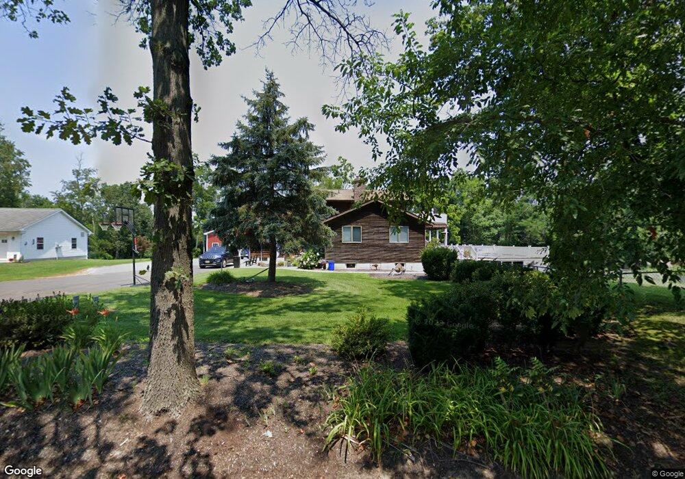
443 Lewistown Rd Columbus, NJ 08022
Estimated Value: $718,000 - $747,825
--
Bed
--
Bath
2,944
Sq Ft
$251/Sq Ft
Est. Value
About This Home
This home is located at 443 Lewistown Rd, Columbus, NJ 08022 and is currently estimated at $738,456, approximately $250 per square foot. 443 Lewistown Rd is a home located in Burlington County with nearby schools including Springfield Township Elementary School, Northern Burlington County Regional Middle School, and Northern Burlington County Regional High School.
Ownership History
Date
Name
Owned For
Owner Type
Purchase Details
Closed on
Dec 15, 2004
Sold by
Santiago Saul and Santiago Tiffanie H
Bought by
Frech Kenneth and Frech Tami L
Current Estimated Value
Home Financials for this Owner
Home Financials are based on the most recent Mortgage that was taken out on this home.
Original Mortgage
$252,900
Outstanding Balance
$126,653
Interest Rate
5.73%
Mortgage Type
Purchase Money Mortgage
Estimated Equity
$611,803
Purchase Details
Closed on
Jul 31, 1998
Sold by
Flynn Gregory
Bought by
Santiago Saul and Santiago Tiffanie H
Purchase Details
Closed on
Jun 18, 1996
Sold by
Flynn Kenneth E
Bought by
Flynn Gregory
Purchase Details
Closed on
May 24, 1996
Sold by
Flynn Michele L
Bought by
Flynn Kenneth E
Create a Home Valuation Report for This Property
The Home Valuation Report is an in-depth analysis detailing your home's value as well as a comparison with similar homes in the area
Home Values in the Area
Average Home Value in this Area
Purchase History
| Date | Buyer | Sale Price | Title Company |
|---|---|---|---|
| Frech Kenneth | $432,900 | -- | |
| Santiago Saul | $137,500 | Surety Title Corporation | |
| Flynn Gregory | $58,401 | -- | |
| Flynn Kenneth E | -- | -- |
Source: Public Records
Mortgage History
| Date | Status | Borrower | Loan Amount |
|---|---|---|---|
| Open | Frech Kenneth | $252,900 |
Source: Public Records
Tax History Compared to Growth
Tax History
| Year | Tax Paid | Tax Assessment Tax Assessment Total Assessment is a certain percentage of the fair market value that is determined by local assessors to be the total taxable value of land and additions on the property. | Land | Improvement |
|---|---|---|---|---|
| 2025 | $12,284 | $387,500 | $91,200 | $296,300 |
| 2024 | $11,954 | $387,500 | $91,200 | $296,300 |
| 2023 | $11,954 | $387,500 | $91,200 | $296,300 |
| 2022 | $11,520 | $387,500 | $91,200 | $296,300 |
| 2021 | $11,590 | $387,500 | $91,200 | $296,300 |
| 2020 | $11,559 | $387,500 | $91,200 | $296,300 |
| 2019 | $11,551 | $387,500 | $91,200 | $296,300 |
| 2018 | $11,544 | $387,500 | $91,200 | $296,300 |
| 2017 | $11,501 | $387,500 | $91,200 | $296,300 |
| 2016 | $11,447 | $387,500 | $91,200 | $296,300 |
| 2015 | $11,028 | $387,500 | $91,200 | $296,300 |
| 2014 | $10,408 | $387,500 | $91,200 | $296,300 |
Source: Public Records
Map
Nearby Homes
- 410 Lewistown Rd
- 13 Wynwood Dr
- 141 Arneys Mount Rd
- 0 N Pemberton Rd Unit NJBL2097176
- 10 Sheldon Rd
- 2770 Monmouth Rd
- 63 Homestead Dr
- 45 W Main St
- 30 Homestead Dr
- 195 N Pemberton Rd
- 23 Homestead Dr
- 2328 Monmouth Rd
- 121 Jane St
- 110 Lemmon Ave
- 200 Norcross Ln Unit 202
- 1 Barclay Ct
- 227 Kinsley Rd
- 60 Hanover St
- 112 Kinsley Rd
- 216 Kinsley Rd
- 441 Lewistown Rd
- 445 Lewistown Rd
- 415 Lewistown Rd
- 439 Lewistown Rd
- 444 Lewistown Rd
- 444 Lewistown
- 442 Lewistown Rd
- 437 Lewistown Rd
- 438 Lewistown Rd
- 446 Lewistown Rd
- 435 Lewistown Rd
- 447 Lewistown Rd
- 436 Lewistown Rd
- 433 Lewistown Rd
- 434 Lewistown Rd
- 431 Lewistown Rd
- 428 Lewistown Rd
- 429 Lewistown Rd
- 427 Lewistown Rd
- 461 Lewistown Rd