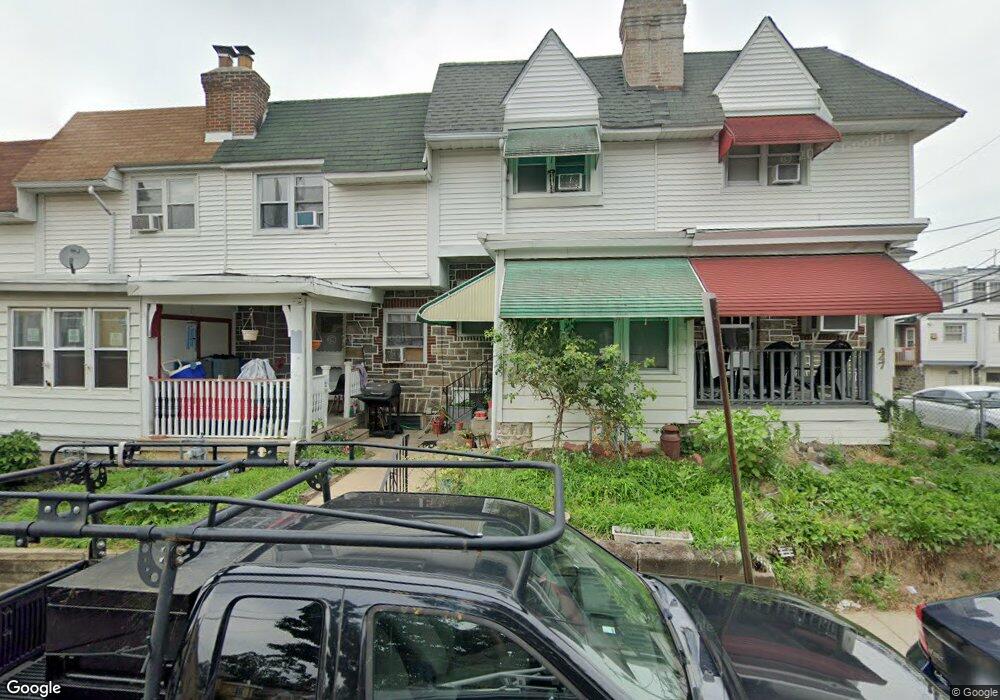
443 Millbank Rd Upper Darby, PA 19082
Estimated Value: $132,000 - $162,000
2
Beds
1
Bath
1,004
Sq Ft
$141/Sq Ft
Est. Value
About This Home
This home is located at 443 Millbank Rd, Upper Darby, PA 19082 and is currently estimated at $141,920, approximately $141 per square foot. 443 Millbank Rd is a home located in Delaware County with nearby schools including Upper Darby Kdg Center, Upper Darby High School, and Philadelphia Christian Academy.
Ownership History
Date
Name
Owned For
Owner Type
Purchase Details
Closed on
Oct 29, 2019
Sold by
Houngue Codjo Gerard
Bought by
Zayas Luis
Current Estimated Value
Home Financials for this Owner
Home Financials are based on the most recent Mortgage that was taken out on this home.
Original Mortgage
$76,587
Outstanding Balance
$67,444
Interest Rate
3.65%
Mortgage Type
FHA
Estimated Equity
$74,476
Purchase Details
Closed on
Sep 7, 2017
Sold by
Us Bank Trust Na
Bought by
Houngue Codjo Gerard
Purchase Details
Closed on
Jun 21, 2017
Sold by
Dorman Eric S
Bought by
U S Bank N A and Government Loan Securitiztion
Purchase Details
Closed on
Dec 30, 1998
Sold by
Pappas Jerry
Bought by
Dorman Eric S
Home Financials for this Owner
Home Financials are based on the most recent Mortgage that was taken out on this home.
Original Mortgage
$40,900
Interest Rate
6.8%
Mortgage Type
FHA
Create a Home Valuation Report for This Property
The Home Valuation Report is an in-depth analysis detailing your home's value as well as a comparison with similar homes in the area
Home Values in the Area
Average Home Value in this Area
Purchase History
| Date | Buyer | Sale Price | Title Company |
|---|---|---|---|
| Zayas Luis | $78,000 | Grateful Abstract Llc | |
| Houngue Codjo Gerard | $20,000 | None Available | |
| U S Bank N A | -- | None Available | |
| Dorman Eric S | $47,900 | Commonwealth Land Title Ins |
Source: Public Records
Mortgage History
| Date | Status | Borrower | Loan Amount |
|---|---|---|---|
| Open | Zayas Luis | $76,587 | |
| Previous Owner | Dorman Eric S | $40,900 |
Source: Public Records
Tax History Compared to Growth
Tax History
| Year | Tax Paid | Tax Assessment Tax Assessment Total Assessment is a certain percentage of the fair market value that is determined by local assessors to be the total taxable value of land and additions on the property. | Land | Improvement |
|---|---|---|---|---|
| 2025 | $2,667 | $63,070 | $13,310 | $49,760 |
| 2024 | $2,667 | $63,070 | $13,310 | $49,760 |
| 2023 | $2,642 | $63,070 | $13,310 | $49,760 |
| 2022 | $2,571 | $63,070 | $13,310 | $49,760 |
| 2021 | $3,467 | $63,070 | $13,310 | $49,760 |
| 2020 | $2,747 | $42,460 | $12,100 | $30,360 |
| 2019 | $2,698 | $42,460 | $12,100 | $30,360 |
| 2018 | $2,667 | $42,460 | $0 | $0 |
| 2017 | $2,598 | $42,460 | $0 | $0 |
| 2016 | $233 | $42,460 | $0 | $0 |
| 2015 | $238 | $42,460 | $0 | $0 |
| 2014 | $233 | $42,460 | $0 | $0 |
Source: Public Records
Map
Nearby Homes
- 424 Woodcliffe Rd
- 504 Woodcliffe Rd
- 513 Woodcliffe Rd
- 426 Hampden Rd
- 418 Hampden Rd
- 433 Copley Rd
- 337 Copley Rd
- 346 Long Ln
- 7114 Locust St
- 6858 Marshall Rd
- 432 Grace Rd
- 271 Wembly Rd
- 517 Wiltshire Rd
- 210 Long Ln
- 268 Hampden Rd
- 577 Snowden Rd
- 7139 Guilford Rd
- 525 Wiltshire Rd
- 607 Littlecroft Rd
- 214 Kingston Rd
- 437 Millbank Rd
- 435 Millbank Rd
- 439 Millbank Rd
- 441 Millbank Rd
- 447 Millbank Rd
- 431 Millbank Rd
- 429 Millbank Rd
- 427 Millbank Rd
- 425 Millbank Rd
- 423 Millbank Rd
- 421 Millbank Rd
- 419 Millbank Rd
- 417 Millbank Rd
- 415 Millbank Rd
- 413 Millbank Rd
- 411 Millbank Rd
- 409 Millbank Rd
- 422 Millbank Rd
- 420 Millbank Rd
- 410 Millbank Rd