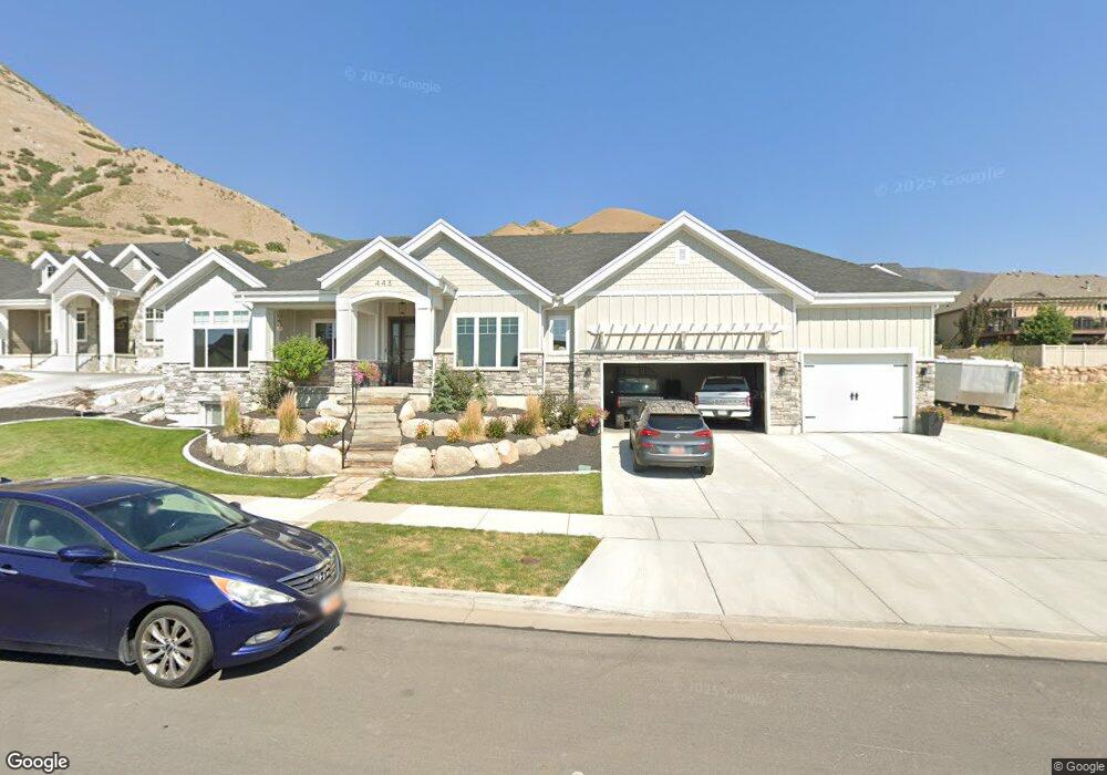
443 S 1950 E Unit 31 Springville, UT 84663
East Hobble Creek NeighborhoodEstimated Value: $983,000 - $1,229,305
2
Beds
5
Baths
2,523
Sq Ft
$443/Sq Ft
Est. Value
About This Home
This home is located at 443 S 1950 E Unit 31, Springville, UT 84663 and is currently estimated at $1,117,435, approximately $442 per square foot. 443 S 1950 E Unit 31 is a home located in Utah County with nearby schools including Brookside School, Springville Junior High School, and Springville High School.
Ownership History
Date
Name
Owned For
Owner Type
Purchase Details
Closed on
Sep 11, 2015
Sold by
Cherrington Partners Llc
Bought by
Paystrup Bashaan
Current Estimated Value
Purchase Details
Closed on
Jul 8, 2008
Sold by
Skalla M Dean
Bought by
Cherrington Partners Llc
Purchase Details
Closed on
Feb 1, 2008
Sold by
Cherrington Heights Llc
Bought by
Skalla M Dean
Create a Home Valuation Report for This Property
The Home Valuation Report is an in-depth analysis detailing your home's value as well as a comparison with similar homes in the area
Home Values in the Area
Average Home Value in this Area
Purchase History
| Date | Buyer | Sale Price | Title Company |
|---|---|---|---|
| Paystrup Bashaan | -- | Utah First Title Ins Ag | |
| Cherrington Partners Llc | -- | Utah First Title Insurance | |
| Skalla M Dean | -- | Utah First Title Insurance |
Source: Public Records
Tax History Compared to Growth
Tax History
| Year | Tax Paid | Tax Assessment Tax Assessment Total Assessment is a certain percentage of the fair market value that is determined by local assessors to be the total taxable value of land and additions on the property. | Land | Improvement |
|---|---|---|---|---|
| 2025 | $5,628 | $626,670 | $206,000 | $933,400 |
| 2024 | $5,628 | $576,620 | $0 | $0 |
| 2023 | $5,625 | $576,895 | $0 | $0 |
| 2022 | $5,187 | $522,445 | $0 | $0 |
| 2021 | $4,661 | $730,700 | $154,000 | $576,700 |
| 2020 | $4,653 | $707,200 | $133,900 | $573,300 |
| 2019 | $1,489 | $126,700 | $126,700 | $0 |
| 2018 | $1,426 | $115,800 | $115,800 | $0 |
| 2017 | $1,246 | $97,700 | $0 | $0 |
| 2016 | $1,224 | $94,100 | $0 | $0 |
| 2015 | $1,197 | $94,100 | $0 | $0 |
| 2014 | $1,205 | $94,100 | $0 | $0 |
Source: Public Records
Map
Nearby Homes
- 314 S 1850 E
- 687 S 2080 E
- 59 E 775 S Unit 21
- 51 E 775 S Unit 20
- 1653 E 300 S
- 1783 E Spring Oaks Dr N Unit 12 & 1
- 2295 E 700 S Unit 18
- 61 E 750 S Unit 2
- 66 E 750 S Unit 23
- 645 S Red Devil Dr
- 2541 Stonebury Loop Rd
- 2554 E 350 S Unit 4
- 1220 E 225 N
- 1206 E 1150 S
- 695 E 1700 N
- 715 E 1700 N
- 1567 N 600 E Unit 26
- 2881 Thirty Oaks Dr Unit 6
- 2881 Thirty Oaks Dr
- 1020 W 2000 N
- 469 S 1950 E Unit 30
- 448 S 2000 E Unit 62
- 448 S 2000 E
- 407 S 1950 E
- 438 S 1950 E Unit 10
- 474 S 2000 E
- 466 S 1950 E
- 402 S 1950 E
- 491 S 1950 E Unit 29
- 424 S 2000 E
- 490 S 2000 E Unit 60
- 490 S 2000 E
- 494 S 1950 E Unit 12
- 494 S 1950 E
- 473 S 1925 E Unit 14
- 1936 E 400 S Unit 8
- 479 S 2000 E
- 1923 E 475 S Unit 15
- 1937 N 500 W Unit 13
- 1937 E 500 S Unit 13