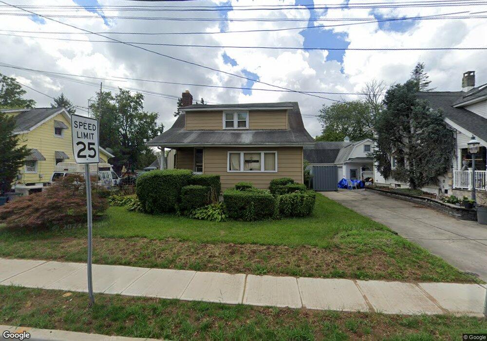
443 Stockton St East Windsor, NJ 08520
Estimated Value: $351,704 - $466,000
--
Bed
--
Bath
1,257
Sq Ft
$329/Sq Ft
Est. Value
About This Home
This home is located at 443 Stockton St, East Windsor, NJ 08520 and is currently estimated at $413,176, approximately $328 per square foot. 443 Stockton St is a home located in Mercer County with nearby schools including Melvin H. Kreps Middle School, Hightstown High School, and SciCore Academy.
Ownership History
Date
Name
Owned For
Owner Type
Purchase Details
Closed on
Sep 9, 1994
Sold by
Petrenka David
Bought by
Campbell Robert and Campbell Dorothy
Current Estimated Value
Home Financials for this Owner
Home Financials are based on the most recent Mortgage that was taken out on this home.
Original Mortgage
$83,000
Interest Rate
8.38%
Purchase Details
Closed on
Jun 28, 1994
Sold by
Pavan William
Bought by
Petrenka David and Petrenka Rebecca
Create a Home Valuation Report for This Property
The Home Valuation Report is an in-depth analysis detailing your home's value as well as a comparison with similar homes in the area
Home Values in the Area
Average Home Value in this Area
Purchase History
| Date | Buyer | Sale Price | Title Company |
|---|---|---|---|
| Campbell Robert | $93,000 | -- | |
| Petrenka David | $162,000 | -- |
Source: Public Records
Mortgage History
| Date | Status | Borrower | Loan Amount |
|---|---|---|---|
| Closed | Campbell Robert | $83,000 |
Source: Public Records
Tax History Compared to Growth
Tax History
| Year | Tax Paid | Tax Assessment Tax Assessment Total Assessment is a certain percentage of the fair market value that is determined by local assessors to be the total taxable value of land and additions on the property. | Land | Improvement |
|---|---|---|---|---|
| 2025 | $7,098 | $190,800 | $86,700 | $104,100 |
| 2024 | $6,720 | $190,800 | $86,700 | $104,100 |
| 2023 | $6,720 | $190,800 | $86,700 | $104,100 |
| 2022 | $6,546 | $190,800 | $86,700 | $104,100 |
| 2021 | $6,499 | $190,800 | $86,700 | $104,100 |
| 2020 | $6,506 | $190,800 | $86,700 | $104,100 |
| 2019 | $6,447 | $190,800 | $86,700 | $104,100 |
| 2018 | $6,363 | $190,800 | $86,700 | $104,100 |
| 2017 | $6,357 | $190,800 | $86,700 | $104,100 |
| 2016 | $5,969 | $181,700 | $86,700 | $95,000 |
| 2015 | $5,853 | $181,700 | $86,700 | $95,000 |
| 2014 | $5,784 | $181,700 | $86,700 | $95,000 |
Source: Public Records
Map
Nearby Homes
- 400 Stockton St
- 365 Stockton St
- 336 Stockton St
- 145 Lincoln Ave
- 107 Hausser Ave
- 141 Lincoln Ave
- 309 Lincoln Ave
- 0 Route 130
- 201 Morrison Ave
- 104 1st Ave
- 1 Sterling Ct
- 102 Teal Ct
- 5 Forest Dr
- 132 The Orchard Unit L
- 17 South Dr
- 121 The Orchard Unit I
- 4 South Dr
- 288 Dutch Neck Rd
- 104 One Mile Rd
- 138 the Orchards Unit C
- 445 Stockton St
- 445 Stockton St
- 447 Stockton St
- 439 Stockton St
- 441 Stockton St
- 437 Stockton St
- 444 Stockton St
- 449 Stockton St
- 446 Stockton St
- 442 Stockton St
- 433 Stockton St
- 440 Stockton St
- 451 Stockton St
- 448 Stockton St
- 438 Stockton St
- 450 Stockton St
- 453 Stockton St
- 436 Stockton St
- 425 Stockton St
- 452 Stockton St