Estimated Value: $668,836 - $732,000
3
Beds
2
Baths
3,032
Sq Ft
$230/Sq Ft
Est. Value
About This Home
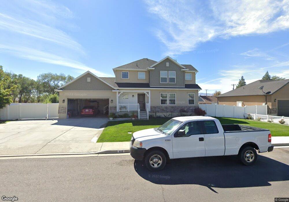
This home is located at 443 W 2070 N Unit 14, Lehi, UT 84043 and is currently estimated at $698,209, approximately $230 per square foot. 443 W 2070 N Unit 14 is a home located in Utah County with nearby schools including Eaglecrest Elementary School, Lehi Junior High School, and Skyridge High School.
Ownership History
Date
Name
Owned For
Owner Type
Purchase Details
Closed on
Oct 13, 2020
Sold by
Catamount Properties 2018 Llc
Bought by
Lamas Lisbeth E Perez
Current Estimated Value
Home Financials for this Owner
Home Financials are based on the most recent Mortgage that was taken out on this home.
Original Mortgage
$475,000
Outstanding Balance
$421,717
Interest Rate
2.8%
Mortgage Type
New Conventional
Estimated Equity
$276,492
Purchase Details
Closed on
Aug 5, 2020
Sold by
France Michael David and France Alylx M
Bought by
Catamont Properties 2018 Llc
Purchase Details
Closed on
Jul 29, 2020
Sold by
France David and France Alyix M
Bought by
Catamount Properties 2018 Llc
Purchase Details
Closed on
Dec 27, 2017
Sold by
Liddle Nathan S and Liddle Lisa D
Bought by
France Michael D and France Alyix M
Purchase Details
Closed on
Oct 11, 2012
Sold by
France Michael and France Alyix
Bought by
France Michael David and France Alyix M
Create a Home Valuation Report for This Property
The Home Valuation Report is an in-depth analysis detailing your home's value as well as a comparison with similar homes in the area
Home Values in the Area
Average Home Value in this Area
Purchase History
| Date | Buyer | Sale Price | Title Company |
|---|---|---|---|
| Lamas Lisbeth E Perez | -- | Security Title Ins Agency | |
| Catamont Properties 2018 Llc | -- | Security Title Ins Agcy | |
| Catamount Properties 2018 Llc | -- | None Available | |
| France Michael D | -- | None Available | |
| France Michael David | -- | None Available |
Source: Public Records
Mortgage History
| Date | Status | Borrower | Loan Amount |
|---|---|---|---|
| Open | Lamas Lisbeth E Perez | $475,000 |
Source: Public Records
Tax History Compared to Growth
Tax History
| Year | Tax Paid | Tax Assessment Tax Assessment Total Assessment is a certain percentage of the fair market value that is determined by local assessors to be the total taxable value of land and additions on the property. | Land | Improvement |
|---|---|---|---|---|
| 2025 | $2,571 | $331,430 | $233,900 | $368,700 |
| 2024 | $2,571 | $300,850 | $0 | $0 |
| 2023 | $2,447 | $310,915 | $0 | $0 |
| 2022 | $2,518 | $310,200 | $0 | $0 |
| 2021 | $2,247 | $418,500 | $135,300 | $283,200 |
| 2020 | $2,119 | $390,000 | $125,300 | $264,700 |
| 2019 | $1,928 | $369,000 | $125,300 | $243,700 |
Source: Public Records
Map
Nearby Homes
- 497 W 2200 N
- 595 W 2200 N
- 1755 N 250 W
- 497 W 2280 N
- 2287 N 750 W
- 1817 W Bad Rock Cir
- 1011 W Mountain Way Unit 316
- 4333 N Baiken Ridge Dr Unit 1020
- 902 W 1500 N
- 192 E 2200 N
- 537 W Sandhill Dr
- 1610 N 1125 W
- 804 W 2700 N
- 1272 W 1800 N
- 1301 N 900 W Unit 12
- 2687 N 900 W
- 1329 N 100 E Unit 21
- 2539 N 300 E
- 1094 W 1425 N
- 1150 N 200 W Unit 6
- 443 W 2070 N
- 415 W 2070 N Unit 15
- 473 W 2070 N Unit 13
- 473 W 2070 N
- 2068 N 500 W
- 2086 N 500 W
- 444 W 2070 N
- 444 W 2070 N Unit 11
- 2046 N 500 W
- 416 W 2070 N Unit 10
- 385 W 2070 N Unit 16
- 2090 N 500 W Unit 12
- 470 W 2070 N Unit 12
- 2010 N 500 W
- 441 W 2100 N Unit 2
- 441 W 2100 N
- 386 W 2070 N Unit 9
- 413 W 2100 N Unit 3
- 2069 N 500 W
- 471 W 2100 N Unit 1