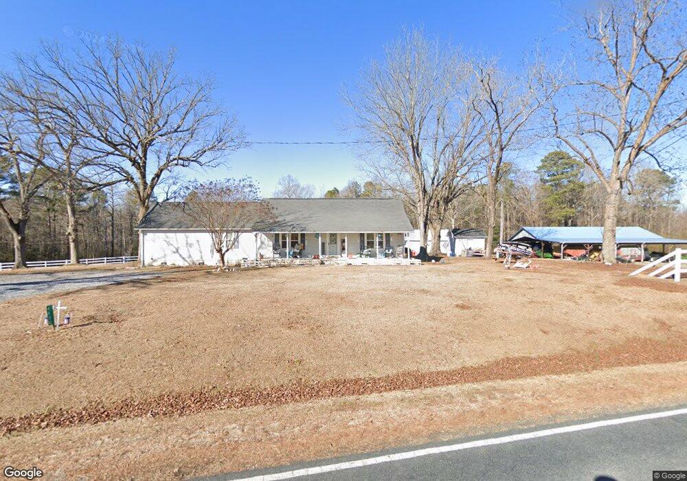
4430 McDougald Rd Lillington, NC 27546
Estimated Value: $315,450 - $386,000
3
Beds
2
Baths
1,912
Sq Ft
$178/Sq Ft
Est. Value
About This Home
This home is located at 4430 McDougald Rd, Lillington, NC 27546 and is currently estimated at $340,817, approximately $178 per square foot. 4430 McDougald Rd is a home located in Harnett County with nearby schools including Boone Trail Elementary School, Western Harnett Middle School, and Western Harnett High School.
Ownership History
Date
Name
Owned For
Owner Type
Purchase Details
Closed on
Jun 20, 2022
Sold by
Arnold Robert G and Arnold Abbey L
Bought by
Farmer Moses T and Farmer Melanie B
Current Estimated Value
Purchase Details
Closed on
Nov 14, 2018
Sold by
Farmer Moses T and Farmer Melanie B
Bought by
Arnold Robert G and Arnold Abbey L
Home Financials for this Owner
Home Financials are based on the most recent Mortgage that was taken out on this home.
Original Mortgage
$219,735
Interest Rate
4.7%
Mortgage Type
New Conventional
Purchase Details
Closed on
Apr 27, 1995
Bought by
Farmer Moses Thomas
Create a Home Valuation Report for This Property
The Home Valuation Report is an in-depth analysis detailing your home's value as well as a comparison with similar homes in the area
Home Values in the Area
Average Home Value in this Area
Purchase History
| Date | Buyer | Sale Price | Title Company |
|---|---|---|---|
| Farmer Moses T | $500 | Pope Law Group Pa | |
| Arnold Robert G | $231,500 | None Available | |
| Farmer Moses Thomas | -- | -- |
Source: Public Records
Mortgage History
| Date | Status | Borrower | Loan Amount |
|---|---|---|---|
| Previous Owner | Arnold Robert G | $219,735 |
Source: Public Records
Tax History Compared to Growth
Tax History
| Year | Tax Paid | Tax Assessment Tax Assessment Total Assessment is a certain percentage of the fair market value that is determined by local assessors to be the total taxable value of land and additions on the property. | Land | Improvement |
|---|---|---|---|---|
| 2025 | $2,045 | $283,655 | $0 | $0 |
| 2024 | $2,045 | $283,655 | $0 | $0 |
| 2023 | $2,045 | $283,655 | $0 | $0 |
| 2022 | $1,852 | $283,655 | $0 | $0 |
| 2021 | $1,852 | $215,530 | $0 | $0 |
| 2020 | $1,364 | $156,030 | $0 | $0 |
| 2019 | $1,349 | $156,030 | $0 | $0 |
| 2016 | $1,162 | $133,230 | $0 | $0 |
| 2015 | -- | $133,230 | $0 | $0 |
| 2014 | -- | $133,230 | $0 | $0 |
Source: Public Records
Map
Nearby Homes
- 2651 Tim Currin Rd
- 26 Charred Oak Ct
- 25 Charred Oak Ct
- 63 Charred Oak Ct
- 61 Single Barrel Ct
- The Carter B Plan at Wellers Knoll
- The Adalynn A Plan at Wellers Knoll
- The Franklin C Plan at Wellers Knoll
- The Willow B Plan at Wellers Knoll
- The Daphne C Plan at Wellers Knoll
- The Hickory II A Plan at Wellers Knoll
- The Grace A Plan at Wellers Knoll
- The Ash Plan at Wellers Knoll
- The Gavin A Plan at Wellers Knoll
- The Preston A Plan at Wellers Knoll
- 67 Single Barrel Ct
- 433 Old Fashioned Way
- 399 Old Fashioned Way
- 4198 Spring Hill Church Rd
- 353 Old Fashioned Way
- 4306 McDougald Rd
- 1158 C P Stewart Rd
- 2593 Tim Currin Rd
- 4235 McDougald Rd
- 35 Exie Place
- 15 Exie Place
- 75 Exie Place
- 499 J M Wallace Ln
- 2537 Tim Currin Rd
- 55 Exie Place
- 103 Exie Place
- 1085 C P Stewart Rd
- 60 Exie Place
- 2496 Tim Currin Rd
- 82 Exie Place
- 16 Exie Place
- 1111 C P Stewart Rd
- 40 Exie Place
- 110 Exie Place
- 1050 C P Stewart Rd