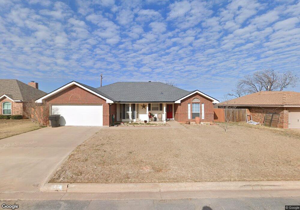
4434 Cole Dr Abilene, TX 79606
Far Southside NeighborhoodEstimated Value: $246,000 - $290,000
3
Beds
2
Baths
1,613
Sq Ft
$163/Sq Ft
Est. Value
About This Home
This home is located at 4434 Cole Dr, Abilene, TX 79606 and is currently estimated at $263,679, approximately $163 per square foot. 4434 Cole Dr is a home located in Taylor County with nearby schools including Wylie West Early Childhood Center, Wylie West Intermediate School, and Wylie West Elementary School.
Ownership History
Date
Name
Owned For
Owner Type
Purchase Details
Closed on
Jun 9, 2011
Sold by
Brown Karla
Bought by
Taylor Electric Co-Op
Current Estimated Value
Home Financials for this Owner
Home Financials are based on the most recent Mortgage that was taken out on this home.
Original Mortgage
$50,000
Interest Rate
4.81%
Mortgage Type
Purchase Money Mortgage
Purchase Details
Closed on
Aug 7, 2007
Sold by
Hewett Alan T and Hewett Rachel Ann
Bought by
Davis Jonathan D
Home Financials for this Owner
Home Financials are based on the most recent Mortgage that was taken out on this home.
Original Mortgage
$26,000
Interest Rate
6.69%
Mortgage Type
Future Advance Clause Open End Mortgage
Create a Home Valuation Report for This Property
The Home Valuation Report is an in-depth analysis detailing your home's value as well as a comparison with similar homes in the area
Home Values in the Area
Average Home Value in this Area
Purchase History
| Date | Buyer | Sale Price | Title Company |
|---|---|---|---|
| Taylor Electric Co-Op | -- | None Available | |
| Brown Karla | -- | None Available | |
| Davis Jonathan D | -- | None Available |
Source: Public Records
Mortgage History
| Date | Status | Borrower | Loan Amount |
|---|---|---|---|
| Closed | Brown Karla | $50,000 | |
| Previous Owner | Davis Jonathan D | $26,000 |
Source: Public Records
Tax History
| Year | Tax Paid | Tax Assessment Tax Assessment Total Assessment is a certain percentage of the fair market value that is determined by local assessors to be the total taxable value of land and additions on the property. | Land | Improvement |
|---|---|---|---|---|
| 2025 | $3,920 | $225,910 | $21,600 | $204,310 |
| 2023 | $3,920 | $197,837 | $0 | $0 |
| 2022 | $4,244 | $179,852 | $0 | $0 |
| 2021 | $4,212 | $163,502 | $14,040 | $149,462 |
| 2020 | $4,111 | $156,986 | $14,040 | $142,946 |
| 2019 | $4,111 | $152,544 | $12,960 | $139,584 |
| 2018 | $3,739 | $149,369 | $12,960 | $136,409 |
| 2017 | $3,567 | $147,919 | $12,960 | $134,959 |
| 2016 | $3,416 | $141,669 | $12,960 | $128,709 |
| 2015 | $3,082 | $138,828 | $12,960 | $125,868 |
| 2014 | $3,082 | $137,201 | $0 | $0 |
Source: Public Records
Map
Nearby Homes
- 4102 Chris Dr
- 4700 Meadow Dr
- 4634 Beall Blvd
- 7234 Buffalo Gap Rd
- 7941 Vita Ct
- 5001 Buffalo Gap Rd
- 8025 Hearne Dr
- 8049 Scooter Ct
- 7801 Old Forrest Hill Rd
- 6642 Buffalo Gap Rd
- 7918 Bonnie Cir
- 5008 Quesnel Ct
- 7967 Bonnie Cir
- 4110 Forrest Hill Rd
- 4102 Forrest Hill Rd
- 4617 High Sierra
- 6890 Buffalo Gap Rd
- 4034 Forrest Hill Rd
- 5149 Western Plains Ave
- 5000 Meadow Dr
- 4442 Cole Dr
- 4426 Cole Dr
- 4450 Cole Dr
- 4433 Cole Dr
- 4449 Cole Dr
- 4425 Cole Dr
- 4458 Cole Dr
- 4402 Cole Dr
- 4417 Cole Dr
- 7525 John Carroll Dr
- 7566 Ruby Esther Cir
- 4466 Cole Dr
- 7582 Ruby Esther Cir
- 4409 Cole Dr
- 7558 Ruby Esther Cir
- 7518 John Carroll Dr
- 7533 John Carroll Dr
- 7550 Ruby Esther Cir
- 4508 Cole Dr
- 4508 Cole Dr Unit 4508
Your Personal Tour Guide
Ask me questions while you tour the home.