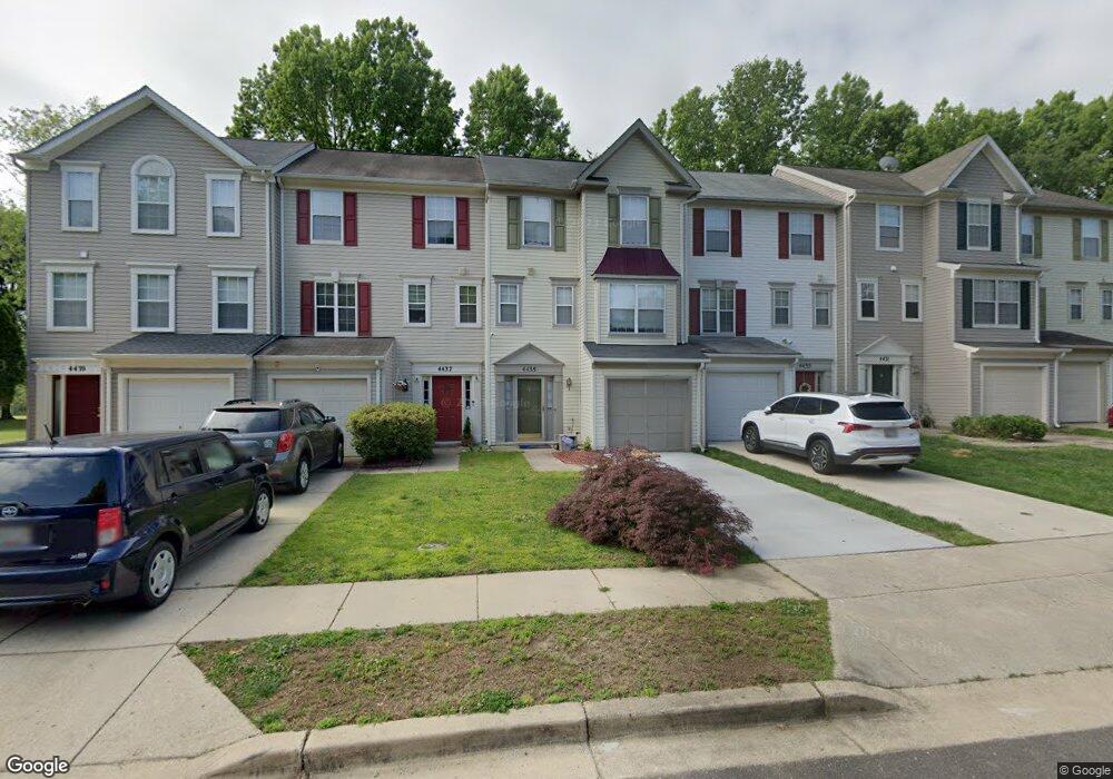
4435 Cornwall Ct Upper Marlboro, MD 20772
Estimated Value: $361,000 - $383,000
Studio
2
Baths
1,136
Sq Ft
$331/Sq Ft
Est. Value
About This Home
This home is located at 4435 Cornwall Ct, Upper Marlboro, MD 20772 and is currently estimated at $376,312, approximately $331 per square foot. 4435 Cornwall Ct is a home located in Prince George's County with nearby schools including Barack Obama Elementary School, James Madison Middle School, and Dr. Henry A. Wise Jr. High School.
Ownership History
Date
Name
Owned For
Owner Type
Purchase Details
Closed on
Dec 1, 2005
Sold by
Wingrove Mary E
Bought by
Bradley Robin R
Current Estimated Value
Home Financials for this Owner
Home Financials are based on the most recent Mortgage that was taken out on this home.
Original Mortgage
$215,000
Outstanding Balance
$115,996
Interest Rate
5.79%
Mortgage Type
New Conventional
Estimated Equity
$260,316
Purchase Details
Closed on
Jul 7, 1993
Sold by
Coscan Washington Inc
Bought by
Wingrove Mary E
Create a Home Valuation Report for This Property
The Home Valuation Report is an in-depth analysis detailing your home's value as well as a comparison with similar homes in the area
Home Values in the Area
Average Home Value in this Area
Purchase History
| Date | Buyer | Sale Price | Title Company |
|---|---|---|---|
| Bradley Robin R | $305,000 | -- | |
| Wingrove Mary E | $119,200 | -- |
Source: Public Records
Mortgage History
| Date | Status | Borrower | Loan Amount |
|---|---|---|---|
| Open | Bradley Robin R | $215,000 |
Source: Public Records
Tax History
| Year | Tax Paid | Tax Assessment Tax Assessment Total Assessment is a certain percentage of the fair market value that is determined by local assessors to be the total taxable value of land and additions on the property. | Land | Improvement |
|---|---|---|---|---|
| 2025 | $3,994 | $347,300 | $100,000 | $247,300 |
| 2024 | $3,994 | $311,333 | -- | -- |
| 2023 | $3,797 | $275,367 | $0 | $0 |
| 2022 | $3,573 | $239,400 | $100,000 | $139,400 |
| 2021 | $3,437 | $231,033 | $0 | $0 |
| 2020 | $3,377 | $222,667 | $0 | $0 |
| 2019 | $3,299 | $214,300 | $100,000 | $114,300 |
| 2018 | $3,182 | $201,300 | $0 | $0 |
| 2017 | $3,083 | $188,300 | $0 | $0 |
| 2016 | -- | $175,300 | $0 | $0 |
| 2015 | $3,365 | $175,300 | $0 | $0 |
| 2014 | $3,365 | $175,300 | $0 | $0 |
Source: Public Records
Map
Nearby Homes
- 4411 Beckenham Place
- 4317 Stockport Way
- 4462 Lord Loudoun Ct
- 14000 Lord Marlborough Place
- 13805 King Gregory Way
- 4708 Halloran Ct
- 4482 Lord Loudoun Ct
- 13825 King Frederick Way
- 13900 King George Way
- 13915 Lord Fairfax Place
- 13824 Churchville Dr
- 13960 King George Way
- 5105 Mapleshade Ln
- 4708 Groover Ln
- 5101 Back Stretch Blvd
- 13900 Farnsworth Ln Unit 4301
- 13900 Farnsworth Ln Unit 4303
- 14100 Farnsworth Ln
- 14134 Reverend Rainsford Ct
- 4316 Reverend Eversfield Ct
- 4437 Cornwall Ct
- 4439 Cornwall Ct
- 4433 Cornwall Ct
- 4431 Cornwall Ct
- 4429 Cornwall Ct
- 4443 Cornwall Ct
- 4445 Cornwall Ct
- 4447 Cornwall Ct
- 4425 Cornwall Ct
- 4449 Cornwall Ct
- 4423 Cornwall Ct
- 4451 Cornwall Ct
- 4421 Cornwall Ct
- 4453 Cornwall Ct
- 4419 Cornwall Ct
- 4417 Cornwall Ct
- 4409 Beckenham Place
- 4407 Beckenham Place
- 4405 Beckenham Place
- 4415 Cornwall Ct
Your Personal Tour Guide
Ask me questions while you tour the home.