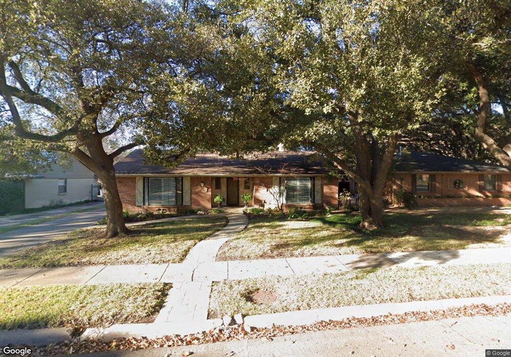
4435 Norris St Dallas, TX 75214
Northeast Dallas NeighborhoodEstimated Value: $665,000 - $700,000
3
Beds
2
Baths
1,631
Sq Ft
$420/Sq Ft
Est. Value
About This Home
This home is located at 4435 Norris St, Dallas, TX 75214 and is currently estimated at $684,645, approximately $419 per square foot. 4435 Norris St is a home located in Dallas County with nearby schools including Mockingbird Elementary School, J L Long Middle School, and Woodrow Wilson High School.
Ownership History
Date
Name
Owned For
Owner Type
Purchase Details
Closed on
Jul 28, 2014
Sold by
Miller Henry Christopher
Bought by
Ritchie Carolyn
Current Estimated Value
Purchase Details
Closed on
Apr 30, 1997
Sold by
Dellitt Helen H and Dellitt Frank R
Bought by
Ritchie Carolyn
Home Financials for this Owner
Home Financials are based on the most recent Mortgage that was taken out on this home.
Original Mortgage
$123,500
Interest Rate
7.92%
Create a Home Valuation Report for This Property
The Home Valuation Report is an in-depth analysis detailing your home's value as well as a comparison with similar homes in the area
Home Values in the Area
Average Home Value in this Area
Purchase History
| Date | Buyer | Sale Price | Title Company |
|---|---|---|---|
| Ritchie Carolyn | -- | None Available | |
| Ritchie Carolyn | -- | -- |
Source: Public Records
Mortgage History
| Date | Status | Borrower | Loan Amount |
|---|---|---|---|
| Previous Owner | Ritchie Carolyn | $123,500 |
Source: Public Records
Tax History Compared to Growth
Tax History
| Year | Tax Paid | Tax Assessment Tax Assessment Total Assessment is a certain percentage of the fair market value that is determined by local assessors to be the total taxable value of land and additions on the property. | Land | Improvement |
|---|---|---|---|---|
| 2025 | $9,430 | $683,350 | $442,750 | $240,600 |
| 2024 | $9,430 | $592,940 | $320,000 | $272,940 |
| 2023 | $9,430 | $592,940 | $320,000 | $272,940 |
| 2022 | $12,232 | $489,190 | $260,000 | $229,190 |
| 2021 | $10,948 | $419,300 | $0 | $0 |
| 2020 | $10,784 | $397,530 | $220,000 | $177,530 |
| 2019 | $11,311 | $397,530 | $220,000 | $177,530 |
| 2018 | $10,810 | $397,530 | $220,000 | $177,530 |
| 2017 | $9,606 | $353,270 | $195,000 | $158,270 |
| 2016 | $9,085 | $334,110 | $175,000 | $159,110 |
| 2015 | $6,737 | $298,340 | $125,000 | $173,340 |
| 2014 | $6,737 | $298,340 | $125,000 | $173,340 |
Source: Public Records
Map
Nearby Homes
- 6126 Sudbury Dr
- 4341 Skillman St
- 6171 Ravendale Ln
- 4427 Somerville Ave
- 6231 Berwyn Ln
- 6269 Saratoga Cir
- 6314 Woodcrest Ln
- 4241 Somerville Ave
- 6023 Sandhurst Ln Unit A
- 4235 Somerville Ave
- 4715 Skillman St Unit B
- 6035 Sandhurst Ln Unit B
- 5934 Sandhurst Ln Unit 109
- 5908 Sandhurst Ln Unit 142
- 5908 Sandhurst Ln Unit 244
- 5934 Sandhurst Ln Unit 207
- 4202 Somerville Ave Unit LOT
- 4244 Concho St
- 6004 E University Blvd Unit 131
- 4816 Amesbury Dr Unit 227
- 4431 Norris St
- 4441 Norris St
- 4425 Norris St
- 6206 Saratoga Cir
- 4432 Dalny St
- 6207 Saint Albans Dr
- 4426 Dalny St
- 4436 Dalny St
- 4419 Norris St
- 4422 Dalny St
- 6181 Saratoga Cir
- 6185 Saratoga Cir
- 6175 Saratoga Cir
- 6210 Saratoga Cir
- 6205 Saratoga Cir
- 4416 Dalny St
- 6211 Saint Albans Dr
- 6171 Saratoga Cir
- 6206 Saint Albans Dr
- 6209 Saratoga Cir