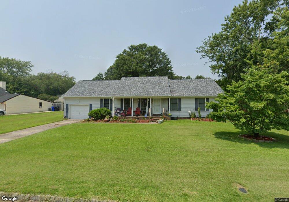
4438 Southampton Arch Portsmouth, VA 23703
Churchland NeighborhoodEstimated Value: $313,999 - $395,000
--
Bed
2
Baths
1,799
Sq Ft
$196/Sq Ft
Est. Value
About This Home
This home is located at 4438 Southampton Arch, Portsmouth, VA 23703 and is currently estimated at $352,500, approximately $195 per square foot. 4438 Southampton Arch is a home located in Portsmouth City with nearby schools including Churchland Primary/Intermediate School, Churchland Middle School, and Churchland High School.
Ownership History
Date
Name
Owned For
Owner Type
Purchase Details
Closed on
Dec 1, 2000
Sold by
Saunders Leroy C
Bought by
Brown Raymond
Current Estimated Value
Home Financials for this Owner
Home Financials are based on the most recent Mortgage that was taken out on this home.
Original Mortgage
$110,900
Outstanding Balance
$41,044
Interest Rate
7.76%
Estimated Equity
$311,456
Create a Home Valuation Report for This Property
The Home Valuation Report is an in-depth analysis detailing your home's value as well as a comparison with similar homes in the area
Home Values in the Area
Average Home Value in this Area
Purchase History
| Date | Buyer | Sale Price | Title Company |
|---|---|---|---|
| Brown Raymond | $114,500 | -- |
Source: Public Records
Mortgage History
| Date | Status | Borrower | Loan Amount |
|---|---|---|---|
| Open | Brown Raymond | $110,900 |
Source: Public Records
Tax History Compared to Growth
Tax History
| Year | Tax Paid | Tax Assessment Tax Assessment Total Assessment is a certain percentage of the fair market value that is determined by local assessors to be the total taxable value of land and additions on the property. | Land | Improvement |
|---|---|---|---|---|
| 2025 | $2,909 | $311,090 | $100,800 | $210,290 |
| 2024 | $2,909 | $306,380 | $100,800 | $205,580 |
| 2023 | $3,536 | $282,840 | $100,800 | $182,040 |
| 2022 | $3,234 | $248,780 | $84,000 | $164,780 |
| 2021 | $2,875 | $221,130 | $56,350 | $164,780 |
| 2020 | $2,840 | $218,450 | $53,670 | $164,780 |
| 2019 | $2,738 | $210,600 | $53,670 | $156,930 |
| 2018 | $2,738 | $210,600 | $53,670 | $156,930 |
| 2017 | $2,738 | $210,600 | $53,670 | $156,930 |
| 2016 | $2,738 | $210,600 | $53,670 | $156,930 |
| 2015 | $2,636 | $202,760 | $53,670 | $149,090 |
| 2014 | $2,575 | $202,760 | $53,670 | $149,090 |
Source: Public Records
Map
Nearby Homes
- 4444 Southampton Arch
- 4619 River Shore Rd
- 5728 Hawthorne Ln
- 21 Windy Pines Crescent
- 5833 Hawthorne Ln
- 5693 Rivermill Cir
- 4232 Summerset Dr
- 4224 Burnham Dr
- 5606 Gregory Ct
- 4726 River Shore Rd
- 4200 Quince Rd
- 4028 Swannanoa Dr
- 8 Compass Ct
- 4100 Mayfair Way
- 17 Shoal Ct
- 5807 Dunkin St
- 4071 Long Point Blvd
- 6750 Burbage Landing Cir
- 6602 James Point Ct
- 3433 Willow Breeze Dr
- 4434 Southampton Arch
- 6-40AC Seacock
- 4448 Southampton Arch
- 4428 N Highgate Cir
- 4430 Southampton Arch
- 4453 Birch Rd
- 4448 Birch Rd
- 5809 Southampton Ln
- 4426 N Highgate Cir
- 4449 Birch Rd
- 4425 Southampton Arch
- 4444 Birch Rd
- 4410 Southampton Arch
- 4424 N Highgate Cir
- 5801 Woodside Ln
- 5805 Woodside Ln
- 4445 Birch Rd
- 4412 N Highgate Cir
- 4423 S Highgate Cir
- 5804 Southampton Ln