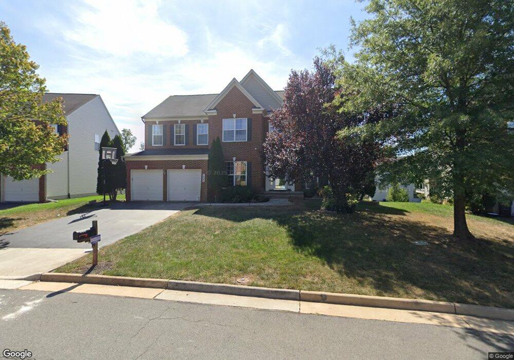
44382 Apache Cir Ashburn, VA 20147
Ashbrook NeighborhoodEstimated Value: $1,003,000 - $1,183,000
5
Beds
4
Baths
4,034
Sq Ft
$266/Sq Ft
Est. Value
About This Home
This home is located at 44382 Apache Cir, Ashburn, VA 20147 and is currently estimated at $1,073,034, approximately $265 per square foot. 44382 Apache Cir is a home located in Loudoun County with nearby schools including Ashburn Elementary School, Farmwell Station Middle School, and Broad Run High School.
Ownership History
Date
Name
Owned For
Owner Type
Purchase Details
Closed on
Dec 28, 2009
Sold by
Khan Umar
Bought by
Kapur Nivaran
Current Estimated Value
Home Financials for this Owner
Home Financials are based on the most recent Mortgage that was taken out on this home.
Original Mortgage
$400,900
Outstanding Balance
$261,875
Interest Rate
4.85%
Mortgage Type
New Conventional
Estimated Equity
$811,159
Purchase Details
Closed on
Dec 2, 2005
Sold by
Richmond American Homes O
Bought by
Khan Umar
Home Financials for this Owner
Home Financials are based on the most recent Mortgage that was taken out on this home.
Original Mortgage
$507,452
Interest Rate
6.14%
Mortgage Type
New Conventional
Create a Home Valuation Report for This Property
The Home Valuation Report is an in-depth analysis detailing your home's value as well as a comparison with similar homes in the area
Home Values in the Area
Average Home Value in this Area
Purchase History
| Date | Buyer | Sale Price | Title Company |
|---|---|---|---|
| Kapur Nivaran | $506,000 | -- | |
| Khan Umar | $634,315 | -- |
Source: Public Records
Mortgage History
| Date | Status | Borrower | Loan Amount |
|---|---|---|---|
| Open | Kapur Nivaran | $400,900 | |
| Previous Owner | Khan Umar | $507,452 |
Source: Public Records
Tax History
| Year | Tax Paid | Tax Assessment Tax Assessment Total Assessment is a certain percentage of the fair market value that is determined by local assessors to be the total taxable value of land and additions on the property. | Land | Improvement |
|---|---|---|---|---|
| 2025 | $8,211 | $1,020,020 | $299,300 | $720,720 |
| 2024 | $7,732 | $893,880 | $284,300 | $609,580 |
| 2023 | $7,360 | $841,180 | $284,300 | $556,880 |
| 2022 | $7,268 | $816,600 | $269,300 | $547,300 |
| 2021 | $6,843 | $698,280 | $239,300 | $458,980 |
| 2020 | $6,830 | $659,930 | $197,900 | $462,030 |
| 2019 | $6,711 | $642,210 | $197,900 | $444,310 |
| 2018 | $6,715 | $618,900 | $187,900 | $431,000 |
| 2017 | $6,717 | $597,030 | $187,900 | $409,130 |
| 2016 | $6,911 | $603,580 | $0 | $0 |
| 2015 | $6,685 | $401,060 | $0 | $401,060 |
| 2014 | $7,001 | $428,260 | $0 | $428,260 |
Source: Public Records
Map
Nearby Homes
- 44438 Cruden Bay Dr
- 20280 Newfoundland Square
- 20276 Newfoundland Square
- 20328 Newfoundland Square
- 44481 Wolfhound Square
- 44499 Wolfhound Square
- 20405 Altavista Way
- 20388 Roslindale Dr
- 44531 Wolfhound Square
- 20305 Savin Hill Dr
- 44186 Shady Glen Terrace
- 44537 Neponset St
- 44442 Oakmont Manor Square
- 44420 Sunset Maple Dr
- 44095 Gala Cir
- 44590 Strabane Terrace
- 44588 Strabane Terrace
- 44576 Strabane Terrace
- Homesite 59 Northpark Dr
- HOMESITE 49 Strabane Terrace
- 44378 Apache Cir
- 44386 Apache Cir
- 44292 Navajo Dr
- 44300 Navajo Dr
- 44288 Navajo Dr
- 44304 Navajo Dr
- 44383 Apache Cir
- 44374 Apache Cir
- 44390 Apache Cir
- 44391 Apache Cir
- 44284 Navajo Dr
- 44308 Navajo Dr
- 44375 Apache Cir
- 44280 Navajo Dr
- 44394 Apache Cir
- 44370 Apache Cir
- 44395 Apache Cir
- 44312 Navajo Dr
- 44325 Crow Ct
- 44272 Navajo Dr
Your Personal Tour Guide
Ask me questions while you tour the home.