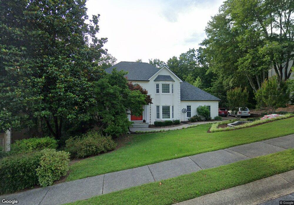
4439 Ormond Trace NE Marietta, GA 30066
Sandy Plains NeighborhoodEstimated Value: $606,000 - $702,000
4
Beds
4
Baths
2,718
Sq Ft
$239/Sq Ft
Est. Value
About This Home
This home is located at 4439 Ormond Trace NE, Marietta, GA 30066 and is currently estimated at $650,278, approximately $239 per square foot. 4439 Ormond Trace NE is a home located in Cobb County with nearby schools including Davis Elementary School, Mabry Middle School, and Lassiter High School.
Ownership History
Date
Name
Owned For
Owner Type
Purchase Details
Closed on
Oct 8, 2010
Sold by
Kraft Daniel W
Bought by
Kraft Daniel W and Kraft Cindy K
Current Estimated Value
Home Financials for this Owner
Home Financials are based on the most recent Mortgage that was taken out on this home.
Original Mortgage
$233,468
Interest Rate
4.76%
Mortgage Type
New Conventional
Purchase Details
Closed on
Dec 19, 2005
Sold by
Mettler Rudolf and Mettler Suzanne
Bought by
Kraft Daniel W
Home Financials for this Owner
Home Financials are based on the most recent Mortgage that was taken out on this home.
Original Mortgage
$255,920
Interest Rate
6.28%
Mortgage Type
New Conventional
Create a Home Valuation Report for This Property
The Home Valuation Report is an in-depth analysis detailing your home's value as well as a comparison with similar homes in the area
Home Values in the Area
Average Home Value in this Area
Purchase History
| Date | Buyer | Sale Price | Title Company |
|---|---|---|---|
| Kraft Daniel W | -- | -- | |
| Kraft Daniel W | $319,900 | -- |
Source: Public Records
Mortgage History
| Date | Status | Borrower | Loan Amount |
|---|---|---|---|
| Previous Owner | Kraft Daniel W | $233,468 | |
| Previous Owner | Kraft Daniel W | $255,920 |
Source: Public Records
Tax History
| Year | Tax Paid | Tax Assessment Tax Assessment Total Assessment is a certain percentage of the fair market value that is determined by local assessors to be the total taxable value of land and additions on the property. | Land | Improvement |
|---|---|---|---|---|
| 2025 | $1,527 | $234,472 | $58,000 | $176,472 |
| 2024 | $1,469 | $213,800 | $58,000 | $155,800 |
| 2023 | $1,269 | $215,612 | $46,000 | $169,612 |
Source: Public Records
Map
Nearby Homes
- 4563 Ashmore Cir NE
- 3025 Oaktree Landing NE
- 4397 Windsor Oaks Cir
- 3338 Devaughn Dr NE
- 4532 High Rock Terrace
- 4409 Windsor Oaks Cir
- 4311 Highborne Dr NE
- 2855 Lamer Trace
- 4466 Windsor Oaks Cir
- 4229 N Mountain Rd NE
- 4492 Windsor Oaks Dr
- 4675 Bluffside Ct
- 3448 Highborne Connector NE Unit 1
- 4743 Carmichael Chase NE
- 4692 Bluffside Ct
- 4180 Summit Way
- 2931 Treeside Terrace
- 3350 Brookhill Cir
- 2973 Forest Chase Terrace NE
- 4802 Township Brow
- 4437 Ormond Trace NE
- 4441 Ormond Trace NE
- 4549 Ashmore Cir NE
- 4551 Ashmore Cir NE
- 4440 Ormond Trace NE
- 4443 Ormond Trace NE
- 4442 Ormond Trace NE
- 4435 Ormond Trace NE
- 4438 Ormond Trace NE
- 4553 Ashmore Cir NE
- 4547 Ashmore Cir NE
- 4545 Ashmore Cir NE
- 4445 Ormond Trace NE
- 4444 Ormond Trace NE
- 4555 Ashmore Cir NE
- 4447 Ormond Trace NE
- 4550 Ashmore Cir NE
- 4503 Bankside Ct NE
- 4500 Bankside Ct NE
- 4552 Ashmore Cir NE
Your Personal Tour Guide
Ask me questions while you tour the home.