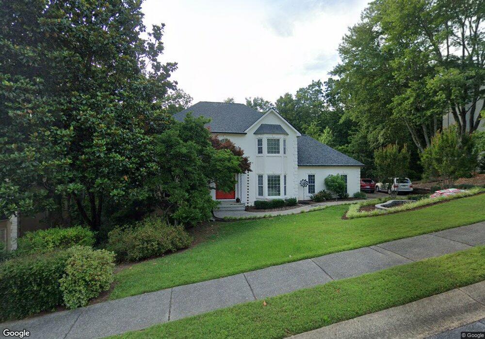
4439 Ormond Trace NE Marietta, GA 30066
Sandy Plains NeighborhoodEstimated Value: $626,000 - $710,000
About This Home
This home is located at 4439 Ormond Trace NE, Marietta, GA 30066 and is currently estimated at $662,164, approximately $243 per square foot. 4439 Ormond Trace NE is a home located in Cobb County with nearby schools including Davis Elementary School, Mabry Middle School, and Lassiter High School.
Ownership History
We collect this data history from publicly available records. To have your information removed, we recommend requesting removal directly through your county’s website.
Purchase Details
Home Financials for this Owner
Home Financials are based on the most recent Mortgage that was taken out on this home.Purchase Details
Home Financials for this Owner
Home Financials are based on the most recent Mortgage that was taken out on this home.Home Values in the Area
Average Home Value in this Area
Purchase History
We collect this data history from publicly available records. To have your information removed, we recommend requesting removal directly through your county’s website.
| Date | Buyer | Sale Price | Title Company |
|---|---|---|---|
| -- | -- | ||
| $319,900 | -- |
Mortgage History
We collect this data history from publicly available records. To have your information removed, we recommend requesting removal directly through your county’s website.
| Date | Status | Borrower | Loan Amount |
|---|---|---|---|
| Previous Owner | $233,468 | ||
| Previous Owner | $255,920 |
Tax History
We collect this data history from publicly available records. To have your information removed, we recommend requesting removal directly through your county’s website.
| Year | Tax Paid | Tax Assessment Tax Assessment Total Assessment is a certain percentage of the fair market value that is determined by local assessors to be the total taxable value of land and additions on the property. | Land | Improvement |
|---|---|---|---|---|
| 2025 | $1,527 | $234,472 | $58,000 | $176,472 |
| 2024 | $1,469 | $213,800 | $58,000 | $155,800 |
| 2023 | $1,269 | $215,612 | $46,000 | $169,612 |
| 2022 | $1,337 | $169,452 | $42,000 | $127,452 |
| 2021 | $1,337 | $169,452 | $42,000 | $127,452 |
| 2020 | $1,303 | $158,068 | $44,000 | $114,068 |
| 2019 | $1,303 | $158,068 | $44,000 | $114,068 |
| 2018 | $1,303 | $158,068 | $44,000 | $114,068 |
| 2017 | $1,152 | $158,068 | $44,000 | $114,068 |
| 2016 | $3,956 | $158,068 | $44,000 | $114,068 |
| 2015 | $3,416 | $130,112 | $43,600 | $86,512 |
| 2014 | $3,442 | $130,112 | $0 | $0 |
Map
- 4563 Ashmore Cir NE
- 4403 Rosemary Ct NE
- 4377 Cades Pointe
- 3025 Oaktree Landing NE
- 4397 Windsor Oaks Cir
- 2951 Summitop Ct NE
- 4510 N Slope Cir
- 3338 Devaughn Dr NE
- 4311 Highborne Dr NE
- 4466 Windsor Oaks Cir
- 4423 Windsor Oaks Cir Unit 5
- 4492 Windsor Oaks Dr
- 4217 N Mountain Rd NE
- 3320 Devaughn Dr NE
- 3671 Forest Peak Landing
- 3448 Highborne Connector NE Unit 1
- 3540 Jefferson Township Pkwy
- 2911 Treeside Terrace
- 2775 Twisted Oak Ln NE
- 2708 Hawk Dr NE Unit 2
- 4437 Ormond Trace NE
- 4435 Ormond Trace NE
- 4551 Ashmore Cir NE
- 4438 Ormond Trace NE
- 4553 Ashmore Cir NE
- 4440 Ormond Trace NE
- 4549 Ashmore Cir NE
- 4441 Ormond Trace NE
- 4442 Ormond Trace NE
- 4555 Ashmore Cir NE
- 4500 Bankside Ct NE
- 4443 Ormond Trace NE
- 4547 Ashmore Cir NE
- 4552 Ashmore Cir NE
- 4502 Bankside Ct NE
- 4550 Ashmore Cir NE
- 4545 Ashmore Cir NE
- 4503 Bankside Ct NE
- 4444 Ormond Trace NE
- 4504 Bankside Ct NE Unit XIV
Ask me questions while you tour the home.